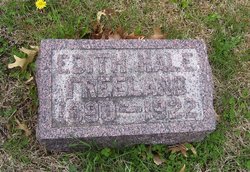
Edith Mable Hale Freeland
| Birth | : | 1 Nov 1890 Jackson County, Kansas, USA |
| Death | : | 30 Oct 1922 Atchison County, Kansas, USA |
| Burial | : | Hillside Cemetery, Torrington, Litchfield County, USA |
| Coordinate | : | 41.7871819, -73.1269608 |
| Plot | : | Section A (east) |
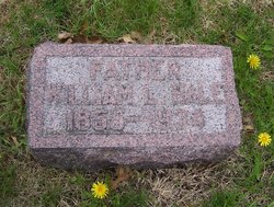
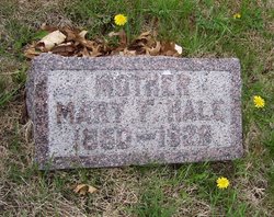
| Description | : | --the following obituary abstract is from Selected Death Notices From Jackson County, Kansas Newspapers, Vol. XII; compiled by Dan Fenton: The Holton Recorder November 9, 1922 Edyth Mabel Hale, daughter of Mr. and Mrs. Wm. Hale, was born near Denison, Kan., November 1, 1890. At the age of 16 years she united with the Christian church at this place. She was married to Charles Holbrook Feb. 10, 1908. To this union one daughter was born. On January 10, 1922, she was married to Mr. John Freeland of Halfmound, Kan. She has been in poor health for some time ... passed peacefully away... Read More |
frequently asked questions (FAQ):
-
Where is Edith Mable Hale Freeland's memorial?
Edith Mable Hale Freeland's memorial is located at: Hillside Cemetery, Torrington, Litchfield County, USA.
-
When did Edith Mable Hale Freeland death?
Edith Mable Hale Freeland death on 30 Oct 1922 in Atchison County, Kansas, USA
-
Where are the coordinates of the Edith Mable Hale Freeland's memorial?
Latitude: 41.7871819
Longitude: -73.1269608
Family Members:
Parent
Spouse
Siblings
Children
Flowers:
Nearby Cemetories:
1. Hillside Cemetery
Torrington, Litchfield County, USA
Coordinate: 41.7871819, -73.1269608
2. Saint Francis Cemetery
Torrington, Litchfield County, USA
Coordinate: 41.7839012, -73.1149979
3. Trinity Episcopal Church Memorial Garden
Torrington, Litchfield County, USA
Coordinate: 41.8017470, -73.1225010
4. Old Saint Francis Cemetery
Torrington, Litchfield County, USA
Coordinate: 41.8017349, -73.1154404
5. Center Cemetery
Torrington, Litchfield County, USA
Coordinate: 41.8041992, -73.1196976
6. Scoville Cemetery
Harwinton, Litchfield County, USA
Coordinate: 41.7557983, -73.0942001
7. Saint Paul's Lutheran Church Garden of Memories
Torrington, Litchfield County, USA
Coordinate: 41.8212900, -73.0925700
8. West Cemetery
Harwinton, Litchfield County, USA
Coordinate: 41.7719002, -73.0727997
9. West Torrington Cemetery
Torrington, Litchfield County, USA
Coordinate: 41.8241997, -73.1669006
10. North Cemetery
Harwinton, Litchfield County, USA
Coordinate: 41.7738991, -73.0607986
11. Old Cemetery
Harwinton, Litchfield County, USA
Coordinate: 41.7713928, -73.0594864
12. South Cemetery
Harwinton, Litchfield County, USA
Coordinate: 41.7647018, -73.0597000
13. East Cemetery
Litchfield, Litchfield County, USA
Coordinate: 41.7482070, -73.1813800
14. Saint Peter Cemetery
Torrington, Litchfield County, USA
Coordinate: 41.8302383, -73.0727310
15. Torringford Cemetery
Torrington, Litchfield County, USA
Coordinate: 41.8333270, -73.0760070
16. First Congregational Church Memorial Garden
Litchfield, Litchfield County, USA
Coordinate: 41.7479470, -73.1880910
17. Collins Cemetery
Goshen, Litchfield County, USA
Coordinate: 41.8238983, -73.1928024
18. Saint Michaels Parish Memorial Garden
Litchfield, Litchfield County, USA
Coordinate: 41.7460500, -73.1887600
19. Sons of Jacob Cemetery
Torrington, Litchfield County, USA
Coordinate: 41.8474998, -73.0960999
20. West Cemetery
Litchfield, Litchfield County, USA
Coordinate: 41.7383003, -73.1980972
21. Newfield Cemetery
Torrington, Litchfield County, USA
Coordinate: 41.8591995, -73.1367035
22. Saint Anthony Cemetery
Litchfield, Litchfield County, USA
Coordinate: 41.7380409, -73.1982956
23. East Cemetery
Harwinton, Litchfield County, USA
Coordinate: 41.7743988, -73.0269012
24. Fyler Cemetery
Torrington, Litchfield County, USA
Coordinate: 41.8631706, -73.1230774

