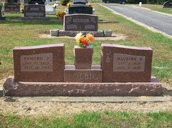
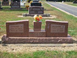
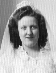
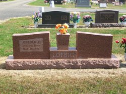
Edmund Joseph Loebig
| Birth | : | 12 Jan 1909 Lismore, Nobles County, Minnesota, USA |
| Death | : | 18 Sep 1995 Rochester, Fulton County, Indiana, USA |
| Burial | : | Big Flat Cemetery, Big Flat, Baxter County, USA |
| Coordinate | : | 36.0092010, -92.4067001 |
| Plot | : | Section 19, Row 2 |
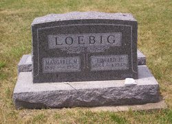
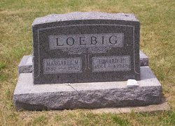
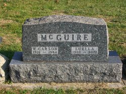
| Description | : | Published in The Rochester Sentinel Monday, September 18, 1995 Edmund J. Loebig Jan. 12, 1909 - Sept. 18, 1995 Edmund Joseph LOEBIG, 86, 3110 E. Manitou Park Rd., died at 1:30 a.m. today at Lifecare Center, Rochester. He was born in Lizmore, Minn. to Edward and Margaret JENSEN LOEBIG. On June 2, 1938 in Algona, Iowa, he married Maurine K. HANSEN, who died on Nov. 4, 1987. On July 25, 1992 in Rochester he married Luella McGUIRE, who survives He managed the former Neuhauser Hatchery, Rochester, from 1954 to 1968 and owned the Montgomery Ward Catalog Store, Rochester, from 1968 to 1974 ... Read More |
frequently asked questions (FAQ):
-
Where is Edmund Joseph Loebig's memorial?
Edmund Joseph Loebig's memorial is located at: Big Flat Cemetery, Big Flat, Baxter County, USA.
-
When did Edmund Joseph Loebig death?
Edmund Joseph Loebig death on 18 Sep 1995 in Rochester, Fulton County, Indiana, USA
-
Where are the coordinates of the Edmund Joseph Loebig's memorial?
Latitude: 36.0092010
Longitude: -92.4067001
Family Members:
Parent
Spouse
Siblings
Children
Flowers:
Nearby Cemetories:
1. Big Flat Cemetery
Big Flat, Baxter County, USA
Coordinate: 36.0092010, -92.4067001
2. Norman-Rorie Cemetery
Big Flat, Baxter County, USA
Coordinate: 36.0099590, -92.3577370
3. Seawright Cemetery
Big Flat, Baxter County, USA
Coordinate: 36.0489426, -92.3969116
4. Treat Cemetery
Searcy County, USA
Coordinate: 35.9686012, -92.4272003
5. Spring Creek Cemetery
Searcy County, USA
Coordinate: 36.0472946, -92.4437714
6. Wallis Cemetery
Alco, Stone County, USA
Coordinate: 35.9505900, -92.4052120
7. Freeman Cemetery
Stone County, USA
Coordinate: 35.9508018, -92.3897018
8. Landis Cemetery
Landis, Searcy County, USA
Coordinate: 35.9385986, -92.4408035
9. Farris Cemetery
Onia, Stone County, USA
Coordinate: 35.9303017, -92.3555984
10. Nancy Lindsey Cemetery
Fiftysix, Stone County, USA
Coordinate: 35.9882164, -92.2935715
11. Rorie Homeplace Cemetery
Fiftysix, Stone County, USA
Coordinate: 35.9946220, -92.2890190
12. Stevens Cemetery
Onia, Stone County, USA
Coordinate: 35.9594002, -92.3043976
13. Pordue Cemetery
Onia, Stone County, USA
Coordinate: 35.9254570, -92.3305130
14. McDaniel Cemetery
Thola, Searcy County, USA
Coordinate: 35.9000015, -92.4321976
15. Rock Creek Cemetery
Harriet, Searcy County, USA
Coordinate: 36.0285988, -92.5460968
16. Stevens Cemetery
Fiftysix, Stone County, USA
Coordinate: 35.9836006, -92.2677994
17. Spoonflat Cemetery
Fiftysix, Stone County, USA
Coordinate: 35.9838000, -92.2677000
18. Elm Springs Cemetery
Marion County, USA
Coordinate: 36.0877991, -92.5158005
19. Alco Cemetery
Alco, Stone County, USA
Coordinate: 35.8913994, -92.3783035
20. Passmore Cemetery
Thola, Searcy County, USA
Coordinate: 35.8885994, -92.4257965
21. Smithee Cemetery
Stone County, USA
Coordinate: 35.9199982, -92.3028030
22. Harmon Cemetery
Fiftysix, Stone County, USA
Coordinate: 35.9692190, -92.2511670
23. Scribner Cemetery
Searcy County, USA
Coordinate: 35.8894005, -92.4781036
24. Curtis Cemetery
McPhearson, Baxter County, USA
Coordinate: 36.1156006, -92.3011017

