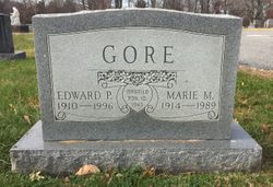
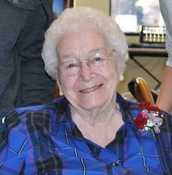
| Birth | : | 29 Dec 1918 Guthrie, Hubbard County, Minnesota, USA |
| Death | : | 24 Feb 1994 Minot, Ward County, North Dakota, USA |
| Burial | : | Bureå Kyrkogård, Burea, Skellefteå kommun, Sweden |
| Coordinate | : | 64.6195220, 21.2026780 |
| Description | : | Edward A. Ethen, 75, Tolley, died Thursday, Feb. 24, 1994, in a Minot hospital. He was born Oct. 29, 1918, in Guthrie, Minn., to Joseph and Mary Ethen. He attended country school near Tolley, in Roosevelt Township, and in the mid ‘30s worked for the Civilian Conservation Corps near Watford City. He graduated from Tolley High School in 1941. He entered the Army in February 1942 and served during World War II in Africa, Italy, France and Germany with the 776 Tank Destroyer Battalion Unit. He was discharged in October 1945. He received the Purple Heart... Read More |
frequently asked questions (FAQ):
-
Where is Edward Arnold Ethen's memorial?
Edward Arnold Ethen's memorial is located at: Bureå Kyrkogård, Burea, Skellefteå kommun, Sweden.
-
When did Edward Arnold Ethen death?
Edward Arnold Ethen death on 24 Feb 1994 in Minot, Ward County, North Dakota, USA
-
Where are the coordinates of the Edward Arnold Ethen's memorial?
Latitude: 64.6195220
Longitude: 21.2026780
Family Members:
Parent
Siblings
Flowers:
Nearby Cemetories:
1. Bureå Kyrkogård
Burea, Skellefteå kommun, Sweden
Coordinate: 64.6195220, 21.2026780
2. Sävenäs
Savenas, Skellefteå kommun, Sweden
Coordinate: 64.6924063, 21.2107215
3. Alhems Kyrkogård (skogskyrkogården)
Skellefteå, Skellefteå kommun, Sweden
Coordinate: 64.7557797, 20.9985884
4. Skellefteå Västra kyrkogård
Skellefteå, Skellefteå kommun, Sweden
Coordinate: 64.7519900, 20.9186000
5. Lund Cemetery
Lund, Skellefteå kommun, Sweden
Coordinate: 64.7491080, 20.9055672
6. Vara Cemetery
Vara, Vara kommun, Sweden
Coordinate: 64.7456327, 20.8466761
7. Lövångers Kyrkogård (Gamla och Nya)
Lovanger, Skellefteå kommun, Sweden
Coordinate: 64.3684860, 21.3181620
8. Bygdsiljums Kyrkogård
Bygdsiljum, Skellefteå kommun, Sweden
Coordinate: 64.3480080, 20.5066770
9. Kalvträsks Kyrkogård
Kalvtrask, Skellefteå kommun, Sweden
Coordinate: 64.6727660, 19.7887160
10. Hortlax Skogskyrkogård
Hortlax, Piteå kommun, Sweden
Coordinate: 65.2840170, 21.4021820
11. Hortlax Kyrkogård
Hortlax, Piteå kommun, Sweden
Coordinate: 65.2852000, 21.3988000
12. Öjeby Kyrkogård
Ojebyn, Piteå kommun, Sweden
Coordinate: 65.3455660, 21.3933039
13. Muslimska Kyrkogården
Ojebyn, Piteå kommun, Sweden
Coordinate: 65.3690850, 21.3619690
14. Hedens Kyrkogård
Piteå, Piteå kommun, Sweden
Coordinate: 65.3718390, 21.3629990
15. Norsjö kyrkogård
Norsjö, Norsjö kommun, Sweden
Coordinate: 64.9147237, 19.4762989
16. Näsets kyrkogård
Norsjö, Norsjö kommun, Sweden
Coordinate: 64.8945800, 19.4582541
17. Norrfjärden Kyrkogården
Norrfjarden, Piteå kommun, Sweden
Coordinate: 65.4215400, 21.4895700
18. Långträsk Kyrkogård
Piteå kommun, Sweden
Coordinate: 65.3866563, 20.3234943
19. Granö kyrkogård
Granon, Vindelns kommun, Sweden
Coordinate: 64.2214400, 19.3540000
20. Västra kyrkogården
Umeå, Umeå kommun, Sweden
Coordinate: 63.8279630, 20.2482690
21. Backens kyrkogård
Umeå, Umeå kommun, Sweden
Coordinate: 63.8304500, 20.1732660
22. Glommersträsk Kyrkogård
Glommerstrask, Arvidsjaurs kommun, Sweden
Coordinate: 65.2812400, 19.6099900
23. Obbola Kyrka
Obbola, Umeå kommun, Sweden
Coordinate: 63.6953200, 20.3041400
24. Gråträsk Kyrkogård
Gratrask, Piteå kommun, Sweden
Coordinate: 65.4861640, 19.7961550


