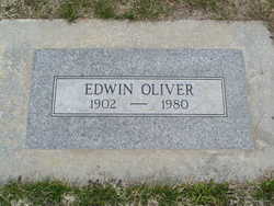
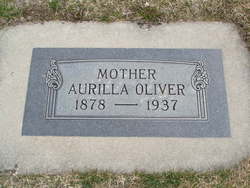
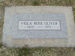
Edwin Earl Oliver
| Birth | : | 2 Jan 1902 Winfield, Cowley County, Kansas, USA |
| Death | : | 31 Jan 1980 Chelan, Chelan County, Washington, USA |
| Burial | : | Lesje Cemetery, Roth, Bottineau County, USA |
| Coordinate | : | 48.9664688, -100.8221359 |
| Plot | : | North Fraternal Row59 BLK60 LS7 |
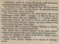
| Description | : | CHELAN - Edwin E. Oliver, 78, Chelan, died Wednesday morning at his home, following a sudden illness. He was born Jan. 2, 1902, at Winfield, Kan. He later moved to Council Grove, Kan., with his family. He attended schools there and in 1922, moved to Chelan. Mr. Oliver was employed at the local bakery and at the Washington Water Power Company. In 1929, he moved to Waterville where he was employed at a bakery before returning to Chelan. He moved to Holden where he worked at the Howe-Sound Mining Company and also worked on the construction of Grand... Read More |
frequently asked questions (FAQ):
-
Where is Edwin Earl Oliver's memorial?
Edwin Earl Oliver's memorial is located at: Lesje Cemetery, Roth, Bottineau County, USA.
-
When did Edwin Earl Oliver death?
Edwin Earl Oliver death on 31 Jan 1980 in Chelan, Chelan County, Washington, USA
-
Where are the coordinates of the Edwin Earl Oliver's memorial?
Latitude: 48.9664688
Longitude: -100.8221359
Family Members:
Parent
Spouse
Siblings
Flowers:
Nearby Cemetories:
1. Lesje Cemetery
Roth, Bottineau County, USA
Coordinate: 48.9664688, -100.8221359
2. Zion Cemetery
Landa, Bottineau County, USA
Coordinate: 48.9375000, -100.8942032
3. Roth Grave Site
Roth, Bottineau County, USA
Coordinate: 48.9008369, -100.7966385
4. Landa Cemetery
Landa, Bottineau County, USA
Coordinate: 48.9077988, -100.9067001
5. Acheson Homestead Cemetery
Westhope, Bottineau County, USA
Coordinate: 48.9622620, -100.9804240
6. Mountain View Cemetery
Souris, Bottineau County, USA
Coordinate: 48.9014015, -100.6750031
7. Bethesda Cemetery
Souris, Bottineau County, USA
Coordinate: 48.9648933, -100.6333923
8. Westhope Cemetery
Westhope, Bottineau County, USA
Coordinate: 48.9094009, -100.9950027
9. Waskada Cemetery
Waskada, Southwestern Census Division, Canada
Coordinate: 49.0947200, -100.7806100
10. Swedish Lutheran Cemetery
Souris, Bottineau County, USA
Coordinate: 48.9858055, -100.6212158
11. Coultervale Cemetery
Coulter, Southwestern Census Division, Canada
Coordinate: 49.0580710, -101.0255330
12. Mouse River Lutheran Cemetery
Landa, Bottineau County, USA
Coordinate: 48.8067741, -100.8635788
13. Turtle Mountain Lutheran Cemetery
Carbury, Bottineau County, USA
Coordinate: 48.9219017, -100.5730972
14. Nedaros Cemetery
Landa, Bottineau County, USA
Coordinate: 48.7916985, -100.8407974
15. Emmanuel Lutheran Brethren Cemetery
Carbury, Bottineau County, USA
Coordinate: 48.9441872, -100.5558243
16. Goodlands Cemetery
Goodlands, Southwestern Census Division, Canada
Coordinate: 49.0874500, -100.6014700
17. Lyleton Cemetery
Lyleton, Southwestern Census Division, Canada
Coordinate: 49.0300320, -101.1489680
18. Inherred Lutheran Cemetery
Bottineau, Bottineau County, USA
Coordinate: 48.9209404, -100.4674301
19. Weeks Cemetery
Westhope, Bottineau County, USA
Coordinate: 48.8365800, -101.1251700
20. Medora Old Cemetery
Medora, Southwestern Census Division, Canada
Coordinate: 49.2082340, -100.7825910
21. Hamel Catholic Cemetery
Dunning, Bottineau County, USA
Coordinate: 48.7707930, -101.0599920
22. Betania Cemetery
Brander Township, Bottineau County, USA
Coordinate: 48.7480060, -101.0259820
23. Saint Paul Roman Catholic Cemetery
Deloraine, Southwestern Census Division, Canada
Coordinate: 49.0866860, -100.4711380
24. Dovre Lutheran Cemetery
Newburg, Bottineau County, USA
Coordinate: 48.7117690, -100.9069410

