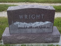
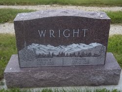
Elaine Henderson Wright
| Birth | : | 12 Feb 1923 Tulare, Spink County, South Dakota, USA |
| Death | : | 4 Oct 2008 Darby, Ravalli County, Montana, USA |
| Burial | : | Stockport Cemetery, Stockport, District Council of Clare and Gilbert Valleys, Australia |
| Coordinate | : | -34.3367900, 138.7405500 |
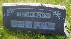
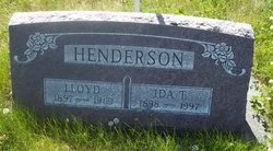
| Description | : | She was born to Lloyd and Ida Henderson. The family then moved to Darby, Montana in 1934. She married Glenn Wright in 1943. She was preceded in death by her husband, Glenn; grandson, Jeremy; and her parents, Lloyd and Ida Henderson. She is survived by her son Bruce Wright and his wife Kathy; two grandchildren and families; sister, Alberta Henderson and brother, Eugene Henderson and wife Mary. Funeral services will be held on Thursday, Oct. 9 at 2 p.m. at the funeral home with burial to follow. There will be a reception following the committal services at St. Philip Benizi Catholic Church... Read More |
frequently asked questions (FAQ):
-
Where is Elaine Henderson Wright's memorial?
Elaine Henderson Wright's memorial is located at: Stockport Cemetery, Stockport, District Council of Clare and Gilbert Valleys, Australia.
-
When did Elaine Henderson Wright death?
Elaine Henderson Wright death on 4 Oct 2008 in Darby, Ravalli County, Montana, USA
-
Where are the coordinates of the Elaine Henderson Wright's memorial?
Latitude: -34.3367900
Longitude: 138.7405500
Family Members:
Parent
Spouse
Siblings
Flowers:
Nearby Cemetories:
1. Stockport Cemetery
Stockport, District Council of Clare and Gilbert Valleys, Australia
Coordinate: -34.3367900, 138.7405500
2. Hamley Bridge Cemetery
Hamley Bridge, Light Regional Council, Australia
Coordinate: -34.3464736, 138.6931000
3. Bethel Steinthal Lutheran Cemetery
Stockport, District Council of Clare and Gilbert Valleys, Australia
Coordinate: -34.3478380, 138.8194770
4. Bethel Moravian Lutheran Cemetery
Bethel, Light Regional Council, Australia
Coordinate: -34.3339900, 138.8276000
5. Bethel Lutheran Cemetery
Bethel, Light Regional Council, Australia
Coordinate: -34.3310930, 138.8341580
6. Pinkerton Plains Cemetery
Pinkertons Plains, Light Regional Council, Australia
Coordinate: -34.3802060, 138.6604327
7. Tarlee Cemetery
Tarlee, District Council of Clare and Gilbert Valleys, Australia
Coordinate: -34.2576100, 138.7846200
8. Alma South Public Cemetery
Alma, Wakefield Regional Council, Australia
Coordinate: -34.2912940, 138.6491930
9. Magdala Lutheran Cemetery
Light Regional Council, Australia
Coordinate: -34.4330100, 138.7088600
10. Morn Hill Primitive Cemetery
Light Regional Council, Australia
Coordinate: -34.4302930, 138.7962190
11. Schoenfeld Lutheran Cemetery
Freeling, Light Regional Council, Australia
Coordinate: -34.4303990, 138.7962020
12. Barabba Cemetery
Barabba, District Council of Mallala, Australia
Coordinate: -34.3456820, 138.5887900
13. Navan Catholic Cemetery
Riverton, District Council of Clare and Gilbert Valleys, Australia
Coordinate: -34.2103860, 138.7482280
14. Kapunda Cemetery
Kapunda, Light Regional Council, Australia
Coordinate: -34.3289814, 138.8983254
15. Alma Plains Congregational Cemetery
Alma, Wakefield Regional Council, Australia
Coordinate: -34.2380300, 138.6354400
16. Freeling General Cemetery
Freeling, Light Regional Council, Australia
Coordinate: -34.4506860, 138.8227030
17. Templers Wesleyan Churchyard
Templers, Light Regional Council, Australia
Coordinate: -34.4699180, 138.7467280
18. Allen Creek Lone Grave
Allendale North, Light Regional Council, Australia
Coordinate: -34.2854010, 138.8967320
19. Allendale North Methodist Cemetery
Allendale North, Light Regional Council, Australia
Coordinate: -34.3016840, 138.9128070
20. Bethlehem Lutheran Church Cemetery
Allendale North, Light Regional Council, Australia
Coordinate: -34.2698250, 138.8994060
21. Macaw Creek Wesleyan Cemetery
Riverton, District Council of Clare and Gilbert Valleys, Australia
Coordinate: -34.1832430, 138.7193220
22. Kapunda Christ Church Anglican Cemetery
Kapunda, Light Regional Council, Australia
Coordinate: -34.3483370, 138.9275760
23. Hamilton Methodist Church Cemetery
Hamilton, Light Regional Council, Australia
Coordinate: -34.2232310, 138.8778960
24. St. Matthew's Anglican Cemetery
Hamilton, Light Regional Council, Australia
Coordinate: -34.2224400, 138.8795100

