
| Birth | : | 11 Apr 1925 Rudd, Floyd County, Iowa, USA |
| Death | : | 29 Aug 2008 Mason City, Cerro Gordo County, Iowa, USA |
| Burial | : | Rudd Evergreen Cemetery, Rudd, Floyd County, USA |
| Coordinate | : | 43.1417007, -92.9214020 |
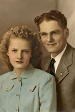
| Description | : | ROCKFORD, IOWA- Eldon Earl Bass Sr. 83, of 1971 Ivory Ave, died Friday, August 29, 2008, at the Muse Norris Hospice Inpatient Unit, Mason City. Funeral services will be held at 10 A.M. Tuesday, September 2, 2008, at the Sheckler Colonial Chapel, 114 North Hawkeye, Nora Springs, with Reverend Martin Miller and Reverend Gordon Berryman officiating. Burial will be in the Rudd Evergreen Cemetery, Rudd. The family will greet visitors Monday from 5 p.m. until 7 p.m.; and continue Tuesday one hour prior to the service at Sheckler Colonial Chapel, 114 North Hawkeye, Nora Springs. Memorials may be directed to... Read More |
frequently asked questions (FAQ):
-
Where is Eldon Earl Bass's memorial?
Eldon Earl Bass's memorial is located at: Rudd Evergreen Cemetery, Rudd, Floyd County, USA.
-
When did Eldon Earl Bass death?
Eldon Earl Bass death on 29 Aug 2008 in Mason City, Cerro Gordo County, Iowa, USA
-
Where are the coordinates of the Eldon Earl Bass's memorial?
Latitude: 43.1417007
Longitude: -92.9214020
Family Members:
Parent

Spouse
Siblings
Flowers:


Nearby Cemetories:
1. Rudd Evergreen Cemetery
Rudd, Floyd County, USA
Coordinate: 43.1417007, -92.9214020
2. Rock Grove Township Cemetery
Nora Springs, Floyd County, USA
Coordinate: 43.1227989, -92.9880981
3. Ulsterville Cemetery
Ulster Township, Floyd County, USA
Coordinate: 43.0936012, -92.8842010
4. Park Cemetery
Nora Springs, Floyd County, USA
Coordinate: 43.1444016, -92.9982986
5. Eden Presbyterian Cemetery
Meroa, Mitchell County, USA
Coordinate: 43.2131004, -92.9103012
6. Spring Grove Cemetery
Nora Springs, Floyd County, USA
Coordinate: 43.1631012, -93.0211029
7. West End Cemetery
Meroa, Mitchell County, USA
Coordinate: 43.2216682, -92.9250031
8. Riverside Cemetery
Rockford, Floyd County, USA
Coordinate: 43.0578003, -92.9464035
9. Dudley Cemetery
Dudley (historical), Mitchell County, USA
Coordinate: 43.2252998, -92.8743973
10. Rock Creek Cemetery
Meroa, Mitchell County, USA
Coordinate: 43.2352791, -92.9225006
11. Calvary Cemetery
Osage, Mitchell County, USA
Coordinate: 43.2238998, -92.8300018
12. Flood Creek Cemetery
Floyd County, USA
Coordinate: 43.0391998, -92.8538971
13. Tucker Cemetery
Osage, Mitchell County, USA
Coordinate: 43.2494011, -92.8319016
14. West Saint Charles United Methodist Cemetery
Floyd County, USA
Coordinate: 43.0580597, -92.7897186
15. Orchard Cemetery
Orchard, Mitchell County, USA
Coordinate: 43.2249985, -92.7838898
16. Rock Falls Cemetery
Rock Falls, Cerro Gordo County, USA
Coordinate: 43.2122192, -93.0858307
17. Oakwood Cemetery
Floyd, Floyd County, USA
Coordinate: 43.1178017, -92.7307968
18. South Osage Mennonite Church Cemetery
Osage, Mitchell County, USA
Coordinate: 43.2544556, -92.7915573
19. Owens Grove Cemetery
Cerro Gordo County, USA
Coordinate: 43.0825005, -93.1144180
20. Saint Marys Catholic Cemetery
Roseville, Floyd County, USA
Coordinate: 43.0090000, -92.8134000
21. Sacred Heart Cemetery
Osage, Mitchell County, USA
Coordinate: 43.2742004, -92.7917023
22. Howardville Cemetery
Floyd, Floyd County, USA
Coordinate: 43.1866989, -92.7016983
23. Osage Cemetery
Osage, Mitchell County, USA
Coordinate: 43.2916700, -92.8201700
24. Oak Grove Cemetery
Mitchell, Mitchell County, USA
Coordinate: 43.3156013, -92.8707962