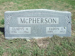
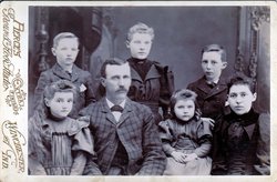
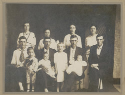
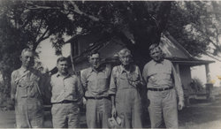
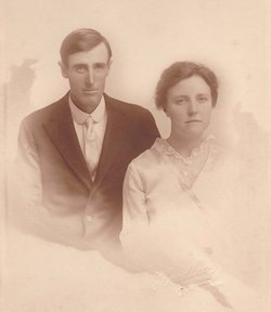
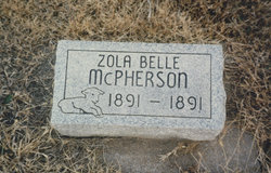
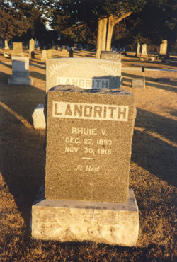
Eldon Edgar McPherson
| Birth | : | 12 Mar 1889 Labette County, Kansas, USA |
| Death | : | 24 Jul 1957 Parsons, Labette County, Kansas, USA |
| Burial | : | Wespark Cemetery, Kroonstad, Fezile Dabi District Municipality, South Africa |
| Coordinate | : | -27.6415390, 27.2175250 |
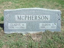
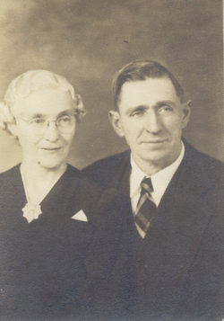
| Description | : | ELDON MCPHERSON, RURAL BARTLETT, DIES "Eldon McPherson, 67, prominent farmer of near Bartlett, died Wednesday, July 24, at 2:45 p.m. in Mercy Hospital at Parsons, following an illness of about six weeks. He had lived in Labette County all of his life. Mr. McPherson was born in Labette county, Kansas on March 12, 1891 near Bartlett. He farmed in that area for many years. He married Gladys A, Wiley on September 29. 1912. Survivors, in addition to his widow, are a son, Harold E. of Sentinel, OK, a daughter, Mrs. Elaine Armstrong, of Lincoln, KS, three brothers,... Read More |
frequently asked questions (FAQ):
-
Where is Eldon Edgar McPherson's memorial?
Eldon Edgar McPherson's memorial is located at: Wespark Cemetery, Kroonstad, Fezile Dabi District Municipality, South Africa.
-
When did Eldon Edgar McPherson death?
Eldon Edgar McPherson death on 24 Jul 1957 in Parsons, Labette County, Kansas, USA
-
Where are the coordinates of the Eldon Edgar McPherson's memorial?
Latitude: -27.6415390
Longitude: 27.2175250
Family Members:
Parent
Spouse
Siblings
Children
Flowers:
Nearby Cemetories:
1. Wespark Cemetery
Kroonstad, Fezile Dabi District Municipality, South Africa
Coordinate: -27.6415390, 27.2175250
2. Kroonstad Old Cemetery
Kroonstad, Fezile Dabi District Municipality, South Africa
Coordinate: -27.6506810, 27.2293460
3. British Military Cemetery
Kroonstad, Fezile Dabi District Municipality, South Africa
Coordinate: -27.6513070, 27.2387370
4. St. John's Methodist Church Memorial Wall
Kroonstad, Fezile Dabi District Municipality, South Africa
Coordinate: -27.6646000, 27.2342830
5. NG Kerk - Kroonstad-Noord Gedenkmuur
Kroonstad, Fezile Dabi District Municipality, South Africa
Coordinate: -27.6576330, 27.2451000
6. Boer War Concentration Camp Cemetery and Memorial
Kroonstad, Fezile Dabi District Municipality, South Africa
Coordinate: -27.6717500, 27.2063670
7. Brentpark Cemetery
Kroonstad, Fezile Dabi District Municipality, South Africa
Coordinate: -27.6643500, 27.1891050
8. Dinoheng Cemetery
Kroonstad, Fezile Dabi District Municipality, South Africa
Coordinate: -27.6301440, 27.1709560
9. Eden Cemetery
Hennenman, Lejweleputswa District Municipality, South Africa
Coordinate: -27.9747940, 27.0487940
10. NG Kerk - Hennenman Muur van Herinnering
Hennenman, Lejweleputswa District Municipality, South Africa
Coordinate: -27.9714960, 27.0228870
11. Phomolong Cemetery
Hennenman, Lejweleputswa District Municipality, South Africa
Coordinate: -28.0085370, 27.0838110
12. Phomolong East Cemetery
Hennenman, Lejweleputswa District Municipality, South Africa
Coordinate: -28.0194870, 27.0959880
13. Steynsrus Cemetery
Steynsrus, Fezile Dabi District Municipality, South Africa
Coordinate: -27.9472110, 27.5522500
14. Ventersburg Old Cemetery
Ventersburg, Lejweleputswa District Municipality, South Africa
Coordinate: -28.0812670, 27.1349830
15. Ventersburg Cemetery
Ventersburg, Lejweleputswa District Municipality, South Africa
Coordinate: -28.0845280, 27.1460060
16. NG Kerk - Ventersburg Muur van Herinnering
Ventersburg, Lejweleputswa District Municipality, South Africa
Coordinate: -28.0843720, 27.1364950
17. Moedergemeente Riebeeckstad Muur van Herinnering
Welkom, Lejweleputswa District Municipality, South Africa
Coordinate: -27.9216670, 26.8126000
18. NG Kerk - Erfdeel Muur van Herinnering
Welkom, Lejweleputswa District Municipality, South Africa
Coordinate: -27.9325830, 26.8073670
19. Viljoenskroon Cemetery
Viljoenskroon, Fezile Dabi District Municipality, South Africa
Coordinate: -27.2154670, 26.9494630
20. Odendaalsrus Cemetery
Odendaalsrus, Lejweleputswa District Municipality, South Africa
Coordinate: -27.8936830, 26.7199830
21. Koppies Cemetery
Koppies, Fezile Dabi District Municipality, South Africa
Coordinate: -27.2358670, 27.5614500
22. Nyakallong Cemetery
Allanridge, Lejweleputswa District Municipality, South Africa
Coordinate: -27.7742550, 26.6630390
23. NG Kerk - Koppies Kerkhof en Gedenkmuur
Koppies, Fezile Dabi District Municipality, South Africa
Coordinate: -27.2411830, 27.5727170
24. NG Kerk - Allanridge Muur van Herinnering
Allanridge, Lejweleputswa District Municipality, South Africa
Coordinate: -27.7531521, 26.6498810

