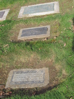
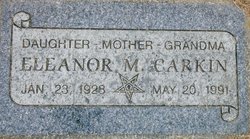
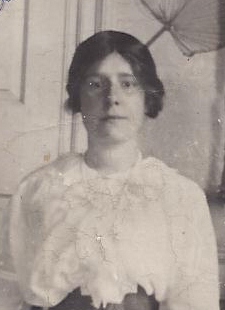
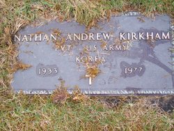
Eleanor Marion Kirkham Carkin
| Birth | : | 23 Jan 1928 Seattle, King County, Washington, USA |
| Death | : | 20 May 1991 Seattle, King County, Washington, USA |
| Burial | : | East Union Cemetery, Honeytown, Wayne County, USA |
| Coordinate | : | 40.7989006, -81.8735962 |
| Plot | : | 3-150-M |
| Description | : | She was the daughter of Arthur Sherman Kirkham and Belle Eleaor Carkin. She married Clayton Lee Carkin on Nov. 27 1948 in Seattle Washington |
frequently asked questions (FAQ):
-
Where is Eleanor Marion Kirkham Carkin's memorial?
Eleanor Marion Kirkham Carkin's memorial is located at: East Union Cemetery, Honeytown, Wayne County, USA.
-
When did Eleanor Marion Kirkham Carkin death?
Eleanor Marion Kirkham Carkin death on 20 May 1991 in Seattle, King County, Washington, USA
-
Where are the coordinates of the Eleanor Marion Kirkham Carkin's memorial?
Latitude: 40.7989006
Longitude: -81.8735962
Family Members:
Parent
Spouse
Siblings
Children
Flowers:
Nearby Cemetories:
1. East Union Cemetery
Honeytown, Wayne County, USA
Coordinate: 40.7989006, -81.8735962
2. Weaver Cemetery
Honeytown, Wayne County, USA
Coordinate: 40.7952995, -81.8688965
3. Stauffer Cemetery
Honeytown, Wayne County, USA
Coordinate: 40.8008003, -81.8610992
4. Wayne County Home Cemetery
Wooster, Wayne County, USA
Coordinate: 40.7848015, -81.8896027
5. Sommer Cemetery
Weilersville, Wayne County, USA
Coordinate: 40.8292999, -81.8616028
6. Ramsey Cemetery #1
Apple Creek, Wayne County, USA
Coordinate: 40.7702500, -81.8535280
7. Maple Grove Memorial Park
Wooster, Wayne County, USA
Coordinate: 40.8302210, -81.8453610
8. Oak Ridge Cemetery
Wooster, Wayne County, USA
Coordinate: 40.8078290, -81.8248230
9. Bodine Cemetery
East Union, Wayne County, USA
Coordinate: 40.8078995, -81.8246002
10. Ramsey Cemetery #2
Apple Creek, Wayne County, USA
Coordinate: 40.7852220, -81.8236110
11. Paradise Cemetery
Smithville, Wayne County, USA
Coordinate: 40.8367996, -81.8417969
12. Price Cemetery
Wooster, Wayne County, USA
Coordinate: 40.8227780, -81.9247220
13. Apple Creek Developmental Center Cemetery #2
Apple Creek, Wayne County, USA
Coordinate: 40.7715280, -81.8250830
14. Amish Plank Cemetery
Wooster, Wayne County, USA
Coordinate: 40.8247780, -81.9241690
15. First Presbyterian Church Memorial Garden
Wooster, Wayne County, USA
Coordinate: 40.8050373, -81.9353000
16. Wooster Cemetery
Wooster, Wayne County, USA
Coordinate: 40.7851067, -81.9340820
17. Old Saint Marys Catholic Cemetery
Wooster, Wayne County, USA
Coordinate: 40.7915000, -81.9367220
18. Old Seceder Church Burial Grounds
Wooster, Wayne County, USA
Coordinate: 40.7932320, -81.9371140
19. Saint Mary's Cemetery
Wooster, Wayne County, USA
Coordinate: 40.7789001, -81.9336014
20. Old Presbyterian Cemetery
Apple Creek, Wayne County, USA
Coordinate: 40.7554410, -81.8415570
21. Saint James Episcopal Church Columbarium
Wooster, Wayne County, USA
Coordinate: 40.7996610, -81.9397870
22. Apple Creek Developmental Center Cemetery #1
Apple Creek, Wayne County, USA
Coordinate: 40.7559700, -81.8390427
23. Wooster German Lutheran Cemetery
Wooster, Wayne County, USA
Coordinate: 40.7955900, -81.9422960
24. Apple Creek Cemetery
Apple Creek, Wayne County, USA
Coordinate: 40.7545013, -81.8366013


