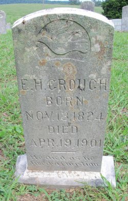
Elias Henderson Crouch
| Birth | : | 13 Nov 1824 Fentress County, Tennessee, USA |
| Death | : | 19 Apr 1901 Pall Mall, Fentress County, Tennessee, USA |
| Burial | : | Big Flats Cemetery, Big Flats, Adams County, USA |
| Coordinate | : | 44.1114998, -89.8221970 |
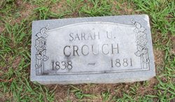
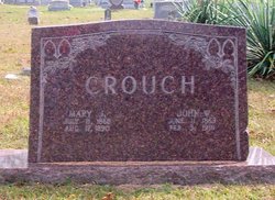
| Description | : | Father: John Wesley Crouch (1803-1841) Mother: Rebecca Elizabeth Kidd (1805-1841) His parents died in Missouri of a fever along with a brother, Aaron. Elias married Sarah Jane "Sally" Upchurch. Their children: Rebecca Jane, Elvira, William H., John Wesley "Johnny", Lucinda A., and Thomas Washington. Married 2nd, Nancy Hatfield. Had one son, Henry. |
frequently asked questions (FAQ):
-
Where is Elias Henderson Crouch's memorial?
Elias Henderson Crouch's memorial is located at: Big Flats Cemetery, Big Flats, Adams County, USA.
-
When did Elias Henderson Crouch death?
Elias Henderson Crouch death on 19 Apr 1901 in Pall Mall, Fentress County, Tennessee, USA
-
Where are the coordinates of the Elias Henderson Crouch's memorial?
Latitude: 44.1114998
Longitude: -89.8221970
Family Members:
Spouse
Children
Flowers:
Nearby Cemetories:
1. Big Flats Cemetery
Big Flats, Adams County, USA
Coordinate: 44.1114998, -89.8221970
2. Niebull Cemetery
Big Flats, Adams County, USA
Coordinate: 44.1267014, -89.7533035
3. Cottonville Cemetery
Cottonville, Adams County, USA
Coordinate: 44.0539017, -89.8265991
4. Goodbear Cemetery
Cottonville, Adams County, USA
Coordinate: 44.0495200, -89.7668800
5. Edwardson Cemetery
Strongs Prairie, Adams County, USA
Coordinate: 44.0539017, -89.9141998
6. Indian Baby Grave
Monroe Center, Adams County, USA
Coordinate: 44.1180077, -89.9447174
7. Monroe Cemetery
Monroe Center, Adams County, USA
Coordinate: 44.1183014, -89.9503021
8. East Arkdale Cemetery
Arkdale, Adams County, USA
Coordinate: 44.0252991, -89.8768997
9. New Rome Cemetery
New Rome, Adams County, USA
Coordinate: 44.1943016, -89.8887024
10. Indian Cemetery
Cottonville, Adams County, USA
Coordinate: 44.0449982, -89.7213974
11. West Arkdale Cemetery
Arkdale, Adams County, USA
Coordinate: 44.0243988, -89.9171982
12. Holliday Cemetery
Big Flats, Adams County, USA
Coordinate: 44.1707993, -89.6889038
13. Spring Branch Cemetery
New Rome, Adams County, USA
Coordinate: 44.2219009, -89.7774963
14. South Arkdale Cemetery
Arkdale, Adams County, USA
Coordinate: 44.0102997, -89.9186020
15. Strongs Prairie Cemetery
Strongs Prairie, Adams County, USA
Coordinate: 44.0607986, -89.9850006
16. Fordham Cemetery
Friendship, Adams County, USA
Coordinate: 43.9814796, -89.7571869
17. Saint Leos Cemetery
Friendship, Adams County, USA
Coordinate: 43.9735985, -89.8383026
18. Mount Repose Cemetery
Friendship, Adams County, USA
Coordinate: 43.9733009, -89.8358002
19. Greenwood Cemetery
New Miner, Juneau County, USA
Coordinate: 44.2386017, -89.9131012
20. Colburn Leola Cemetery
Big Flats, Adams County, USA
Coordinate: 44.1556015, -89.6260986
21. Green Hill Cemetery
Nekoosa, Wood County, USA
Coordinate: 44.2606010, -89.8713989
22. Dellwood Cemetery
Dellwood, Adams County, USA
Coordinate: 43.9789009, -89.9383011
23. Novotny Cemetery
New Miner, Juneau County, USA
Coordinate: 44.1702995, -90.0263977
24. Searles Prairie Cemetery
New Miner, Juneau County, USA
Coordinate: 44.1514015, -90.0361023


