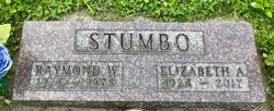
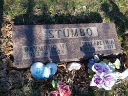
Elizabeth Ann Ross Stumbo
| Birth | : | 2 Apr 1924 Iowa, USA |
| Death | : | 17 Aug 2017 Boone, Boone County, Iowa, USA |
| Burial | : | Bluff Creek Cemetery, Boone, Boone County, USA |
| Coordinate | : | 42.0774994, -93.9796982 |
| Description | : | Elizabeth Ann Stumbo, 93, of Boone and the Westhaven Community, died August 17, 2017 at the Westhaven Community. Elizabeth Ann (Ross) Stumbo, was born April 2, 1924 in Boone, Iowa, the daughter of Frank and Marie (Stotts) Ross. She graduated from Boone High School in 1942. On May 16, 1942, Elizabeth was united in marriage to Arnold Staley. Arnold was killed in Italy during WWII. On September 30, 1944, Elizabeth married Raymond Stumbo Sr. at the Bell Tower in Jefferson, Iowa. In her younger years, Elizabeth worked for a Hemp plant during WWII, then she worked at the former Places Store,... Read More |
frequently asked questions (FAQ):
-
Where is Elizabeth Ann Ross Stumbo's memorial?
Elizabeth Ann Ross Stumbo's memorial is located at: Bluff Creek Cemetery, Boone, Boone County, USA.
-
When did Elizabeth Ann Ross Stumbo death?
Elizabeth Ann Ross Stumbo death on 17 Aug 2017 in Boone, Boone County, Iowa, USA
-
Where are the coordinates of the Elizabeth Ann Ross Stumbo's memorial?
Latitude: 42.0774994
Longitude: -93.9796982
Family Members:
Parent
Spouse
Siblings
Children
Flowers:
Nearby Cemetories:
1. Bluff Creek Cemetery
Boone, Boone County, USA
Coordinate: 42.0774994, -93.9796982
2. Buckley Cemetery
Boone, Boone County, USA
Coordinate: 42.0999810, -93.9418960
3. Hickory Grove Cemetery
Boone County, USA
Coordinate: 42.1074982, -93.9507980
4. Rose Hill Cemetery
Boone, Boone County, USA
Coordinate: 42.0419006, -93.9408035
5. Sacred Heart Cemetery
Boone, Boone County, USA
Coordinate: 42.0485992, -93.9163971
6. Boone Memorial Gardens Cemetery
Boone, Boone County, USA
Coordinate: 42.0449982, -93.9152985
7. Biblical College Cemetery
Boone, Boone County, USA
Coordinate: 42.0456009, -93.9113998
8. Maas Cemetery
Boone County, USA
Coordinate: 42.0908012, -94.0618973
9. Saint Johns Catholic Cemetery
Ogden, Boone County, USA
Coordinate: 42.0344000, -94.0407000
10. Oakwood Cemetery
Moingona, Boone County, USA
Coordinate: 42.0219002, -93.9396973
11. Glenwood Cemetery
Ogden, Boone County, USA
Coordinate: 42.0340000, -94.0440000
12. Bass Point Cemetery
Boone, Boone County, USA
Coordinate: 42.0992012, -93.8957977
13. Hollaway Cemetery
Moingona, Boone County, USA
Coordinate: 42.0138720, -93.9530080
14. Schlicht Cemetery
Fraser, Boone County, USA
Coordinate: 42.1444200, -93.9780100
15. Quincy Cemetery
Boone, Boone County, USA
Coordinate: 42.0074997, -93.9503021
16. Linwood Park Cemetery
Boone, Boone County, USA
Coordinate: 42.0550003, -93.8850021
17. Latham Cemetery
Boone, Boone County, USA
Coordinate: 42.0489006, -93.8878021
18. Maple Grove Cemetery
Boxholm, Boone County, USA
Coordinate: 42.0793690, -94.0859890
19. Pilot Mound Cemetery
Pilot Mound, Boone County, USA
Coordinate: 42.1636200, -94.0282600
20. Boone County Poor Farm Cemetery
Boone County, USA
Coordinate: 42.1591100, -93.9159000
21. Sarah Dinwoodie Cemetery
Worth Township, Boone County, USA
Coordinate: 42.0278000, -93.8697000
22. Union Cemetery
Boxholm, Boone County, USA
Coordinate: 42.1369019, -94.0852966
23. Runyan Cemetery
Pilot Mound, Boone County, USA
Coordinate: 42.1749992, -94.0015030
24. White Cemetery
Boone County, USA
Coordinate: 42.1777992, -93.9636002


