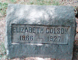
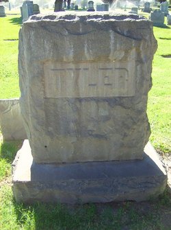
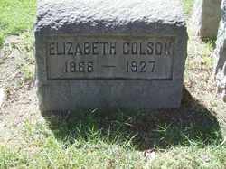
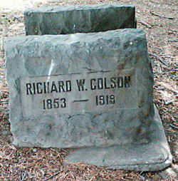
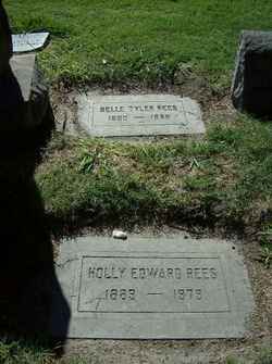
Elizabeth Anne “Lizzie” Tyler Colson
| Birth | : | 10 Feb 1866 Payson, Utah County, Utah, USA |
| Death | : | 11 Jan 1927 San Bernardino, San Bernardino County, California, USA |
| Burial | : | Desert Lawn Memorial Park, Kennewick, Benton County, USA |
| Coordinate | : | 46.1983643, -119.1785507 |
| Description | : | Elizabeth's parents were: Uriah Urban Tyler, b. Nov. 13, 1826 in Lowville, Lewis County, NY. and d. Jul. 4, 1871 in San Bernardino, San Bernardino County, CA. & Rachel Melinda Moore , b. Aug. 26. 1841 in Nauvoo, Hancock County, IL. and d. May 21, 1913 in San Bernardino, San Bernardino County, CA. In 1864, Rachel Hancock and Uriah Urban Tyler were married. Uriah & Rachel Tyler's children were: 1. Elizabeth "Lizzie" Anne Tyler Colson, b. Feb. 10, 1866 in Payson, Utah County, UT. and d. Jan. 11, 1927 in San Bernardino, San Bernardino County, CA. Lizzie marr.... Read More |
frequently asked questions (FAQ):
-
Where is Elizabeth Anne “Lizzie” Tyler Colson's memorial?
Elizabeth Anne “Lizzie” Tyler Colson's memorial is located at: Desert Lawn Memorial Park, Kennewick, Benton County, USA.
-
When did Elizabeth Anne “Lizzie” Tyler Colson death?
Elizabeth Anne “Lizzie” Tyler Colson death on 11 Jan 1927 in San Bernardino, San Bernardino County, California, USA
-
Where are the coordinates of the Elizabeth Anne “Lizzie” Tyler Colson's memorial?
Latitude: 46.1983643
Longitude: -119.1785507
Family Members:
Parent
Spouse
Siblings
Children
Flowers:
Nearby Cemetories:
1. Desert Lawn Memorial Park
Kennewick, Benton County, USA
Coordinate: 46.1983643, -119.1785507
2. Saint Paul's Episcopal Church Columbarium
Kennewick, Benton County, USA
Coordinate: 46.1978264, -119.1408081
3. Riverview Heights Cemetery
Kennewick, Benton County, USA
Coordinate: 46.1977768, -119.1400986
4. Saint Joseph Catholic Church Columbarium
Kennewick, Benton County, USA
Coordinate: 46.2041750, -119.1281330
5. Columbia Memorial Gardens
Pasco, Franklin County, USA
Coordinate: 46.2294006, -119.1216965
6. City View Cemetery
Pasco, Franklin County, USA
Coordinate: 46.2496986, -119.0852966
7. Resthaven Cemetery
Richland, Benton County, USA
Coordinate: 46.2861023, -119.2804413
8. All Saints Episcopal Church Memorial Garden
Richland, Benton County, USA
Coordinate: 46.2875000, -119.2824000
9. Sunset Memorial Gardens
Richland, Benton County, USA
Coordinate: 46.2825127, -119.3098602
10. Burbank Cemetery
Walla Walla County, USA
Coordinate: 46.1975365, -118.9809036
11. Country Christian Center Cemetery
Pasco, Franklin County, USA
Coordinate: 46.3873600, -119.1831800
12. Horse Heaven Hills Cemetery
Benton County, USA
Coordinate: 46.1551018, -119.4826736
13. Old German Baptist Brethren Church Cemetery
Pasco, Franklin County, USA
Coordinate: 46.4156800, -119.1566600
14. Wallula Cemetery
Wallula, Walla Walla County, USA
Coordinate: 46.0844400, -118.8997200
15. Evergreen Cemetery
Benton City, Benton County, USA
Coordinate: 46.2867012, -119.4938965
16. Eltopia Cemetery
Eltopia, Franklin County, USA
Coordinate: 46.4608002, -119.0222015
17. Pioneer Memorial Cemetery
Umatilla, Umatilla County, USA
Coordinate: 45.9164009, -119.3486023
18. Sunset Hills Cemetery
Umatilla, Umatilla County, USA
Coordinate: 45.9077988, -119.3507996
19. Holdman Cemetery
Holdman, Umatilla County, USA
Coordinate: 45.8744011, -118.9443970
20. Desert Lawn Memorial Cemetery
Irrigon, Morrow County, USA
Coordinate: 45.8972015, -119.4721985
21. Paterson Memorial Cemetery
Paterson, Benton County, USA
Coordinate: 45.9437943, -119.5705566
22. Stanfield Hutterite Cemetery
Stanfield, Umatilla County, USA
Coordinate: 45.8271307, -119.0798728
23. Country View Cemetery
Basin City, Franklin County, USA
Coordinate: 46.5768210, -119.1484080
24. Hermiston Cemetery
Hermiston, Umatilla County, USA
Coordinate: 45.8236008, -119.2806015

