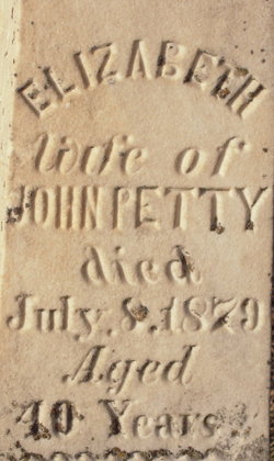
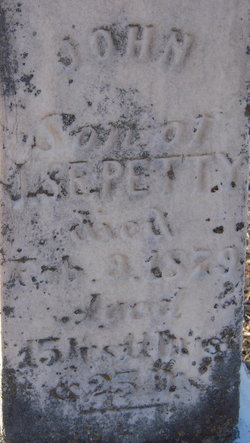
Elizabeth Coleman Petty
| Birth | : | 1839 Ireland |
| Death | : | 8 Jul 1879 Papillion, Sarpy County, Nebraska, USA |
| Burial | : | Santa Fe Cemetery, Bradford County, USA |
| Coordinate | : | 29.8727360, -82.1614075 |
frequently asked questions (FAQ):
-
Where is Elizabeth Coleman Petty's memorial?
Elizabeth Coleman Petty's memorial is located at: Santa Fe Cemetery, Bradford County, USA.
-
When did Elizabeth Coleman Petty death?
Elizabeth Coleman Petty death on 8 Jul 1879 in Papillion, Sarpy County, Nebraska, USA
-
Where are the coordinates of the Elizabeth Coleman Petty's memorial?
Latitude: 29.8727360
Longitude: -82.1614075
Family Members:
Parent
Spouse
Siblings
Children
Flowers:
Nearby Cemetories:
1. Santa Fe Cemetery
Bradford County, USA
Coordinate: 29.8727360, -82.1614075
2. Hampton Cemetery
Hampton, Bradford County, USA
Coordinate: 29.8642502, -82.1309814
3. Prescott Cemetery
Bradford County, USA
Coordinate: 29.9036007, -82.1828003
4. Prevatt Cemetery
Bradford County, USA
Coordinate: 29.9041996, -82.1378021
5. Brymer Cemetery
Starke, Bradford County, USA
Coordinate: 29.9006700, -82.1273100
6. Odd Fellows Cemetery
Starke, Bradford County, USA
Coordinate: 29.9006700, -82.1273090
7. Sparkman Cemetery
Bradford County, USA
Coordinate: 29.8474998, -82.2185974
8. Waldo Cemetery
Waldo, Alachua County, USA
Coordinate: 29.8131008, -82.1669006
9. Mount Sinai Cemetery
Bradford County, USA
Coordinate: 29.8539009, -82.2444000
10. Crosby Lake Cemetery
Starke, Bradford County, USA
Coordinate: 29.9493999, -82.1472015
11. Griffis Family Cemetery
Starke, Bradford County, USA
Coordinate: 29.9107826, -82.0797910
12. Laurel Grove Cemetery
Waldo, Alachua County, USA
Coordinate: 29.7905998, -82.1604996
13. Brown Cemetery
Starke, Bradford County, USA
Coordinate: 29.9477997, -82.2091980
14. Saint Marks Episcopal Church Cemetery
Starke, Bradford County, USA
Coordinate: 29.9445190, -82.1065280
15. Hope Baptist Cemetery
Starke, Bradford County, USA
Coordinate: 29.8381004, -82.0682983
16. Rock Church Cemetery
Bradford County, USA
Coordinate: 29.8585400, -82.2711460
17. Freedom Cemetery
Alachua County, USA
Coordinate: 29.8257999, -82.2630997
18. DeSue Cemetery
Starke, Bradford County, USA
Coordinate: 29.9748840, -82.1499700
19. Bob Lov Cemetery
Starke, Bradford County, USA
Coordinate: 29.9754200, -82.1500092
20. Pleasant Grove Cemetery
Starke, Bradford County, USA
Coordinate: 29.9751580, -82.1360560
21. Blue Pond Cemetery
Clay County, USA
Coordinate: 29.8558006, -82.0327988
22. Free Canaan Methodist Cemetery
Alachua County, USA
Coordinate: 29.7541000, -82.1318200
23. Lee Cemetery
Clay County, USA
Coordinate: 29.8568993, -82.0175018
24. Keystone Heights Cemetery
Keystone Heights, Clay County, USA
Coordinate: 29.7928009, -82.0453033

