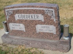
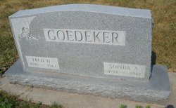
| Birth | : | 28 Mar 1884 Washington County, Nebraska, USA |
| Death | : | 23 Oct 1961 Omaha, Douglas County, Nebraska, USA |
| Burial | : | Flower Hill Cemetery, Omaha, Douglas County, USA |
| Coordinate | : | 41.3133011, -96.1371994 |
| Inscription | : | Mother |
| Description | : | From obituary: Elizabeth Goedeker was born March 28, 1888. She was married to Charles Lamp who preceded her in death, and later married Adolph Paulsen* who has also passed away. *Undetermined if the marker or obit has the correct spelling. ∼~~~~~~~~~~~~~~~~~~~~~~~~~~~~~~~~~~~~~~~~~~~~~~~ Lizzie Lamp, both parents born in Germany ~~~~~~~~~~~~~~~~~~~~~~~~~~~~~~~~~~~~~~~~~~~~~~~~ Charles Lamp and "Lizzie" Gudeker were married on 2/24/1904 in Washington County, Nebraska. By 1910, the couple was living in Richland, Washington, Nebraska. Family members were: Head Charley Lamp, b ca 1878, Nebraska Wife Lizzie Lamp, b ca 1885, Nebraska REQ Son Hans F Lamp, b ca 1904, Nebraska, 16546704 Son Henry Lamp,... Read More |
frequently asked questions (FAQ):
-
Where is Elizabeth “Lizzie” Goedeker Paulson's memorial?
Elizabeth “Lizzie” Goedeker Paulson's memorial is located at: Flower Hill Cemetery, Omaha, Douglas County, USA.
-
When did Elizabeth “Lizzie” Goedeker Paulson death?
Elizabeth “Lizzie” Goedeker Paulson death on 23 Oct 1961 in Omaha, Douglas County, Nebraska, USA
-
Where are the coordinates of the Elizabeth “Lizzie” Goedeker Paulson's memorial?
Latitude: 41.3133011
Longitude: -96.1371994
Family Members:
Parent
Spouse
Siblings
Children
Flowers:
Nearby Cemetories:
1. Flower Hill Cemetery
Omaha, Douglas County, USA
Coordinate: 41.3133011, -96.1371994
2. Kobs Pioneer Cemetery
Bennington, Douglas County, USA
Coordinate: 41.3453000, -96.1389000
3. Dowd Memorial Chapel of the Immaculate Conception
Boys Town, Douglas County, USA
Coordinate: 41.2609200, -96.1310400
4. Pleasant Hill Cemetery
Omaha, Douglas County, USA
Coordinate: 41.2558975, -96.1194687
5. Union Memorial Cemetery
Omaha, Douglas County, USA
Coordinate: 41.3512611, -96.0620193
6. All Saints Episcopal Church Columbarium
Omaha, Douglas County, USA
Coordinate: 41.2785000, -96.0579000
7. Mount Sinai Cemetery
Omaha, Douglas County, USA
Coordinate: 41.3116989, -96.0314026
8. Mount Hope Cemetery
Omaha, Douglas County, USA
Coordinate: 41.3041992, -96.0310974
9. Servants of Mary Cemetery
Omaha, Douglas County, USA
Coordinate: 41.3017170, -96.0258260
10. Countryside Community Church Columbarium
Omaha, Douglas County, USA
Coordinate: 41.2483660, -96.0500270
11. Prospect Hill Cemetery
Elkhorn, Douglas County, USA
Coordinate: 41.2924995, -96.2577972
12. Saint Augustine of Canterbury Columbarium
Elkhorn, Douglas County, USA
Coordinate: 41.2582030, -96.2396490
13. Mount Calvary Cemetery
Elkhorn, Douglas County, USA
Coordinate: 41.2668991, -96.2474976
14. Saint Andrews Episcopal Church Columbarium
Omaha, Douglas County, USA
Coordinate: 41.2492500, -96.0427500
15. Springwell Cemetery
Omaha, Douglas County, USA
Coordinate: 41.3114014, -96.0096970
16. Mount Michael High School and Abbey Cemetery
Elkhorn, Douglas County, USA
Coordinate: 41.3157690, -96.2688670
17. German Cemetery
Washington County, USA
Coordinate: 41.4150600, -96.1366900
18. Evergreen Memorial Park Cemetery
Omaha, Douglas County, USA
Coordinate: 41.2393990, -96.0355988
19. Resurrection Cemetery
Omaha, Douglas County, USA
Coordinate: 41.2344208, -96.0365448
20. Calvary Cemetery
Omaha, Douglas County, USA
Coordinate: 41.2364006, -96.0294037
21. Potter Field
Omaha, Douglas County, USA
Coordinate: 41.3320274, -95.9902878
22. Forest Lawn Memorial Park
Omaha, Douglas County, USA
Coordinate: 41.3272018, -95.9847031
23. Ak-Sar-Ben Racetrack Grounds
Omaha, Douglas County, USA
Coordinate: 41.2414703, -96.0159607
24. Mount Auburn Cemetery
Omaha, Douglas County, USA
Coordinate: 41.2047005, -96.2050018


