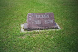
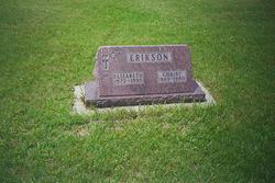
Elizabeth “Lizzie” Maher Erikson
| Birth | : | Jan 1872 Freeport, Stephenson County, Illinois, USA |
| Death | : | 4 Aug 1935 Sioux Falls, Minnehaha County, South Dakota, USA |
| Burial | : | Rochdale Cemetery, Rochdale, Metropolitan Borough of Rochdale, England |
| Coordinate | : | 53.6132698, -2.1833401 |
| Plot | : | Block 3, lot 21, grave 2 |
| Description | : | Lizzie was the daughter of James and Anna (Farley) Maher, and was the wife of Christ Erikson. She was raised in the vicinity of Beresford, SD. After marriage, she continued to live there until moving to a farm near Sioux Falls, SD in 1920. Before 1920, she had also lived at Canton, SD and Hartford, SD. Lizzie was survived by her husband and by only two of her siblings, Kate Buckler and Lucy Maher. She was also surived by some of her children. She was preceded in death by two children and by her parents. |
frequently asked questions (FAQ):
-
Where is Elizabeth “Lizzie” Maher Erikson's memorial?
Elizabeth “Lizzie” Maher Erikson's memorial is located at: Rochdale Cemetery, Rochdale, Metropolitan Borough of Rochdale, England.
-
When did Elizabeth “Lizzie” Maher Erikson death?
Elizabeth “Lizzie” Maher Erikson death on 4 Aug 1935 in Sioux Falls, Minnehaha County, South Dakota, USA
-
Where are the coordinates of the Elizabeth “Lizzie” Maher Erikson's memorial?
Latitude: 53.6132698
Longitude: -2.1833401
Family Members:
Parent
Spouse
Siblings
Children
Flowers:
Nearby Cemetories:
1. Rochdale Cemetery
Rochdale, Metropolitan Borough of Rochdale, England
Coordinate: 53.6132698, -2.1833401
2. Rochdale Crematorium
Rochdale, Metropolitan Borough of Rochdale, England
Coordinate: 53.6160820, -2.1830570
3. Denehurst Cemetery
Rochdale, Metropolitan Borough of Rochdale, England
Coordinate: 53.6206199, -2.1821104
4. Heywood Cemetery
Heywood, Metropolitan Borough of Rochdale, England
Coordinate: 53.6010610, -2.1931250
5. St. Paul's Churchyard
Norden, Metropolitan Borough of Rochdale, England
Coordinate: 53.6273006, -2.2126936
6. St Martin Churchyard
Castleton Moor, Metropolitan Borough of Rochdale, England
Coordinate: 53.5885050, -2.1756140
7. Christ Church Churchyard
Healey, Metropolitan Borough of Rochdale, England
Coordinate: 53.6378630, -2.1741198
8. St. James Ashworth
Rochdale, Metropolitan Borough of Rochdale, England
Coordinate: 53.6214693, -2.2261040
9. St. John's Churchyard Thornham
Middleton, Metropolitan Borough of Rochdale, England
Coordinate: 53.5760100, -2.1718300
10. St Bartholomew Churchyard
Whitworth, Rossendale Borough, England
Coordinate: 53.6553000, -2.1709700
11. St James the Apostle Churchyard
Wardle, Metropolitan Borough of Rochdale, England
Coordinate: 53.6497550, -2.1338420
12. Saint Andrew's
Dearnley, Metropolitan Borough of Rochdale, England
Coordinate: 53.6395100, -2.1168400
13. Littleborough Cemetery
Littleborough, Metropolitan Borough of Rochdale, England
Coordinate: 53.6407500, -2.1167500
14. Royton Cemetery
Royton, Metropolitan Borough of Oldham, England
Coordinate: 53.5727450, -2.1302850
15. St. Mary's Churchyard Birch-In-Hopwood
Heywood, Metropolitan Borough of Rochdale, England
Coordinate: 53.5662410, -2.2247560
16. St. Thomas Churchyard
Newhey, Metropolitan Borough of Rochdale, England
Coordinate: 53.6019166, -2.0958889
17. Whitworth Cemetery
Whitworth, Rossendale Borough, England
Coordinate: 53.6671650, -2.1674750
18. Boarshaw Cemetery and Crematorium
Middleton, Metropolitan Borough of Rochdale, England
Coordinate: 53.5584100, -2.1773100
19. Middleton Cemetery and Crematorium
Middleton, Metropolitan Borough of Rochdale, England
Coordinate: 53.5574400, -2.1829200
20. Saint Paul Churchyard
Royton, Metropolitan Borough of Oldham, England
Coordinate: 53.5653330, -2.1261450
21. Crompton Cemetery
Shaw, Metropolitan Borough of Oldham, England
Coordinate: 53.5799840, -2.1003410
22. St Matthew Churchyard
Chadderton, Metropolitan Borough of Oldham, England
Coordinate: 53.5565975, -2.1528452
23. Old Burial Grounds
Middleton, Metropolitan Borough of Rochdale, England
Coordinate: 53.5534036, -2.1948053
24. St Leonard's Churchyard
Middleton, Metropolitan Borough of Rochdale, England
Coordinate: 53.5530640, -2.1945060

