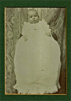
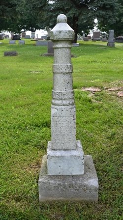
Ella May Brockman
| Birth | : | 15 Dec 1898 Cass County, Iowa, USA |
| Death | : | 28 Feb 1899 Anita, Cass County, Iowa, USA |
| Burial | : | Reservation Community Memorial Park, Wapato, Yakima County, USA |
| Coordinate | : | 46.4484291, -120.5375519 |
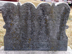
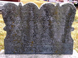
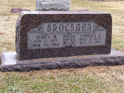
| Inscription | : | Aged 2 m. 13 d. Child of C.E. & M.A. Brockman |
| Description | : | A Great Bereavement DIED:--Sunday, February 26th., 1899 Chesley H., son of Charles E. and Mary A. Brockman: aged one year and eleven months DIED:--Tuesday, February 28th., 1899 Ella May, daughter of Charles E. and Mary A. Brockman: aged two months and thirteen days. The unwelcome hand of death has been laid heavily on the hearts of Mr. and Mrs. Charles E. Brockman during the past week, and the once happy home has been made desolate by the sudden summons, calling to a brighter world on high, the cherished treasures of earthly home, the joy and comfort of fond parents, whose great sorrow... Read More |
frequently asked questions (FAQ):
-
Where is Ella May Brockman's memorial?
Ella May Brockman's memorial is located at: Reservation Community Memorial Park, Wapato, Yakima County, USA.
-
When did Ella May Brockman death?
Ella May Brockman death on 28 Feb 1899 in Anita, Cass County, Iowa, USA
-
Where are the coordinates of the Ella May Brockman's memorial?
Latitude: 46.4484291
Longitude: -120.5375519
Family Members:
Parent
Siblings
Flowers:
Nearby Cemetories:
1. Reservation Community Memorial Park
Wapato, Yakima County, USA
Coordinate: 46.4484291, -120.5375519
2. Union Gap Cemetery
Yakima County, USA
Coordinate: 46.5209084, -120.4850998
3. Lewis Family Cemetery
Yakima, Yakima County, USA
Coordinate: 46.5390013, -120.5052581
4. Yemowat Cemetery
Yakima County, USA
Coordinate: 46.5475006, -120.5730972
5. Shaker Cemetery
White Swan, Yakima County, USA
Coordinate: 46.3891907, -120.6621399
6. Emeunot Cemetery
Wapato, Yakima County, USA
Coordinate: 46.5243988, -120.6616974
7. Pioneer Cemetery
Union Gap, Yakima County, USA
Coordinate: 46.5578003, -120.4697037
8. Sloutier Cemetery
Yakima County, USA
Coordinate: 46.5231018, -120.6722031
9. Tahoma Cemetery
Yakima, Yakima County, USA
Coordinate: 46.5753610, -120.5332320
10. Calvary Cemetery
Yakima, Yakima County, USA
Coordinate: 46.5790740, -120.5407420
11. Saluskin Cemetery
Yakima County, USA
Coordinate: 46.5266991, -120.7039032
12. Methodist Cemetery
White Swan, Yakima County, USA
Coordinate: 46.3862686, -120.7268066
13. Klick-Peter Cemetery
White Swan, Yakima County, USA
Coordinate: 46.3748370, -120.7323250
14. St. Mary's Catholic Cemetery
White Swan, Yakima County, USA
Coordinate: 46.3764000, -120.7391968
15. West Hills Memorial Park
Yakima, Yakima County, USA
Coordinate: 46.5819016, -120.6647034
16. Holy Rosary Cemetery
Moxee City, Yakima County, USA
Coordinate: 46.5531006, -120.3585968
17. Elmwood Cemetery
Toppenish, Yakima County, USA
Coordinate: 46.3673830, -120.3334530
18. Holland Cemetery
Moxee City, Yakima County, USA
Coordinate: 46.5766983, -120.3861008
19. Terrace Heights Memorial Park
Yakima, Yakima County, USA
Coordinate: 46.6068600, -120.4598900
20. Winnier Cemetery
Toppenish, Yakima County, USA
Coordinate: 46.3590060, -120.3192450
21. Toppenish Creek Cemetery
White Swan, Yakima County, USA
Coordinate: 46.3256660, -120.7206900
22. Zillah Cemetery
Zillah, Yakima County, USA
Coordinate: 46.4055202, -120.2726072
23. McCoy Cemetery
Toppenish, Yakima County, USA
Coordinate: 46.3835983, -120.2755966
24. Nelson Pioneer Cemetery
Yakima County, USA
Coordinate: 46.6404310, -120.5831510

