
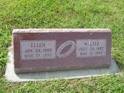
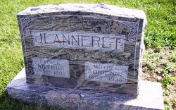
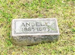
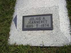
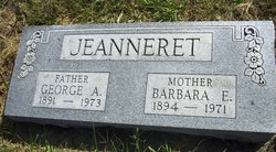
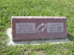
Ellen Jeanneret Robbins
| Birth | : | 24 Jan 1889 Pottawatomie County, Kansas, USA |
| Death | : | 19 Mar 1980 Onaga, Pottawatomie County, Kansas, USA |
| Burial | : | Ashland Cemetery, Ashland, Boyd County, USA |
| Coordinate | : | 38.4597850, -82.6313980 |
| Plot | : | BLOCK II |
| Description | : | Funeral services for Mrs. Ellen Robbins, 91, will be at 2:00 p.m. Friday at the Congregational Church. Burial will be in Neuchatel Cemetery. Mrs. Robbins died early Wednesday morning at Onaga Community Hospital, where she was admitted Tuesday. She was born January 24, 1889 north of Onaga and lived all of her life in the Onaga and Neuchatel communities. She was a member of the Congregational Church, Rebekah Lodge, Royal Neighbors and the Congregational Ladies Aid, all in Onaga. She was married February 20, 1907, to Walter Robbins at Onaga. He died May 17, 1976. A grandson, Stanley Robbins, died... Read More |
frequently asked questions (FAQ):
-
Where is Ellen Jeanneret Robbins's memorial?
Ellen Jeanneret Robbins's memorial is located at: Ashland Cemetery, Ashland, Boyd County, USA.
-
When did Ellen Jeanneret Robbins death?
Ellen Jeanneret Robbins death on 19 Mar 1980 in Onaga, Pottawatomie County, Kansas, USA
-
Where are the coordinates of the Ellen Jeanneret Robbins's memorial?
Latitude: 38.4597850
Longitude: -82.6313980
Family Members:
Parent
Spouse

Siblings
Children
Flowers:


Nearby Cemetories:
1. Ashland Cemetery
Ashland, Boyd County, USA
Coordinate: 38.4597850, -82.6313980
2. Jones Cemetery
Ashland, Boyd County, USA
Coordinate: 38.4463890, -82.6277780
3. Gallaher Cemetery
Ashland, Boyd County, USA
Coordinate: 38.4622820, -82.6524240
4. Bethesda Cemetery
Ashland, Boyd County, USA
Coordinate: 38.4721500, -82.6491510
5. Brickey Cemetery
Boyd County, USA
Coordinate: 38.4563900, -82.6577800
6. Calvary Catholic Cemetery
Ashland, Boyd County, USA
Coordinate: 38.4742012, -82.6519012
7. Brubaker Cemetery
Perry Township, Lawrence County, USA
Coordinate: 38.4604840, -82.6021710
8. Golden Oaks Memorial Gardens
Ashland, Boyd County, USA
Coordinate: 38.4383011, -82.6166992
9. Beech Grove Cemetery
Ashland, Boyd County, USA
Coordinate: 38.4802610, -82.6483320
10. Pollard Cemetery
Ashland, Boyd County, USA
Coordinate: 38.4717920, -82.6617380
11. Rose Hill Burial Park and Mausoleum
Ashland, Boyd County, USA
Coordinate: 38.4557991, -82.6718979
12. Crabtree Family Cemetery
Kitts Hill, Lawrence County, USA
Coordinate: 38.4907280, -82.6183990
13. Allen-Smallwood Cemetery
Boyd County, USA
Coordinate: 38.4625772, -82.6754914
14. Warner Cemetery
Catlettsburg, Boyd County, USA
Coordinate: 38.4236110, -82.6430560
15. McCoy Cemetery
Perry Township, Lawrence County, USA
Coordinate: 38.4473740, -82.5859400
16. Walker Cemetery
Catlettsburg, Boyd County, USA
Coordinate: 38.4227780, -82.6161110
17. Zoar Cemetery
Coal Grove, Lawrence County, USA
Coordinate: 38.5010986, -82.6280975
18. Winslow Cemetery
Ashland, Boyd County, USA
Coordinate: 38.4475900, -82.6821680
19. Highland Memorial Gardens
South Point, Lawrence County, USA
Coordinate: 38.4423000, -82.5821000
20. Barnett Cemetery
Catlettsburg, Boyd County, USA
Coordinate: 38.4180550, -82.6166660
21. Cumpston Cemetery
Catlettsburg, Boyd County, USA
Coordinate: 38.4191580, -82.6508480
22. Neal-Rice Cemetery
Boyd County, USA
Coordinate: 38.4161111, -82.6333333
23. Newton Cemetery
Coal Grove, Lawrence County, USA
Coordinate: 38.5024986, -82.6492004
24. Eads Cemetery
Catlettsburg, Boyd County, USA
Coordinate: 38.4155560, -82.6476280