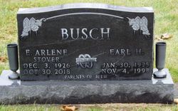
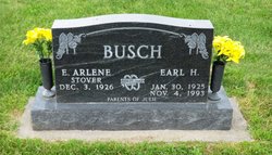
Ellner Arlene Stover Busch
| Birth | : | 3 Dec 1926 Jackson County, Iowa, USA |
| Death | : | 30 Oct 2018 Lavinia, Carroll County, Tennessee, USA |
| Burial | : | Massillon Cemetery, Massillon, Cedar County, USA |
| Coordinate | : | 41.9150000, -90.9205000 |
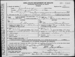
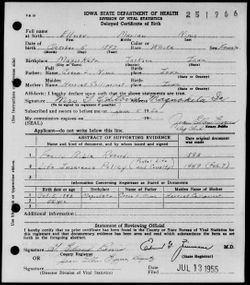
| Description | : | Ellner A. "Arlene" Busch, 91, passed away October 30, 2018, at her daughter’s home in Lavinia, Tennessee. Graveside services will be 11:00 a.m., Wednesday, November 7, at the Massillon Cemetery, Massillon, Iowa, with Pastor Tessa Cavey officiating. Ellner Arlene Stover was born December 3, 1926, on the family farm in Jackson County near Maquoketa, the daughter of Thomas and Ellner Marian (Nims) Stover. She graduated from Maquoketa High School in 1944. She was employed as a secretary to the city manager of Maquoketa for five years. She married Earl Busch on November 20, 1949, in Maquoketa. He preceded... Read More |
frequently asked questions (FAQ):
-
Where is Ellner Arlene Stover Busch's memorial?
Ellner Arlene Stover Busch's memorial is located at: Massillon Cemetery, Massillon, Cedar County, USA.
-
When did Ellner Arlene Stover Busch death?
Ellner Arlene Stover Busch death on 30 Oct 2018 in Lavinia, Carroll County, Tennessee, USA
-
Where are the coordinates of the Ellner Arlene Stover Busch's memorial?
Latitude: 41.9150000
Longitude: -90.9205000
Family Members:
Parent
Spouse
Flowers:
Nearby Cemetories:
1. Massillon Cemetery
Massillon, Cedar County, USA
Coordinate: 41.9150000, -90.9205000
2. Center Cemetery
Cedar County, USA
Coordinate: 41.9019012, -90.9555969
3. Saint James Cemetery
Toronto, Clinton County, USA
Coordinate: 41.9014015, -90.8681030
4. Rose Hill Cemetery
Toronto, Clinton County, USA
Coordinate: 41.9028015, -90.8660965
5. Lowden Cemetery
Lowden, Cedar County, USA
Coordinate: 41.8657990, -90.9289017
6. Trinity Lutheran Church Cemetery
Lowden, Cedar County, USA
Coordinate: 41.8658360, -90.9305830
7. Brink Cemetery
Clarence, Cedar County, USA
Coordinate: 41.9213982, -90.9903030
8. Van Horn Cemetery
Lowden, Cedar County, USA
Coordinate: 41.8438988, -90.9353027
9. Dayton Valley Cemetery
Clarence, Cedar County, USA
Coordinate: 41.9322014, -91.0207977
10. Oxford Junction Cemetery
Jones County, USA
Coordinate: 41.9764800, -90.9854200
11. Mayflower Cemetery
Oxford Junction, Jones County, USA
Coordinate: 41.9935989, -90.9494019
12. Pine Hill Cemetery
Wheatland, Clinton County, USA
Coordinate: 41.8446999, -90.8582993
13. Richman Cemetery
Lowden, Cedar County, USA
Coordinate: 41.8300010, -90.9077450
14. Saint Johns Cemetery
Clarence, Cedar County, USA
Coordinate: 41.8885994, -91.0317001
15. Sacred Heart Cemetery
Lost Nation, Clinton County, USA
Coordinate: 41.9659500, -90.8199500
16. Lost Nation Cemetery
Lost Nation, Clinton County, USA
Coordinate: 41.9654000, -90.8184000
17. Smithtown Cemetery
Lost Nation, Clinton County, USA
Coordinate: 41.9955000, -90.8555000
18. English Cemetery
Wheatland, Clinton County, USA
Coordinate: 41.8365000, -90.8490000
19. Rustic Park
Clinton County, USA
Coordinate: 41.9712334, -90.8088684
20. Saint Paul's Cemetery
Wheatland, Clinton County, USA
Coordinate: 41.8382988, -90.8336029
21. Diamond Cemetery
Hale, Jones County, USA
Coordinate: 41.9526500, -91.0491400
22. Clarence Cemetery
Clarence, Cedar County, USA
Coordinate: 41.8972015, -91.0606003
23. Fairview Cemetery
Bennett, Cedar County, USA
Coordinate: 41.8156013, -90.9863968
24. Homrighausen Cemetery
Wheatland, Clinton County, USA
Coordinate: 41.8088000, -90.8755000


