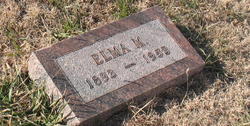
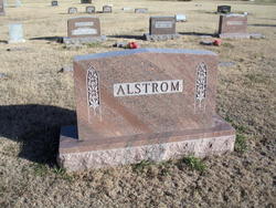
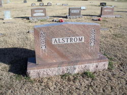
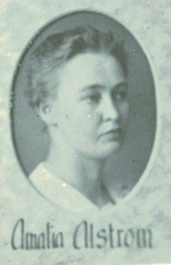
Elma Mathilda Alstrom
| Birth | : | 15 Mar 1893 Summit Township, Decatur County, Kansas, USA |
| Death | : | 12 Apr 1952 Summit Township, Decatur County, Kansas, USA |
| Burial | : | Clinton Township Cemetery, Sac County, USA |
| Coordinate | : | 42.3330600, -95.1475000 |
| Description | : | Elma was born and lived all her life in the same house on the Alstrom homestead in the Lund, Kansas community. |
frequently asked questions (FAQ):
-
Where is Elma Mathilda Alstrom's memorial?
Elma Mathilda Alstrom's memorial is located at: Clinton Township Cemetery, Sac County, USA.
-
When did Elma Mathilda Alstrom death?
Elma Mathilda Alstrom death on 12 Apr 1952 in Summit Township, Decatur County, Kansas, USA
-
Where are the coordinates of the Elma Mathilda Alstrom's memorial?
Latitude: 42.3330600
Longitude: -95.1475000
Family Members:
Parent
Siblings
Flowers:
Nearby Cemetories:
1. Clinton Township Cemetery
Sac County, USA
Coordinate: 42.3330600, -95.1475000
2. Linton Cemetery
Sac County, USA
Coordinate: 42.3330994, -95.1474991
3. Salem Reform Cemetery
Sac County, USA
Coordinate: 42.3555984, -95.1866989
4. Richland Cemetery
Sac County, USA
Coordinate: 42.3544006, -95.2238998
5. Wall Lake Cemetery
Wall Lake, Sac County, USA
Coordinate: 42.2757988, -95.0805969
6. Emmanuel Cemetery
Cook Township, Sac County, USA
Coordinate: 42.3993988, -95.2063980
7. Tom Marks Cemetery
Wall Lake, Sac County, USA
Coordinate: 42.2537000, -95.1605000
8. Odebolt Cemetery
Odebolt, Sac County, USA
Coordinate: 42.2985992, -95.2469025
9. Saint Martins Catholic Cemetery
Odebolt, Sac County, USA
Coordinate: 42.2985573, -95.2481842
10. Protestant Union Cemetery
Early, Sac County, USA
Coordinate: 42.4294014, -95.1483002
11. Sac County Farm Cemetery
Early, Sac County, USA
Coordinate: 42.4295560, -95.1175190
12. Ferguson Cemetery
Lake View, Sac County, USA
Coordinate: 42.3142014, -95.0132980
13. South Wall Lake Cemetery
Wall Lake, Sac County, USA
Coordinate: 42.2318993, -95.0911026
14. Early Union Cemetery
Early, Sac County, USA
Coordinate: 42.4578018, -95.1425018
15. Immanuel Presbyterian Cemetery
Carnarvon, Sac County, USA
Coordinate: 42.2392006, -95.0224991
16. Sacred Heart Cemetery
Early, Sac County, USA
Coordinate: 42.4650002, -95.1446991
17. Cory Grove Cemetery
Sac City, Sac County, USA
Coordinate: 42.3932991, -94.9788971
18. Cook Center Cemetery
Schaller, Sac County, USA
Coordinate: 42.4432983, -95.2649994
19. Oakland Cemetery
Sac City, Sac County, USA
Coordinate: 42.4272100, -94.9910760
20. Hayes Township Cemetery
Arthur, Ida County, USA
Coordinate: 42.2943993, -95.3427963
21. Bethel Cemetery
Kiron, Crawford County, USA
Coordinate: 42.2192001, -95.3043976
22. Wheatland Cemetery
Carroll County, USA
Coordinate: 42.1814003, -95.0582962
23. Saint John Lutheran Church Cemetery
Crawford County, USA
Coordinate: 42.1780000, -95.2650000
24. Chase Cemetery
Sac County, USA
Coordinate: 42.5036011, -95.2288971

