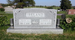
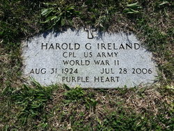
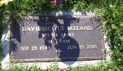
Elsie D. Burroughs Ireland
| Birth | : | 31 May 1926 Bismarck, Hot Spring County, Arkansas, USA |
| Death | : | 5 Feb 2008 Topeka, Shawnee County, Kansas, USA |
| Burial | : | Ayr Cemetery, Ayr, Burdekin Shire, Australia |
| Coordinate | : | -19.5641000, 147.3909940 |
| Plot | : | Section H |
| Description | : | Elsie D. Ireland, 81, Holton, died Feb. 5, 2008, at her son's home in Topeka. She was born May 31, 1926, at Bismark, Ark., the daughter of Charles S. and Vida L. Sargent Burroughs. She graduated from Bismark High School in 1944. Mrs. Ireland worked at the Fabric Nook, Slender You and Stephenson's Gifts, all in Holton. She was a member of First Presbyterian Church, Presbyterian Women, Rural Carriers Auxiliary, Holton Community Hospital Auxiliary, Garden Club, Qui Vive Club, and a 4-H leader with the Lucky Stars 4-H Club, all of Holton, and the Menninger Bible Study Club. She married... Read More |
frequently asked questions (FAQ):
-
Where is Elsie D. Burroughs Ireland's memorial?
Elsie D. Burroughs Ireland's memorial is located at: Ayr Cemetery, Ayr, Burdekin Shire, Australia.
-
When did Elsie D. Burroughs Ireland death?
Elsie D. Burroughs Ireland death on 5 Feb 2008 in Topeka, Shawnee County, Kansas, USA
-
Where are the coordinates of the Elsie D. Burroughs Ireland's memorial?
Latitude: -19.5641000
Longitude: 147.3909940
Family Members:
Parent
Spouse
Siblings
Children
Flowers:
Nearby Cemetories:
1. Ayr Cemetery
Ayr, Burdekin Shire, Australia
Coordinate: -19.5641000, 147.3909940
2. St Helens Anglican Church Columbarium Wall
Home Hill, Burdekin Shire, Australia
Coordinate: -19.6572720, 147.4130880
3. Home Hill General Cemetery
Home Hill, Burdekin Shire, Australia
Coordinate: -19.6630800, 147.4259200
4. Giru-Woodstock Road Homestead Cemetery
Giru, Burdekin Shire, Australia
Coordinate: -19.5477500, 147.0598300
5. Woongarra Crematorium
Townsville, Townsville City, Australia
Coordinate: -19.3580935, 146.8756311
6. Manton Cemetery
Manton, Townsville City, Australia
Coordinate: -19.6511300, 146.8335700
7. Stewart's Creek Penal Establishment Cemetery
Stuart, Townsville City, Australia
Coordinate: -19.3524684, 146.8498339
8. North Queensland Garden of Remembrance
Townsville, Townsville City, Australia
Coordinate: -19.2554030, 146.8240260
9. Sacred Heart Cathedral
Townsville, Townsville City, Australia
Coordinate: -19.2589000, 146.8118000
10. West End Cemetery
West End, Townsville City, Australia
Coordinate: -19.2657130, 146.8011430
11. Magnetic Island Memorial Gardens
Townsville, Townsville City, Australia
Coordinate: -19.1562722, 146.8551167
12. Florence Bay Scout Chapel Cemetery
Magnetic Island, Townsville City, Australia
Coordinate: -19.1239643, 146.8765564
13. Belgian Gardens Cemetery
Belgian Gardens, Townsville City, Australia
Coordinate: -19.2431100, 146.7826400
14. West Point Cemetery
Magnetic Island, Townsville City, Australia
Coordinate: -19.1334561, 146.7864305
15. Ravenswood Cemetery
Ravenswood, Charters Towers Region, Australia
Coordinate: -20.1116040, 146.8872210
16. Range Hotel
Townsville City, Australia
Coordinate: -19.3514510, 146.4871560
17. Bowen Flemington Road Cemetery
Bowen, Whitsunday Region, Australia
Coordinate: -20.0059100, 148.2123100
18. Bowen General Cemetery
Bowen, Whitsunday Region, Australia
Coordinate: -20.0014860, 148.2321260
19. Stone Island Homestead Cemetery
Bowen, Whitsunday Region, Australia
Coordinate: -20.0361500, 148.2790300
20. Cunningham Family Cemetery
Collinsville, Whitsunday Region, Australia
Coordinate: -20.4982000, 147.6299000
21. Macrossan Cemetery
Macrossan, Charters Towers Region, Australia
Coordinate: -20.0021640, 146.4439990
22. Sellheim Cemetery
Sellheim, Charters Towers Region, Australia
Coordinate: -20.0096093, 146.4013893
23. Collinsville Cemetery
Collinsville, Whitsunday Region, Australia
Coordinate: -20.5690210, 147.8369070
24. Palm Island
Palm Island, Palm Island Shire, Australia
Coordinate: -18.7354000, 146.5778575


