| Birth | : | 1 Jul 1839 Bloomington, McLean County, Illinois, USA |
| Death | : | 16 Jan 1912 Hoisington, Barton County, Kansas, USA |
| Burial | : | Layton Township Cemetery, Walnut, Pottawattamie County, USA |
| Coordinate | : | 41.4755478, -95.2109756 |
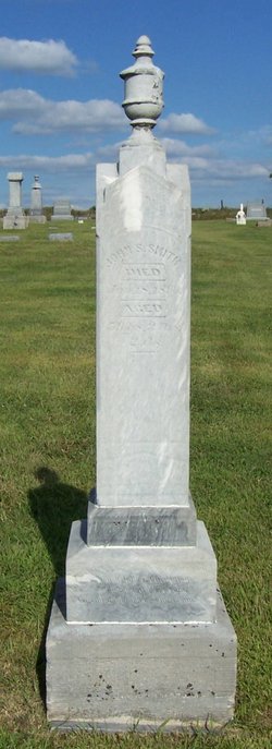
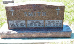
| Plot | : | Section C, Block 27, Lot A. Stone should read, |
| Description | : | Miss Elvira Deen was born June 1, 1938, at Bloomington, Illinois. She moved to Iowa with her parents when she was nine years old. She joined the United Brethren Church when she was 15 years of age. Deceased was united in marriage to John S. Smith August 16th, 1858. She remained a member of the United Brethren Church until she, with her husband, united with the Methodist Episcopal Church in December 1887. About two years ago she became connected with the Latter Day Saints Church, at Independence, Missouri. Mrs. Smith died... Read More |
frequently asked questions (FAQ):
-
Where is Elvira Melvina Melvira “Zilvery” Deen Smith's memorial?
Elvira Melvina Melvira “Zilvery” Deen Smith's memorial is located at: Layton Township Cemetery, Walnut, Pottawattamie County, USA.
-
When did Elvira Melvina Melvira “Zilvery” Deen Smith death?
Elvira Melvina Melvira “Zilvery” Deen Smith death on 16 Jan 1912 in Hoisington, Barton County, Kansas, USA
-
Where are the coordinates of the Elvira Melvina Melvira “Zilvery” Deen Smith's memorial?
Latitude: 41.4755478
Longitude: -95.2109756
Family Members:
Parent
Spouse
Siblings
Children
Flowers:
Nearby Cemetories:
1. Layton Township Cemetery
Walnut, Pottawattamie County, USA
Coordinate: 41.4755478, -95.2109756
2. Saint Patricks Catholic Cemetery
Walnut, Pottawattamie County, USA
Coordinate: 41.4831000, -95.2310000
3. Monroe United Methodist Church Cemetery
Monroe Township, Shelby County, USA
Coordinate: 41.5312000, -95.1735410
4. Newtown Cemetery
Avoca, Pottawattamie County, USA
Coordinate: 41.4583200, -95.3169400
5. Jacobson Cemetery
Shelby County, USA
Coordinate: 41.5277700, -95.2988900
6. Brighton Cemetery
Marne, Cass County, USA
Coordinate: 41.4622002, -95.0999985
7. Lincoln Township Cemetery
Hancock, Pottawattamie County, USA
Coordinate: 41.3824997, -95.2313995
8. Cuppys Grove Cemetery
Harlan, Shelby County, USA
Coordinate: 41.5643997, -95.2561035
9. Graceland Cemetery
Avoca, Pottawattamie County, USA
Coordinate: 41.4935989, -95.3368988
10. Lee Cemetery
Shelby, Shelby County, USA
Coordinate: 41.5555450, -95.2974981
11. Oak Hill Cemetery
Hancock, Pottawattamie County, USA
Coordinate: 41.3908005, -95.3360977
12. Clay Township Cemetery
Shelby County, USA
Coordinate: 41.5639000, -95.0886002
13. Olson Cemetery
Shelby County, USA
Coordinate: 41.5275002, -95.3806000
14. Fairview Township Cemetery
Corley, Shelby County, USA
Coordinate: 41.5856500, -95.3207500
15. Carlsen-Larsen Cemetery
Elk Horn, Shelby County, USA
Coordinate: 41.5772018, -95.0742035
16. Folck Cemetery
Harlan, Shelby County, USA
Coordinate: 41.6198000, -95.2456000
17. Heine Cemetery
Shelby, Shelby County, USA
Coordinate: 41.5277500, -95.4033000
18. Elk Horn Cemetery
Elk Horn, Shelby County, USA
Coordinate: 41.5950000, -95.0590000
19. Jacksonville Cemetery
Jacksonville, Shelby County, USA
Coordinate: 41.6488647, -95.1700211
20. Oak Hill Cemetery
Brayton, Audubon County, USA
Coordinate: 41.5450000, -94.9930000
21. Oakfield Baptist Cemetery
Oakfield, Audubon County, USA
Coordinate: 41.5774994, -95.0168991
22. Lorah Cemetery
Lorah, Cass County, USA
Coordinate: 41.4575005, -94.9738998
23. Southlawn Memorial Gardens
Atlantic, Cass County, USA
Coordinate: 41.3842010, -95.0044022
24. Immanuel Lutheran Cemetery
Kimballton, Audubon County, USA
Coordinate: 41.6306000, -95.0832977


