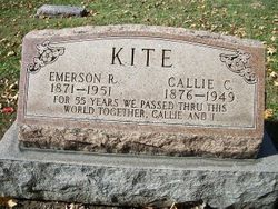
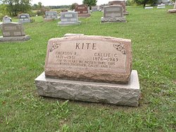
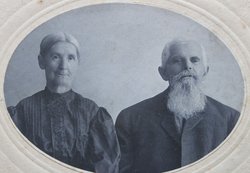
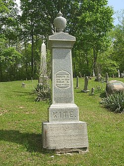
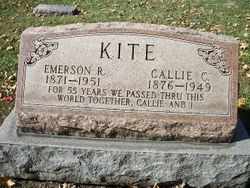
Emerson R. Kite
| Birth | : | 19 Mar 1871 Champaign County, Ohio, USA |
| Death | : | 26 Jan 1951 Sidney, Shelby County, Ohio, USA |
| Burial | : | Laurel Lawn Cemetery, Upper Deerfield Township, Cumberland County, USA |
| Coordinate | : | 39.4602930, -75.2292470 |
| Description | : | "Funeral Services For Emerson Kite Are Postponed "Funeral services for Emerson Kite, 80, of Sidney, a Champaign Co native, scheduled for Sunday, were postponed because of weather until 2 p.m. Tuesday. "Services will be held in the Baker funeral home at St. Paris with Rev. Rex G Van Court of St. Paris offiiciating. Interment will be in Evergreen cemetery, St. Paris. "Mr. Kite died at 10:30 a.m. Friday in a Sidney rest home after sustaining a hip fracture three months ago. He had been a patient at the home about one week. "A native of Champaign Co, he was a son of Joseph and... Read More |
frequently asked questions (FAQ):
-
Where is Emerson R. Kite's memorial?
Emerson R. Kite's memorial is located at: Laurel Lawn Cemetery, Upper Deerfield Township, Cumberland County, USA.
-
When did Emerson R. Kite death?
Emerson R. Kite death on 26 Jan 1951 in Sidney, Shelby County, Ohio, USA
-
Where are the coordinates of the Emerson R. Kite's memorial?
Latitude: 39.4602930
Longitude: -75.2292470
Family Members:
Parent
Spouse
Siblings
Flowers:
Nearby Cemetories:
1. Laurel Lawn Cemetery
Upper Deerfield Township, Cumberland County, USA
Coordinate: 39.4602930, -75.2292470
2. Saint Marys Cemetery
Bridgeton, Cumberland County, USA
Coordinate: 39.4403992, -75.2252274
3. Cohanzick Zoo
Bridgeton, Cumberland County, USA
Coordinate: 39.4395510, -75.2388370
4. First Baptist Church Cemetery
Bridgeton, Cumberland County, USA
Coordinate: 39.4325638, -75.2298355
5. First United Methodist Churchyard
Bridgeton, Cumberland County, USA
Coordinate: 39.4282417, -75.2277298
6. Old Broad Street Presbyterian Church Cemetery
Bridgeton, Cumberland County, USA
Coordinate: 39.4295235, -75.2457123
7. Woodruff United Methodist Church Cemetery
Woodruff, Cumberland County, USA
Coordinate: 39.4699516, -75.1877289
8. Friendship Finley Methodist Church Cemetery
Bridgeton, Cumberland County, USA
Coordinate: 39.4835472, -75.1940002
9. Overlook Cemetery
Bridgeton, Cumberland County, USA
Coordinate: 39.4239006, -75.2536011
10. Fernwood Memorial Park
Bridgeton, Cumberland County, USA
Coordinate: 39.4514008, -75.2844009
11. Cedar Hill Memorial Park
Bridgeton, Cumberland County, USA
Coordinate: 39.4244003, -75.2647018
12. Northville Estonian Lutheran Church Cemetery
Bridgeton, Cumberland County, USA
Coordinate: 39.5048890, -75.2039760
13. Shiloh Seventh Day Baptist Church Cemetery
Shiloh, Cumberland County, USA
Coordinate: 39.4591293, -75.2956696
14. Deerfield Presbyterian Cemetery
Deerfield, Cumberland County, USA
Coordinate: 39.5117000, -75.2375900
15. Gouldtown Memorial Park
Gouldtown, Cumberland County, USA
Coordinate: 39.4199170, -75.1858060
16. Cumberland County Memorial Cemetery
Bridgeton, Cumberland County, USA
Coordinate: 39.4125600, -75.2638800
17. Cumberland County Veterans Cemetery
Bridgeton, Cumberland County, USA
Coordinate: 39.4105186, -75.2588959
18. Fordville Memorial Cemetery
Bridgeton, Cumberland County, USA
Coordinate: 39.4265840, -75.1713430
19. Deerfield United Methodist Church Cemetery
Deerfield, Cumberland County, USA
Coordinate: 39.5258700, -75.2361200
20. Cohansey Baptist Church Cemetery
Roadstown, Cumberland County, USA
Coordinate: 39.4388630, -75.3143070
21. German Presbyterian Church Graveyard
Hopewell Township, Cumberland County, USA
Coordinate: 39.5144000, -75.2884060
22. Beth Abraham Memorial Park
Rosenhayn, Cumberland County, USA
Coordinate: 39.4699211, -75.1374817
23. Mount Hope Cemetery
Rosenhayn, Cumberland County, USA
Coordinate: 39.4667600, -75.1299200
24. Saint Marys Cemetery
Rosenhayn, Cumberland County, USA
Coordinate: 39.4659500, -75.1295800

