| Birth | : | 25 Apr 1883 Coon Rapids, Carroll County, Iowa, USA |
| Death | : | 4 Aug 1954 Council Bluffs, Pottawattamie County, Iowa, USA |
| Burial | : | Utakarra Cemetery, Geraldton, Greater Geraldton City, Australia |
| Coordinate | : | -28.7812120, 114.6432320 |
| Plot | : | Hillsdale section, lot 011, grave 2 |
| Inscription | : | FATHER |
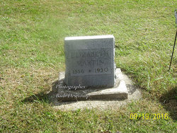
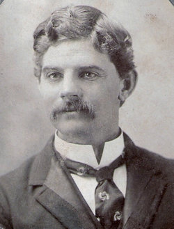
| Description | : | Emery was the son of Sarah Elizabeth "Libbie" Mowder and Wallace Martin. He married Nancy Myra Breakenridge. Obituary 05 Aug 1954 Council Bluffs IA Nonpareil: Emery M. Martin, 69, of 1623 Avenue J, died Wednesday at a local hospital after a long illness. Born in Coon Rapids, Martin had been a resident of Council Bluffs 48 years. He was a retired employe of the power company in Omaha. Survivors inclue widow, Nancy; four sons, Maurice, Donald, Clarence, and Russell, all of Council Bluffs; and six grandchildren. Burial will be in Memorial Park, Cutler... Read More |
frequently asked questions (FAQ):
-
Where is Emery Matson Martin's memorial?
Emery Matson Martin's memorial is located at: Utakarra Cemetery, Geraldton, Greater Geraldton City, Australia.
-
When did Emery Matson Martin death?
Emery Matson Martin death on 4 Aug 1954 in Council Bluffs, Pottawattamie County, Iowa, USA
-
Where are the coordinates of the Emery Matson Martin's memorial?
Latitude: -28.7812120
Longitude: 114.6432320
Family Members:
Parent
Spouse
Siblings
Children
Flowers:
Nearby Cemetories:
1. Utakarra Cemetery
Geraldton, Greater Geraldton City, Australia
Coordinate: -28.7812120, 114.6432320
2. Geraldton War Cemetery
Geraldton, Greater Geraldton City, Australia
Coordinate: -28.7778800, 114.6425400
3. Eastern Road Cemetery
Geraldton, Greater Geraldton City, Australia
Coordinate: -28.7712940, 114.6171010
4. Geraldton Apex Park Pioneer Cemetery
Geraldton, Greater Geraldton City, Australia
Coordinate: -28.7650370, 114.6169030
5. Rudds Gully
Rudds Gully, Greater Geraldton City, Australia
Coordinate: -28.8388820, 114.6689490
6. Bootenal Cemetery
Greater Geraldton City, Australia
Coordinate: -28.8563000, 114.7300000
7. Greenough Pioneer Cemetery
Greenough, Greater Geraldton City, Australia
Coordinate: -28.9288520, 114.7331180
8. Walkaway Cemetery
Walkaway, Greater Geraldton City, Australia
Coordinate: -28.9627830, 114.7673000
9. Tibradden Station Cemetery
Greenough, Greater Geraldton City, Australia
Coordinate: -28.7660000, 114.9220000
10. Sandsprings Homestead
Greater Geraldton City, Australia
Coordinate: -28.8120000, 114.9420000
11. Nabawa Public Cemetery
Nabawa, Chapman Valley Shire, Australia
Coordinate: -28.5148240, 114.7830850
12. Ellendale Homestead Cemetery
Greenough, Greater Geraldton City, Australia
Coordinate: -28.8660000, 114.9810000
13. Bowes Station Cemetery
Northampton Shire, Australia
Coordinate: -28.4008590, 114.7289340
14. Northampton Old Catholic Cemetery
Northampton, Northampton Shire, Australia
Coordinate: -28.3521530, 114.6274920
15. Dongara Cemetery
Dongara, Irwin Shire, Australia
Coordinate: -29.2506340, 114.9250660
16. Lynton Convict Depot
Gregory, Northampton Shire, Australia
Coordinate: -28.2118830, 114.3092510
17. Mullewa Pioneer Cemetery
Mullewa, Greater Geraldton City, Australia
Coordinate: -28.5387400, 115.5179800
18. Kalbarri Cemetery
Kalbarri, Northampton Shire, Australia
Coordinate: -27.7130246, 114.1809216
19. Murchison House Station
Northampton Shire, Australia
Coordinate: -27.6466000, 114.2370000
20. Morawa Pioneer Cemetery
Morawa, Morawa Shire, Australia
Coordinate: -29.2164050, 116.0025160
21. Rest in Reef
Jurien Bay, Dandaragan Shire, Australia
Coordinate: -30.3009433, 115.0386250
22. Perenjori Cemetery
Perenjori, Perenjori Shire, Australia
Coordinate: -29.4329260, 116.2891670
23. Cervantes Memorial Park
Cervantes, Dandaragan Shire, Australia
Coordinate: -30.4995770, 115.0694160
24. Badgingarra Cemetery
Dandaragan, Dandaragan Shire, Australia
Coordinate: -30.3821330, 115.4965640


