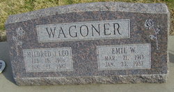
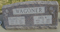
Emil Ward Wagoner
| Birth | : | 21 Mar 1913 Tekamah, Burt County, Nebraska, USA |
| Death | : | 23 Jan 1982 Blue Hill, Webster County, Nebraska, USA |
| Burial | : | Blue Hill Cemetery, Blue Hill, Webster County, USA |
| Coordinate | : | 40.3344002, -98.4357986 |
| Plot | : | SW section Lot 78 |
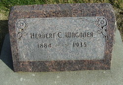
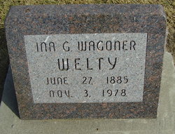
| Description | : | WWII Emil Wagoner services on Tuesday Emil Ward Wagoner, aged 68, died on Saturday, January 23. Death was attributed to a heart attack. Emil was born to Herbert Wagoner and Ina G. Hampton Wagoner on March 21, 1913 at Tekamah, Nebraska. He was married to Mildred Johnson on October 16, 1954. He joined St. Paul’s Lutheran Church in the rite of baptism on February 6, 1956. He served in World War II from1942 to 1945. Emil had lived in this community most of his life and had owned and operated the Blue Hill Tavern for many years and had sold the business... Read More |
frequently asked questions (FAQ):
-
Where is Emil Ward Wagoner's memorial?
Emil Ward Wagoner's memorial is located at: Blue Hill Cemetery, Blue Hill, Webster County, USA.
-
When did Emil Ward Wagoner death?
Emil Ward Wagoner death on 23 Jan 1982 in Blue Hill, Webster County, Nebraska, USA
-
Where are the coordinates of the Emil Ward Wagoner's memorial?
Latitude: 40.3344002
Longitude: -98.4357986
Family Members:
Parent
Spouse
Siblings
Flowers:
Nearby Cemetories:
1. Blue Hill Cemetery
Blue Hill, Webster County, USA
Coordinate: 40.3344002, -98.4357986
2. Trinity Lutheran Cemetery
Adams County, USA
Coordinate: 40.3516998, -98.4400024
3. Walker Cemetery
Blue Hill, Webster County, USA
Coordinate: 40.2881012, -98.4255981
4. Saxour Cemetery
Ayr, Adams County, USA
Coordinate: 40.3940700, -98.4867600
5. Oak Creek Cemetery
Webster County, USA
Coordinate: 40.3436012, -98.3293991
6. Cloverton Cemetery
Bladen, Webster County, USA
Coordinate: 40.2989006, -98.5378036
7. Rosemont Presbyterian Cemetery
Rosemont, Webster County, USA
Coordinate: 40.2775002, -98.3475037
8. Howe Cemetery
Webster County, USA
Coordinate: 40.2341730, -98.4154440
9. Salem Cemetery
Webster County, USA
Coordinate: 40.2341995, -98.3855972
10. Batin Cemetery
Cowles, Webster County, USA
Coordinate: 40.2299995, -98.4822006
11. OBanion Cemetery
Blue Hill, Webster County, USA
Coordinate: 40.2850000, -98.3020000
12. Kingston Cemetery
Adams County, USA
Coordinate: 40.4383250, -98.3695220
13. East Lawn Cemetery
Bladen, Webster County, USA
Coordinate: 40.3208008, -98.5886002
14. Blue Valley Cemetery
Ayr, Adams County, USA
Coordinate: 40.4488983, -98.4011002
15. Roseland Mennonite Cemetery
Roseland, Adams County, USA
Coordinate: 40.4411011, -98.5164032
16. Plainview Cemetery
Bladen, Webster County, USA
Coordinate: 40.2841988, -98.5858002
17. Evergreen Cemetery
Lawrence, Nuckolls County, USA
Coordinate: 40.2922401, -98.2723236
18. Emmanuel Lutheran Cemetery
Webster County, USA
Coordinate: 40.2057991, -98.3728027
19. Eckley Cemetery
Webster County, USA
Coordinate: 40.2057991, -98.3581009
20. Silver Lake Cemetery
Roseland, Adams County, USA
Coordinate: 40.4522018, -98.5425034
21. Zion Cemetery
Webster County, USA
Coordinate: 40.2277985, -98.2921982
22. Saint Stephens Cemetery
Nuckolls County, USA
Coordinate: 40.2544899, -98.2562485
23. Cowles Cemetery
Cowles, Webster County, USA
Coordinate: 40.1755000, -98.4425000
24. Spring Ranch Cemetery
Clay County, USA
Coordinate: 40.4065100, -98.2484100

