
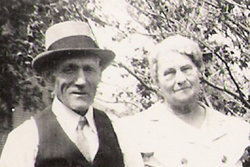
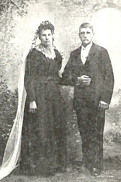


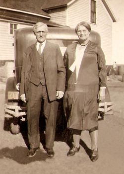
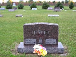
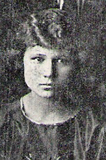
Emilie Jasmer Hoeft
| Birth | : | 4 Oct 1874 Winona County, Minnesota, USA |
| Death | : | 14 Apr 1945 Leola, McPherson County, South Dakota, USA |
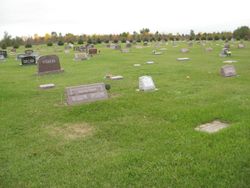
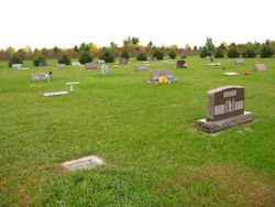
| Burial | : | Foxton Cemetery, Foxton, Horowhenua District, New Zealand |
| Coordinate | : | -40.4800880, 175.3133440 |
| Description | : | Emilie moved from MN with her parents, brothers and sisters to McPherson Co, Dakota Territory (Leola) in 1884 at the age of 10. On Aprl 2, 1889 she fled the fire that destroyed most of Leola, SD. She and her husband Julius Hoeft had 11 children. |
frequently asked questions (FAQ):
-
Where is Emilie Jasmer Hoeft's memorial?
Emilie Jasmer Hoeft's memorial is located at: Foxton Cemetery, Foxton, Horowhenua District, New Zealand.
-
When did Emilie Jasmer Hoeft death?
Emilie Jasmer Hoeft death on 14 Apr 1945 in Leola, McPherson County, South Dakota, USA
-
Where are the coordinates of the Emilie Jasmer Hoeft's memorial?
Latitude: -40.4800880
Longitude: 175.3133440
Family Members:
Parent
Spouse
Siblings
Children

Flowers:


Nearby Cemetories:
1. Foxton Cemetery
Foxton, Horowhenua District, New Zealand
Coordinate: -40.4800880, 175.3133440
2. Ihakara Gardens
Foxton, Horowhenua District, New Zealand
Coordinate: -40.4702980, 175.2815650
3. Poutu (Shannon) Marae Cemetery
Moutoa, Horowhenua District, New Zealand
Coordinate: -40.5222650, 175.4003673
4. Puaotapu Cemetery
Koputaroa, Horowhenua District, New Zealand
Coordinate: -40.5602300, 175.3522700
5. Shannon Cemetery
Shannon, Horowhenua District, New Zealand
Coordinate: -40.5476570, 175.4006020
6. Avenue Cemetery
Levin, Horowhenua District, New Zealand
Coordinate: -40.5974007, 175.2957001
7. McDonald Family Cemetery
Hokio, Horowhenua District, New Zealand
Coordinate: -40.6038400, 175.2331650
8. Old Levin Cemetery
Levin, Horowhenua District, New Zealand
Coordinate: -40.6248570, 175.2710830
9. Calleson Family Cemetery
Palmerston North, Palmerston North City, New Zealand
Coordinate: -40.3814600, 175.5157840
10. Kuku Māori Cemetery
Ohau, Horowhenua District, New Zealand
Coordinate: -40.6743300, 175.2402000
11. Rongotea Cemetery
Rongotea, Manawatu District, New Zealand
Coordinate: -40.3026690, 175.4526040
12. Wheriko Anglican Church Cemetery
Bulls, Rangitikei District, New Zealand
Coordinate: -40.2322588, 175.3195457
13. All Saint's Anglican Church
Palmerston North, Palmerston North City, New Zealand
Coordinate: -40.3581590, 175.6107926
14. Parewanui Presbyterian Cemetery
Tangimoana, Manawatu District, New Zealand
Coordinate: -40.2229440, 175.3061780
15. Manakau Cemetery
Manakau, Horowhenua District, New Zealand
Coordinate: -40.7289340, 175.2067100
16. Maunga Tauari Urupa
Awahuri, Manawatu District, New Zealand
Coordinate: -40.2619750, 175.5081430
17. St Peter's Anglican Church
Roslyn, Palmerston North City, New Zealand
Coordinate: -40.3468897, 175.6279770
18. Fraser Family Cemetery
Bulls, Rangitikei District, New Zealand
Coordinate: -40.2000380, 175.3294560
19. Terrace End Cemetery
Palmerston North, Palmerston North City, New Zealand
Coordinate: -40.3427170, 175.6433160
20. Pukekaraka Cemetery
Otaki, Kapiti Coast District, New Zealand
Coordinate: -40.7453310, 175.1434230
21. Sandon Cemetery
Sanson, Manawatu District, New Zealand
Coordinate: -40.2026230, 175.4451310
22. Otaki Catholic Cemetery
Otaki, Kapiti Coast District, New Zealand
Coordinate: -40.7453400, 175.1426220
23. Otaki Public Cemetery
Otaki, Kapiti Coast District, New Zealand
Coordinate: -40.7528152, 175.1497955
24. Rangiatea Churchyard
Otaki, Kapiti Coast District, New Zealand
Coordinate: -40.7499200, 175.1375800