
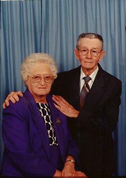
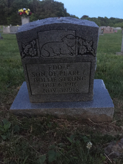
Emma Dee Strong McLerran
| Birth | : | 12 Apr 1921 |
| Death | : | 22 Aug 2015 Moss, Clay County, Tennessee, USA |
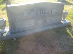
| Burial | : | Macedonia Cemetery, Moss, Clay County, USA |
| Coordinate | : | 36.5643997, -85.6110992 |
| Description | : | Mrs. Emma Dee (Strong) McLerran, 94, of the New Hope Community of Clay County, TN passed away at her residence on Saturday, August 22, 2015. Mrs. McLerran was born on April 12, 1921 in Moss., TN to her late parents James Frank “Dollie” and Pearl (Kirby) Strong. She was a retired factory worker and a homemaker. Dee was baptized at the age of 16 and was a life-long member of the New Hope Church of Christ. PRECEDED IN DEATH: Parents: James Frank “Dollie” and Pearl (Kirby) Strong. Brothers: Raymond, Herbert “Hub”, Hershell, Sherman “Sherd”, Jimmy, and Ed Strong. Sisters: Minnie... Read More |
frequently asked questions (FAQ):
-
Where is Emma Dee Strong McLerran's memorial?
Emma Dee Strong McLerran's memorial is located at: Macedonia Cemetery, Moss, Clay County, USA.
-
When did Emma Dee Strong McLerran death?
Emma Dee Strong McLerran death on 22 Aug 2015 in Moss, Clay County, Tennessee, USA
-
Where are the coordinates of the Emma Dee Strong McLerran's memorial?
Latitude: 36.5643997
Longitude: -85.6110992
Family Members:
Parent

Spouse

Siblings
Children
Flowers:


Nearby Cemetories:
1. Strong Family Cemetery
Clay County, USA
Coordinate: 36.5690700, -85.6042600
2. McLerran Cemetery
Moss, Clay County, USA
Coordinate: 36.5790000, -85.5973000
3. Kendall Cemetery
Moss, Clay County, USA
Coordinate: 36.5672540, -85.6362650
4. Moss Cemetery
Moss, Clay County, USA
Coordinate: 36.5911210, -85.6214460
5. Eads-Denton Cemetery
Pine Hill, Clay County, USA
Coordinate: 36.5644207, -85.6503187
6. Odle Cemetery
Clay County, USA
Coordinate: 36.5966988, -85.6085968
7. Spear Family Cemetery
Moss, Clay County, USA
Coordinate: 36.5933200, -85.5876500
8. Meadows Cemetery
Clay County, USA
Coordinate: 36.5946999, -85.5875015
9. Smith Cemetery
Pine Hill, Clay County, USA
Coordinate: 36.5714930, -85.6568170
10. Liberty Church Cemetery
Boles, Clay County, USA
Coordinate: 36.6010850, -85.6496830
11. Dalton Cemetery
Arcott, Clay County, USA
Coordinate: 36.5429540, -85.5546170
12. Moore Cemetery
Moss, Clay County, USA
Coordinate: 36.6113400, -85.6374980
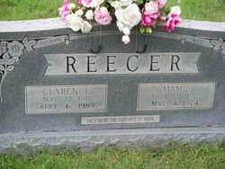
13. Walker Reecer Cemetery
Celina, Clay County, USA
Coordinate: 36.5746290, -85.5480270
14. New Hope Cemetery
Clay County, USA
Coordinate: 36.6021996, -85.5653000
15. Archibald Plumlee Cemetery
Pine Hill, Clay County, USA
Coordinate: 36.5203018, -85.5682983
16. Pricetown Cemetery
Clay County, USA
Coordinate: 36.5422500, -85.6750670
17. Willhoite-Curtis Cemetery
Tompkinsville, Monroe County, USA
Coordinate: 36.6182208, -85.6442948
18. Lester Brown Family Cemetery
Arcott, Clay County, USA
Coordinate: 36.5205700, -85.5547530
19. Jonestown Cemetery
Clay County, USA
Coordinate: 36.5619011, -85.6921997
20. McColgan Cemetery
Clay County, USA
Coordinate: 36.5163994, -85.5560989
21. Roberts Cemetery
Celina, Clay County, USA
Coordinate: 36.5066986, -85.5727997
22. Freedom Cemetery #2
Tompkinsville, Monroe County, USA
Coordinate: 36.6284060, -85.6289940
23. Plumlee Cemetery
Celina, Clay County, USA
Coordinate: 36.5694280, -85.5282830
24. Moore Cemetery #1
Moss, Clay County, USA
Coordinate: 36.6164920, -85.6636620