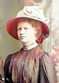
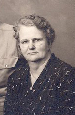
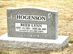
Emma Dorthea Jensen Hogenson
| Birth | : | 3 Jul 1892 Smoot, Lincoln County, Wyoming, USA |
| Death | : | 26 Feb 1981 Raymond, Lethbridge Census Division, Alberta, Canada |
| Burial | : | St. Nicholas Churchyard, Halewood, Metropolitan Borough of Knowsley, England |
| Coordinate | : | 53.3694400, -2.8284900 |
| Plot | : | Lot 35 Block 6 Plot 5 |
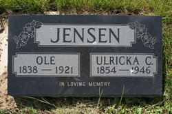
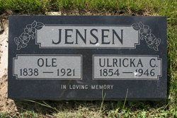
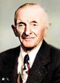
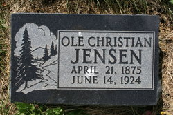
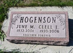
| Description | : | Stirling History Book page 342, at www.ourroots.ca History book says she was born in Smoot, Star Valley, Wyoming Parents: Ole and Ulricka Christana C. Jensen Spouse: Niels Peter Hogenson Married: 20 July 1919 Logan Temple |
frequently asked questions (FAQ):
-
Where is Emma Dorthea Jensen Hogenson's memorial?
Emma Dorthea Jensen Hogenson's memorial is located at: St. Nicholas Churchyard, Halewood, Metropolitan Borough of Knowsley, England.
-
When did Emma Dorthea Jensen Hogenson death?
Emma Dorthea Jensen Hogenson death on 26 Feb 1981 in Raymond, Lethbridge Census Division, Alberta, Canada
-
Where are the coordinates of the Emma Dorthea Jensen Hogenson's memorial?
Latitude: 53.3694400
Longitude: -2.8284900
Family Members:
Parent
Spouse
Siblings
Children
Nearby Cemetories:
1. St. Nicholas Churchyard
Halewood, Metropolitan Borough of Knowsley, England
Coordinate: 53.3694400, -2.8284900
2. St. Peter's Churchyard
Woolton, Metropolitan Borough of Liverpool, England
Coordinate: 53.3759310, -2.8693390
3. St. Mary's Churchyard
Woolton, Metropolitan Borough of Liverpool, England
Coordinate: 53.3750550, -2.8703760
4. All Saints Churchyard
Speke, Metropolitan Borough of Liverpool, England
Coordinate: 53.3439300, -2.8582400
5. Allerton Cemetery
Allerton, Metropolitan Borough of Liverpool, England
Coordinate: 53.3615646, -2.8844030
6. St. Agnes Roman Catholic
Huyton with Roby, Metropolitan Borough of Knowsley, England
Coordinate: 53.4090600, -2.8320100
7. St. Nicholas' Churchyard
Whiston, Metropolitan Borough of Knowsley, England
Coordinate: 53.4069736, -2.8028920
8. All Saints Churchyard
Childwall, Metropolitan Borough of Liverpool, England
Coordinate: 53.3952880, -2.8816030
9. St. Mary's Churchyard
Hale, Halton Unitary Authority, England
Coordinate: 53.3325900, -2.7952900
10. Calderstones Park
Liverpool, Metropolitan Borough of Liverpool, England
Coordinate: 53.3817419, -2.8956218
11. Saint Michael's Church
Garston, Metropolitan Borough of Liverpool, England
Coordinate: 53.3518400, -2.8973800
12. St. Michael Churchyard
Huyton with Roby, Metropolitan Borough of Knowsley, England
Coordinate: 53.4139560, -2.8396720
13. St. Bartholomew's Churchyard
Huyton with Roby, Metropolitan Borough of Knowsley, England
Coordinate: 53.4120023, -2.8556125
14. St Michael Churchyard Extension
Huyton with Roby, Metropolitan Borough of Knowsley, England
Coordinate: 53.4143310, -2.8418050
15. All Hallows Churchyard
Mossley Hill, Metropolitan Borough of Liverpool, England
Coordinate: 53.3808740, -2.9039930
16. Knowsley Cemetery
Knowsley, Metropolitan Borough of Knowsley, England
Coordinate: 53.4083240, -2.7847870
17. St Austin's Churchyard
Grassendale, Metropolitan Borough of Liverpool, England
Coordinate: 53.3614552, -2.9124587
18. St Matthew & St James Churchyard
Mossley Hill, Metropolitan Borough of Liverpool, England
Coordinate: 53.3764200, -2.9204740
19. Broadgreen Jewish Cemetery
Liverpool, Metropolitan Borough of Liverpool, England
Coordinate: 53.4101320, -2.8977320
20. Widnes Cemetery
Widnes, Halton Unitary Authority, England
Coordinate: 53.3803470, -2.7326050
21. Prescot Cemetery
Prescot, Metropolitan Borough of Knowsley, England
Coordinate: 53.4266620, -2.8081590
22. Holy Trinity Churchyard
Wavertree, Metropolitan Borough of Liverpool, England
Coordinate: 53.3946000, -2.9175700
23. St Bartholomew's Churchyard
Rainhill, Metropolitan Borough of St Helens, England
Coordinate: 53.4076231, -2.7513287
24. St. John the Evangelist Churchyard
Knotty Ash, Metropolitan Borough of Liverpool, England
Coordinate: 53.4160757, -2.8913708

