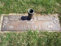
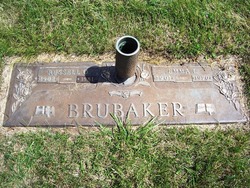
Emma L. Roddy Brubaker
| Birth | : | 20 Apr 1901 Freedom Township, Henry County, Ohio, USA |
| Death | : | 31 May 1970 Defiance County, Ohio, USA |
| Burial | : | Fairview Cemetery, Rockford, Spokane County, USA |
| Coordinate | : | 47.4421997, -117.1296997 |
| Plot | : | Gethsemane 91 C 4 |
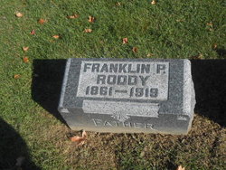
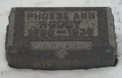
| Description | : | Mrs. Emma E. Brubaker, 69, rt. 4, was dead on arrival at 11:45 p.m. Sunday, May 31, 1970, at Defiance Hospital. Born May 20, 1901 in Freedom Tp., Henry Co., she was a daughter of Frank and Phoebe (Harmon) Roddy. On May 6, 1962, she and Russell Brubaker were married and he survives. Mrs. Brubaker resided in Henry County until 1962 and was a member of United Methodist Church, Napoleon; North-Richland Get-Together Club, and was a former office clerk for Dr. K. E. Dye. Also surviving are nieces and nephews. She was preceded in death... Read More |
frequently asked questions (FAQ):
-
Where is Emma L. Roddy Brubaker's memorial?
Emma L. Roddy Brubaker's memorial is located at: Fairview Cemetery, Rockford, Spokane County, USA.
-
When did Emma L. Roddy Brubaker death?
Emma L. Roddy Brubaker death on 31 May 1970 in Defiance County, Ohio, USA
-
Where are the coordinates of the Emma L. Roddy Brubaker's memorial?
Latitude: 47.4421997
Longitude: -117.1296997
Family Members:
Parent
Spouse
Siblings
Flowers:
Nearby Cemetories:
1. Fairview Cemetery
Rockford, Spokane County, USA
Coordinate: 47.4421997, -117.1296997
2. Fairfield Cemetery
Fairfield, Spokane County, USA
Coordinate: 47.3699989, -117.1402969
3. Mount Hope Cemetery
Mount Hope, Spokane County, USA
Coordinate: 47.4477997, -117.2382965
4. Mica Peak Cemetery
Saxby, Spokane County, USA
Coordinate: 47.5078011, -117.0764008
5. Butte Cemetery
Spokane County, USA
Coordinate: 47.3850000, -117.0577780
6. Mica Creek Cemetery
Rockford, Spokane County, USA
Coordinate: 47.5217018, -117.1093979
7. Evergreen Cemetery
Freeman, Spokane County, USA
Coordinate: 47.5181790, -117.1886620
8. Rosewood Cemetery
Fairfield, Spokane County, USA
Coordinate: 47.3474998, -117.1722031
9. Wood Memorial Cemetery
Valleyford, Spokane County, USA
Coordinate: 47.5071983, -117.2692032
10. Mica Cemetery
Mica, Spokane County, USA
Coordinate: 47.5433006, -117.2146988
11. Spring Valley Cemetery
Spring Valley, Spokane County, USA
Coordinate: 47.5150140, -117.2713870
12. Waverly Cemetery
Waverly, Spokane County, USA
Coordinate: 47.3432999, -117.2366028
13. Worley Cemetery
Worley, Kootenai County, USA
Coordinate: 47.4199982, -116.9167023
14. Latah Evergreen Cemetery
Latah, Spokane County, USA
Coordinate: 47.2961006, -117.1619034
15. Saint Michaels Cemetery
Worley, Kootenai County, USA
Coordinate: 47.4098000, -116.9111100
16. Latah Cemetery
Latah, Spokane County, USA
Coordinate: 47.2821999, -117.1264038
17. Broadacres Cemetery
Spangle, Spokane County, USA
Coordinate: 47.4144440, -117.3647220
18. Spangle Cemetery
Spangle, Spokane County, USA
Coordinate: 47.4202766, -117.3775024
19. Evergreen Cemetery
Plummer, Benewah County, USA
Coordinate: 47.3375000, -116.9065000
20. Saltese Cemetery
Greenacres, Spokane County, USA
Coordinate: 47.6278000, -117.1660995
21. Chester Community Cemetery
Chester, Spokane County, USA
Coordinate: 47.6138802, -117.2486343
22. South Pines Cemetery
Spokane, Spokane County, USA
Coordinate: 47.6277000, -117.2261500
23. Spokane Valley Church of the Nazarene Columbarium
Spokane, Spokane County, USA
Coordinate: 47.6393000, -117.1948000
24. Queen of Peace Cemetery
Spokane, Spokane County, USA
Coordinate: 47.5893200, -117.3409370

