
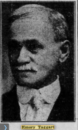
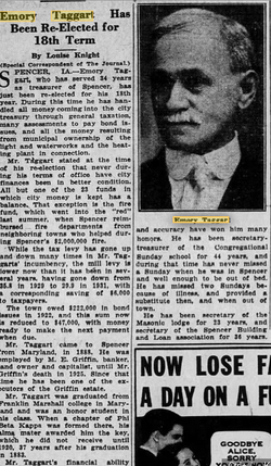
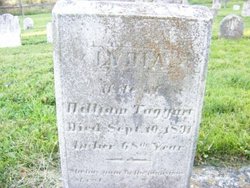
Emory Taggart
| Birth | : | 1859 Maryland, USA |
| Death | : | 1 Mar 1950 |
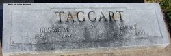
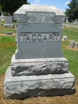
| Burial | : | Riverside Cemetery, Spencer, Clay County, USA |
| Coordinate | : | 43.1441994, -95.1671982 |
| Plot | : | Block 22 Lot 92 Plot 1 |
| Description | : | Name: Emory Taggart Gender: Male Age: 42 Birth Year: abt 1858 Marriage Date: 12 Sep 1900 Marriage Place: Clay, Iowa, USA Father: William Taggart Mother: Lydia Bueshoff Spouse: Bessie Maud Burgie |
frequently asked questions (FAQ):
-
Where is Emory Taggart's memorial?
Emory Taggart's memorial is located at: Riverside Cemetery, Spencer, Clay County, USA.
-
When did Emory Taggart death?
Emory Taggart death on 1 Mar 1950 in
-
Where are the coordinates of the Emory Taggart's memorial?
Latitude: 43.1441994
Longitude: -95.1671982
Family Members:
Parent
Spouse

Siblings

Children
Flowers:


Nearby Cemetories:
1. Riverside Cemetery
Spencer, Clay County, USA
Coordinate: 43.1441994, -95.1671982
2. Dewey Readmore Books Memorial
Spencer, Clay County, USA
Coordinate: 43.1403999, -95.1443024
3. North Lawn Cemetery
Spencer, Clay County, USA
Coordinate: 43.1600000, -95.1470000
4. Evergreen Cemetery
Clay County, USA
Coordinate: 43.2052994, -95.2086029
5. Fairview Cemetery
Clay County, USA
Coordinate: 43.1899986, -95.0800018
6. Swedish Lutheran Cemetery
Royal, Clay County, USA
Coordinate: 43.0683000, -95.2350000
7. Dickens Cemetery
Dickens, Clay County, USA
Coordinate: 43.1280000, -95.0155000
8. Rosehill Cemetery
Clay County, USA
Coordinate: 43.0368996, -95.0919037
9. Lone Tree Cemetery
Everly, Clay County, USA
Coordinate: 43.1411018, -95.3347015
10. Little Sioux Lutheran Cemetery
Milford, Dickinson County, USA
Coordinate: 43.2702065, -95.2109528
11. First Reformed Cemetery
Clay County, USA
Coordinate: 43.2399500, -95.2889000
12. Lincoln Cemetery
Rossie, Clay County, USA
Coordinate: 43.0111008, -95.2313995
13. Willow Creek Cemetery
Royal, Clay County, USA
Coordinate: 43.0214005, -95.2885971
14. Liberty Cemetery
Greenville, Clay County, USA
Coordinate: 42.9897003, -95.1417007
15. Clay Center Cemetery
Royal, Clay County, USA
Coordinate: 43.0410995, -95.3272018
16. Milford Cemetery
Milford, Dickinson County, USA
Coordinate: 43.3092003, -95.1481018
17. TriMello Cemetery
Royal, Clay County, USA
Coordinate: 43.0682983, -95.3728027
18. Logan Township Cemetery
Clay County, USA
Coordinate: 43.0489006, -94.9747009
19. Zion Methodist Cemetery
Clay County, USA
Coordinate: 42.9808006, -95.2497025
20. Calvary Cemetery
Milford, Dickinson County, USA
Coordinate: 43.3213997, -95.1688995
21. Fanny Fern Cemetery
Clay County, USA
Coordinate: 42.9530983, -95.1607971
22. Crown Hill Cemetery
Ruthven, Palo Alto County, USA
Coordinate: 43.1328011, -94.8878021
23. Calvary Cemetery
Ruthven, Palo Alto County, USA
Coordinate: 43.1314011, -94.8869019
24. Westport Cemetery
Dickinson County, USA
Coordinate: 43.3130989, -95.3289032