| Birth | : | 19 Aug 1915 Russell County, Kansas, USA |
| Death | : | 12 Dec 2015 Plainville, Rooks County, Kansas, USA |
| Burial | : | Immanuel Lutheran Cemetery, Natoma, Osborne County, USA |
| Coordinate | : | 39.2708015, -99.0096970 |
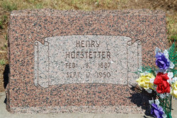
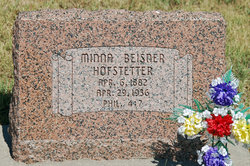
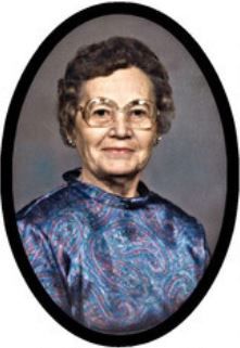
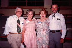
| Description | : | Ernest Henry Hofstetter, 100, of Natoma, Kansas, passed away Saturday, December 12, 2015 at the Redbud Estates in Plainville, Kansas. Ernest was born on a farm near Paradise, Kansas on August 19, 1915, the son of Henry and Minnie (Beisner) Hofstetter. He grew up and attended schools north of Natoma and was baptized in the Lutheran faith. Ernest served his country in the U.S. Army during WWII. He was stationed in Europe where he received a Purple Heart. After the war he returned to Natoma. Ernest was a farmer and rancher his whole life. He also raised and trained horses. ... Read More |
frequently asked questions (FAQ):
-
Where is Ernest Henry Hofstetter's memorial?
Ernest Henry Hofstetter's memorial is located at: Immanuel Lutheran Cemetery, Natoma, Osborne County, USA.
-
When did Ernest Henry Hofstetter death?
Ernest Henry Hofstetter death on 12 Dec 2015 in Plainville, Rooks County, Kansas, USA
-
Where are the coordinates of the Ernest Henry Hofstetter's memorial?
Latitude: 39.2708015
Longitude: -99.0096970
Family Members:
Parent
Siblings
Flowers:
Nearby Cemetories:
1. Immanuel Lutheran Cemetery
Natoma, Osborne County, USA
Coordinate: 39.2708015, -99.0096970
2. Round Mound Cemetery
Osborne County, USA
Coordinate: 39.2630997, -98.9636002
3. Aurora Cemetery
Laton, Rooks County, USA
Coordinate: 39.2778015, -99.0847015
4. Natoma Catholic Cemetery
Natoma, Osborne County, USA
Coordinate: 39.2054050, -99.0289480
5. Pleasant Plain Cemetery
Osborne County, USA
Coordinate: 39.3367004, -99.0372009
6. IXL Cemetery
Natoma, Osborne County, USA
Coordinate: 39.2491989, -98.9218979
7. Chalk Mound Cemetery
Laton, Rooks County, USA
Coordinate: 39.3208008, -99.0852966
8. Natoma Cemetery
Natoma, Osborne County, USA
Coordinate: 39.1907700, -99.0162700
9. Natoma Lutheran Cemetery
Natoma, Osborne County, USA
Coordinate: 39.1907700, -99.0162700
10. Shiloh Cemetery
Codell, Rooks County, USA
Coordinate: 39.2350006, -99.1410980
11. Mount Ayr Cemetery
Alton, Osborne County, USA
Coordinate: 39.3764000, -98.9717026
12. Conger Cemetery
Plainville, Rooks County, USA
Coordinate: 39.1978700, -99.1232100
13. Victor Cemetery
Osborne County, USA
Coordinate: 39.2380981, -98.8613968
14. Cedar Bluff Cemetery
Osborne County, USA
Coordinate: 39.2496986, -98.8431015
15. Survey Cemetery
Woodston, Rooks County, USA
Coordinate: 39.3722000, -99.1333008
16. Kill Creek Cemetery
Alton, Osborne County, USA
Coordinate: 39.3805528, -98.8967658
17. Mount Hermon Cemetery
Paradise, Russell County, USA
Coordinate: 39.1324997, -98.9439011
18. Covert Cemetery
Osborne County, USA
Coordinate: 39.2896996, -98.8107986
19. Bowlby Ranch Cemetery
Ellis County, USA
Coordinate: 39.1127430, -99.0513540
20. Cole Cemetery
Osborne County, USA
Coordinate: 39.2352982, -98.8060989
21. Johnson Cemetery
Stockton, Rooks County, USA
Coordinate: 39.3493996, -99.1941986
22. Paradise Center Cemetery
Codell, Rooks County, USA
Coordinate: 39.2050570, -99.2058100
23. Twin Mound Cemetery
Rooks County, USA
Coordinate: 39.2855988, -99.2319031
24. Mount Hope Cemetery
Bloomington, Osborne County, USA
Coordinate: 39.3939018, -98.8450012


