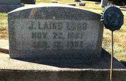
| Birth | : | 8 Sep 1911 Clinton, Clinton County, Iowa, USA |
| Death | : | 6 Nov 1929 Clinton, Clinton County, Iowa, USA |
| Burial | : | Puerto Rico National Cemetery, Bayamon, Bayamon Municipality, USA |
| Coordinate | : | 18.4109097, -66.1693268 |
| Description | : | Two of Long Family Buried Today Robert and Margaret Long Double funeral services for Margaret Long, aged 23, and her 11-year-old brother, Robert, victims of typhoid fever one day apart, were conducted at the home of their brother, Frank Long, 1118 North Third street, and at St. Paul's English Lutheran church this afternoon and burial made in Springdale cemetery beside their mother and brother Ernest, both of whom succumbed to the malady this month. Margaret was to have been buried yesterday, but when her small brother passed away, her funeral plans were halted. Two more members, Mabel and Ruby, of the Luther... Read More |
frequently asked questions (FAQ):
-
Where is Ernest L. Long's memorial?
Ernest L. Long's memorial is located at: Puerto Rico National Cemetery, Bayamon, Bayamon Municipality, USA.
-
When did Ernest L. Long death?
Ernest L. Long death on 6 Nov 1929 in Clinton, Clinton County, Iowa, USA
-
Where are the coordinates of the Ernest L. Long's memorial?
Latitude: 18.4109097
Longitude: -66.1693268
Family Members:
Parent
Siblings
Flowers:
Nearby Cemetories:
1. Cementerio Porta Coeli
Hato Tejas, Bayamon Municipality, USA
Coordinate: 18.4140450, -66.1721380
2. Cementerio Municipal Braulio Dueño Colón
Bayamon, Bayamon Municipality, USA
Coordinate: 18.3929400, -66.1608700
3. Cementerio y Mausoléo Barrio Palma
Las Palmas, Catano Municipality, USA
Coordinate: 18.4358130, -66.1543280
4. Los Angeles Memorial Park
Guaynabo, Guaynabo Municipality, USA
Coordinate: 18.3963450, -66.1214500
5. Cementerio Municipal
Bay View, Catano Municipality, USA
Coordinate: 18.4439080, -66.1326360
6. Cementerio Municipal Amelia
Amelia, Guaynabo Municipality, USA
Coordinate: 18.4330540, -66.1200940
7. Cementerio Los Cipreses
Bayamon, Bayamon Municipality, USA
Coordinate: 18.3558250, -66.1783380
8. Mausoleo Municipal Cemetery
Toa Baja, Toa Baja Municipality, USA
Coordinate: 18.4265370, -66.2292400
9. Cementerio Los Hermanos Memorial Park
Toa Alta Municipality, USA
Coordinate: 18.3930683, -66.2366714
10. Cementerio Nuevo Barrio Los Frailes
Guaynabo, Guaynabo Municipality, USA
Coordinate: 18.3685590, -66.1151280
11. Catedral de San Juan Bautista
San Juan, San Juan Municipality, USA
Coordinate: 18.4656070, -66.1179690
12. Cementerio Santa María Magdalena de Pazzis
San Juan, San Juan Municipality, USA
Coordinate: 18.4692410, -66.1199200
13. San Francisco de Asis
San Juan, San Juan Municipality, USA
Coordinate: 18.4663550, -66.1134620
14. Cementerio Municipal Viejo de Toa Alta
Toa Alta, Toa Alta Municipality, USA
Coordinate: 18.3882890, -66.2512600
15. Cementerio Historico de Guaynabo
Guaynabo, Guaynabo Municipality, USA
Coordinate: 18.3489400, -66.1082400
16. Cementerio Municipal
Toa Baja, Toa Baja Municipality, USA
Coordinate: 18.4455380, -66.2548220
17. Cementerio de la Capital
Puerto Nuevo, San Juan Municipality, USA
Coordinate: 18.3842810, -66.0724590
18. Cementerio Villa Nevárez
Rio Piedras, San Juan Municipality, USA
Coordinate: 18.3924500, -66.0638900
19. Parroquia San Vicente de Paul Criptas
San Juan, San Juan Municipality, USA
Coordinate: 18.4420270, -66.0653170
20. Cementerio Municipal de Río Piedras
Rio Piedras, San Juan Municipality, USA
Coordinate: 18.4017485, -66.0528151
21. Cementerio Municipal de Dorado
Dorado, Dorado Municipality, USA
Coordinate: 18.4640400, -66.2753490
22. Cementerio San José
San Juan, San Juan Municipality, USA
Coordinate: 18.4385570, -66.0498880
23. Buxeda Memorial Park
Rio Piedras, San Juan Municipality, USA
Coordinate: 18.3755675, -66.0480496
24. El Señorial Memorial Park
San Juan, San Juan Municipality, USA
Coordinate: 18.3446200, -66.0541130


