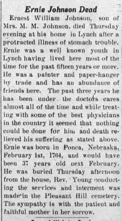
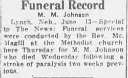
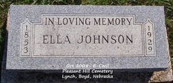
Ernest William “Ernie” Johnson
| Birth | : | 1 Feb 1873 Ponca, Dixon County, Nebraska, USA |
| Death | : | 23 Dec 1909 Lynch, Boyd County, Nebraska, USA |
| Burial | : | Pleasant Hill Cemetery, Lynch, Boyd County, USA |
| Coordinate | : | 42.8199997, -98.4674988 |
frequently asked questions (FAQ):
-
Where is Ernest William “Ernie” Johnson's memorial?
Ernest William “Ernie” Johnson's memorial is located at: Pleasant Hill Cemetery, Lynch, Boyd County, USA.
-
When did Ernest William “Ernie” Johnson death?
Ernest William “Ernie” Johnson death on 23 Dec 1909 in Lynch, Boyd County, Nebraska, USA
-
Where are the coordinates of the Ernest William “Ernie” Johnson's memorial?
Latitude: 42.8199997
Longitude: -98.4674988
Family Members:
Parent
Siblings
Flowers:
Nearby Cemetories:
1. Pleasant Hill Cemetery
Lynch, Boyd County, USA
Coordinate: 42.8199997, -98.4674988
2. ZCBJ Bohemian National Cemetery
Lynch, Boyd County, USA
Coordinate: 42.8286000, -98.4550100
3. ABVM Catholic Cemetery
Lynch, Boyd County, USA
Coordinate: 42.8352000, -98.4675000
4. Highland Cemetery
Lynch, Boyd County, USA
Coordinate: 42.8718987, -98.4561005
5. Old Paddock Cemetery
Paddock, Holt County, USA
Coordinate: 42.7705000, -98.5509000
6. Beulah Cemetery
Monowi, Boyd County, USA
Coordinate: 42.8610992, -98.3692017
7. Bristow Cemetery
Bristow, Boyd County, USA
Coordinate: 42.8321991, -98.5856018
8. Alford Cemetery
Monowi, Boyd County, USA
Coordinate: 42.7997017, -98.3450012
9. Rosedale Covenant Cemetery
Bristow, Boyd County, USA
Coordinate: 42.8722390, -98.5751470
10. Pleasant View Cemetery
Lynch, Boyd County, USA
Coordinate: 42.9147300, -98.4863400
11. Trinity Lutheran Cemetery
Bristow, Boyd County, USA
Coordinate: 42.9012830, -98.5844310
12. Riha Cemetery
Verdel, Knox County, USA
Coordinate: 42.7930000, -98.3086000
13. Greenwood Episcopal Cemetery
Greenwood, Charles Mix County, USA
Coordinate: 42.9307833, -98.3795556
14. Holy Fellowship Cemetery
Greenwood, Charles Mix County, USA
Coordinate: 42.9308014, -98.3788986
15. Greenwood Presbyterian Cemetery
Greenwood, Charles Mix County, USA
Coordinate: 42.9318533, -98.3792422
16. Overlook Cemetery
Boyd County, USA
Coordinate: 42.8138890, -98.6442642
17. Scottville Cemetery
O'Neill, Holt County, USA
Coordinate: 42.6834120, -98.5120140
18. Gross Cemetery
Gross, Boyd County, USA
Coordinate: 42.9514008, -98.5742035
19. Old Immanuel Cemetery
Spencer, Boyd County, USA
Coordinate: 42.9006004, -98.6528015
20. Paddock Cemetery
Midway, Holt County, USA
Coordinate: 42.6834380, -98.5887760
21. Devil's Gulch Ranch Cemetery
Spencer, Boyd County, USA
Coordinate: 42.8565316, -98.6871239
22. Dorsey Cemetery
Holt County, USA
Coordinate: 42.6755981, -98.3339005
23. Saint Marys Cemetery
Spencer, Boyd County, USA
Coordinate: 42.8669014, -98.6980972
24. Union Cemetery
Spencer, Boyd County, USA
Coordinate: 42.8602982, -98.7018967


