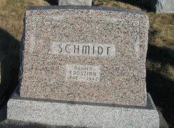
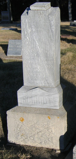
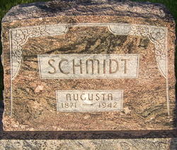
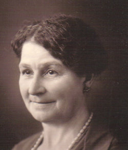
Ernstina Lueke Schmidt
| Birth | : | 3 Sep 1848 Poland |
| Death | : | 24 May 1942 Webster County, Nebraska, USA |
| Burial | : | Russell City Cemetery, Russell, Russell County, USA |
| Coordinate | : | 38.8851500, -98.8369600 |
| Plot | : | NW 199 |
| Description | : | Mrs. Ernstine Schmidt Called by Death Mrs. Ernstine Schmidt, pioneer resident, died at the home of her son, William, two miles east of Blue Hill, on Sunday, Mary 24, after a long illness. She had been bedfast the past seven months. Funeral services were held Tuesday afternoon at 2:00 o'clock at St. Paul's Lutheran Church with pastor, Rev. J. Peil in charge. Mrs. Emil Kort and Mrs. Glen Blauch sang with organ accompaniment by Burnell Hartman. Pallbearers were grandsons and grandsons by marriage of the deceased. They were Ed and Rinehart Wibben, Ernest Schmidt, Chas. Schmidt, Frank Schmidt, Jr., and Floyd Schmidt.... Read More |
frequently asked questions (FAQ):
-
Where is Ernstina Lueke Schmidt's memorial?
Ernstina Lueke Schmidt's memorial is located at: Russell City Cemetery, Russell, Russell County, USA.
-
When did Ernstina Lueke Schmidt death?
Ernstina Lueke Schmidt death on 24 May 1942 in Webster County, Nebraska, USA
-
Where are the coordinates of the Ernstina Lueke Schmidt's memorial?
Latitude: 38.8851500
Longitude: -98.8369600
Family Members:
Spouse
Children
Flowers:
Nearby Cemetories:
1. Russell City Cemetery
Russell, Russell County, USA
Coordinate: 38.8851500, -98.8369600
2. Saint Marys Catholic Cemetery
Russell, Russell County, USA
Coordinate: 38.8856200, -98.8370100
3. Saint Johns Lutheran Cemetery
Russell, Russell County, USA
Coordinate: 38.8819900, -98.8359200
4. Ebenezer Cemetery
Russell County, USA
Coordinate: 38.7765030, -98.8735200
5. Bunker Hill Cemetery
Bunker Hill, Russell County, USA
Coordinate: 38.8843994, -98.6889038
6. Blooming Grove Cemetery
Bunker Hill, Russell County, USA
Coordinate: 38.8130450, -98.6969020
7. Trinity Lutheran Cemetery
Russell County, USA
Coordinate: 38.7470000, -98.8798900
8. Saint Marys Cemetery
Gorham, Russell County, USA
Coordinate: 38.8835983, -99.0214005
9. Prairie Lawn Cemetery
Gorham, Russell County, USA
Coordinate: 38.8786011, -99.0385971
10. Hyde Park Cemetery
Russell County, USA
Coordinate: 38.7846985, -98.6697006
11. Michaelis Cemetery
Russell County, USA
Coordinate: 38.7117004, -98.8189011
12. Cross Plains Cemetery
Russell, Russell County, USA
Coordinate: 38.7202988, -98.7636032
13. Amherst Cemetery
Waldo, Russell County, USA
Coordinate: 39.0588989, -98.7605972
14. Milberger Cemetery
Milberger, Russell County, USA
Coordinate: 38.7085991, -98.9124985
15. Saint Anns Cemetery
Ellis County, USA
Coordinate: 38.8731003, -99.0772018
16. Colony Cemetery
Dorrance, Russell County, USA
Coordinate: 38.8278008, -98.6046982
17. Dorrance City Cemetery
Dorrance, Russell County, USA
Coordinate: 38.8425030, -98.5916910
18. Saint Joseph Cemetery
Dorrance, Russell County, USA
Coordinate: 38.8560982, -98.5860977
19. Winterset Cemetery
Russell County, USA
Coordinate: 38.7550011, -99.0310974
20. Schneider Cemetery
Barton County, USA
Coordinate: 38.6817017, -98.8482971
21. Schoenfeld Cemetery
Barton County, USA
Coordinate: 38.6814003, -98.8760986
22. Forest Hill Cemetery
Russell County, USA
Coordinate: 38.7256940, -98.6673360
23. Saint John Lutheran Cemetery
Susank, Barton County, USA
Coordinate: 38.6810989, -98.7568970
24. Fairport Cemetery
Russell County, USA
Coordinate: 39.0463982, -99.0207977

