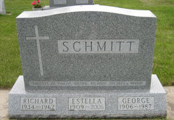
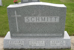
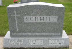
Estella Catherine “Stella” Grace Schmitt
| Birth | : | 30 May 1909 |
| Death | : | 22 Mar 2006 |
| Burial | : | Saint Marys Catholic Cemetery, Roseville, Floyd County, USA |
| Coordinate | : | 43.0090000, -92.8134000 |
| Description | : | Estella Schmitt, 96, of Marble Rock, died Wednesday, March 22, 2006, at St. Luke's Living Center East in Cedar Rapids. Estella Catherine Grace Schmitt was born May 30, 1929, in Cedar Township, Greene County, Churdan, the daughter of Michael and Ellen (Carey) Grace. On September 29, 1928, she was united in marriage to George Schmitt in Churdan. Living family members include four children, Rev. Phillip Schmitt of Mt. Vernon, Maxine Bouchonville, Palatine, Ill., Dolores (Stan) Goszczynski of Evanston, Ill., and Dr. Marvin (Sue) Schmitt DVM of Central City; 13 grandchildren and their families, Denise (Scott) Hemenway, and Brian and Kyle, Jean... Read More |
frequently asked questions (FAQ):
-
Where is Estella Catherine “Stella” Grace Schmitt's memorial?
Estella Catherine “Stella” Grace Schmitt's memorial is located at: Saint Marys Catholic Cemetery, Roseville, Floyd County, USA.
-
When did Estella Catherine “Stella” Grace Schmitt death?
Estella Catherine “Stella” Grace Schmitt death on 22 Mar 2006 in
-
Where are the coordinates of the Estella Catherine “Stella” Grace Schmitt's memorial?
Latitude: 43.0090000
Longitude: -92.8134000
Family Members:
Parent
Spouse
Siblings
Children
Flowers:
Nearby Cemetories:
1. Saint Marys Catholic Cemetery
Roseville, Floyd County, USA
Coordinate: 43.0090000, -92.8134000
2. Flood Creek Cemetery
Floyd County, USA
Coordinate: 43.0391998, -92.8538971
3. West Saint Charles United Methodist Cemetery
Floyd County, USA
Coordinate: 43.0580597, -92.7897186
4. Hillside Cemetery
Marble Rock, Floyd County, USA
Coordinate: 42.9583015, -92.8666992
5. Westside Cemetery
Marble Rock, Floyd County, USA
Coordinate: 42.9556007, -92.8739014
6. Pleasant Grove Cemetery
Powersville, Floyd County, USA
Coordinate: 42.9441986, -92.7446976
7. Ulsterville Cemetery
Ulster Township, Floyd County, USA
Coordinate: 43.0936012, -92.8842010
8. Riverside Cemetery
Rockford, Floyd County, USA
Coordinate: 43.0578003, -92.9464035
9. Riverside Cemetery
Charles City, Floyd County, USA
Coordinate: 43.0766983, -92.6881027
10. Calvary Cemetery
Charles City, Floyd County, USA
Coordinate: 43.0574989, -92.6594009
11. Sunnyside Memory Gardens
Charles City, Floyd County, USA
Coordinate: 43.0280991, -92.6457977
12. Oakwood Cemetery
Floyd, Floyd County, USA
Coordinate: 43.1178017, -92.7307968
13. Rose Hill Cemetery
Greene, Butler County, USA
Coordinate: 42.8843994, -92.7988968
14. Saint Marys Cemetery
Greene, Butler County, USA
Coordinate: 42.8827300, -92.7990200
15. Liggett Cemetery
Charles City, Floyd County, USA
Coordinate: 42.9583100, -92.6529700
16. Halls Grove Cemetery
Greene, Butler County, USA
Coordinate: 42.8840100, -92.8782300
17. Shannon Cemetery
Charles City, Floyd County, USA
Coordinate: 42.9366500, -92.6532000
18. Hardeman Cemetery
Greene, Butler County, USA
Coordinate: 42.8706017, -92.8013992
19. Brethren Cemetery
Greene, Butler County, USA
Coordinate: 42.8695500, -92.7909100
20. Rudd Evergreen Cemetery
Rudd, Floyd County, USA
Coordinate: 43.1417007, -92.9214020
21. Riverton Cemetery
Floyd County, USA
Coordinate: 42.9981003, -92.5994034
22. Nettleton Cemetery
Greene, Butler County, USA
Coordinate: 42.8438988, -92.7881012
23. Pleasant Hill Cemetery
Butler County, USA
Coordinate: 42.9067001, -92.6342010
24. Rock Grove Township Cemetery
Nora Springs, Floyd County, USA
Coordinate: 43.1227989, -92.9880981

