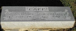
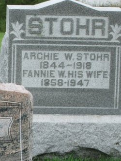
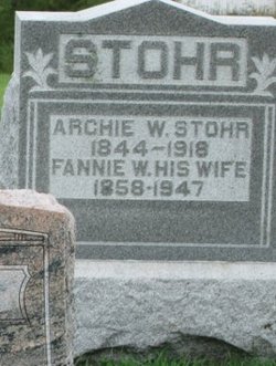
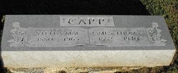
Estella Mae “Stella” Stohr Capp
| Birth | : | 13 Mar 1880 Clarence, Shelby County, Missouri, USA |
| Death | : | 1 Dec 1963 Wichita, Sedgwick County, Kansas, USA |
| Burial | : | Christ Church, Doncaster, Metropolitan Borough of Doncaster, England |
| Coordinate | : | 53.5231570, -1.1270320 |
| Plot | : | BUNN Block 1 Row 6 Lot 6s |
| Description | : | STELLA MAE CAPP Stella Mae Capp, 83, of 221 N Elizabeth, died Sunday. She was born March 13, 1880 in Clarence Mo and moved to Wichita in 1920. She was a 50 year member of Royal Neighbors Lodge. Services will be at 8:30 a.m. Monday at Culbertson Mortuary. Burial will be in Maple Wood Cemetery, Clarence, Mo. The Wichita Eagle, Wichita, Kansas, 02 Dec 1963, Mon • Page 30, Column 4 (Contributor: Pam Witherow) |
frequently asked questions (FAQ):
-
Where is Estella Mae “Stella” Stohr Capp's memorial?
Estella Mae “Stella” Stohr Capp's memorial is located at: Christ Church, Doncaster, Metropolitan Borough of Doncaster, England.
-
When did Estella Mae “Stella” Stohr Capp death?
Estella Mae “Stella” Stohr Capp death on 1 Dec 1963 in Wichita, Sedgwick County, Kansas, USA
-
Where are the coordinates of the Estella Mae “Stella” Stohr Capp's memorial?
Latitude: 53.5231570
Longitude: -1.1270320
Family Members:
Parent
Spouse
Siblings
Flowers:
Nearby Cemetories:
1. Christ Church
Doncaster, Metropolitan Borough of Doncaster, England
Coordinate: 53.5231570, -1.1270320
2. St. George's Churchyard
Doncaster, Metropolitan Borough of Doncaster, England
Coordinate: 53.5233060, -1.1268600
3. Carmelite Friary Whitefriars
Doncaster, Metropolitan Borough of Doncaster, England
Coordinate: 53.5230210, -1.1346580
4. Quaker Burial Ground
Balby, Metropolitan Borough of Doncaster, England
Coordinate: 53.5215420, -1.1386660
5. Friars Minor Greyfriars
Doncaster, Metropolitan Borough of Doncaster, England
Coordinate: 53.5263550, -1.1388230
6. Black Friars Friars Preachers
Doncaster, Metropolitan Borough of Doncaster, England
Coordinate: 53.5160000, -1.1330000
7. Hyde Park Cemetery
Doncaster, Metropolitan Borough of Doncaster, England
Coordinate: 53.5150570, -1.1316170
8. St John the Evangelist Churchyard
Balby, Metropolitan Borough of Doncaster, England
Coordinate: 53.5075700, -1.1506000
9. Balby War Memorial
Balby, Metropolitan Borough of Doncaster, England
Coordinate: 53.5072040, -1.1504580
10. Rose Hill Cemetery
Cantley, Metropolitan Borough of Doncaster, England
Coordinate: 53.5145880, -1.0863210
11. Rose Hill Crematorium
Cantley, Metropolitan Borough of Doncaster, England
Coordinate: 53.5129200, -1.0813200
12. Arksey Cemetery
Arksey, Metropolitan Borough of Doncaster, England
Coordinate: 53.5522620, -1.1312680
13. Arksey Old Cemetery
Arksey, Metropolitan Borough of Doncaster, England
Coordinate: 53.5531600, -1.1312200
14. Old Church Burial Ground
Warmsworth, Metropolitan Borough of Doncaster, England
Coordinate: 53.5049870, -1.1700830
15. All Saints Churchyard
Arksey, Metropolitan Borough of Doncaster, England
Coordinate: 53.5557580, -1.1271520
16. Warmsworth Cemetery
Warmsworth, Metropolitan Borough of Doncaster, England
Coordinate: 53.5056631, -1.1736180
17. St. Peter's Churchyard
Warmsworth, Metropolitan Borough of Doncaster, England
Coordinate: 53.5004220, -1.1679401
18. St. Mary's Churchyard
Sprotbrough, Metropolitan Borough of Doncaster, England
Coordinate: 53.5122280, -1.1878590
19. St. Wilfrid Churchyard
Cantley, Metropolitan Borough of Doncaster, England
Coordinate: 53.5058500, -1.0688800
20. Quaker Burial Ground
Warmsworth, Metropolitan Borough of Doncaster, England
Coordinate: 53.4994820, -1.1784890
21. St. Leonard & St. Mary Churchyard
Armthorpe, Metropolitan Borough of Doncaster, England
Coordinate: 53.5368555, -1.0633563
22. St. Katherine Churchyard
Loversall, Metropolitan Borough of Doncaster, England
Coordinate: 53.4821700, -1.1333650
23. Edlington Cemetery
Edlington, Metropolitan Borough of Doncaster, England
Coordinate: 53.4927440, -1.1810370
24. Saint Oswald's Churchyard
Kirk Sandall, Metropolitan Borough of Doncaster, England
Coordinate: 53.5665233, -1.0806768


