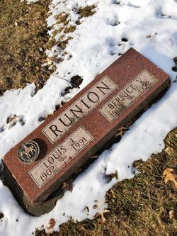
| Birth | : | 1880 Lindenwood, Ogle County, Illinois, USA |
| Death | : | 17 Mar 1968 Fort Dodge, Webster County, Iowa, USA |
| Burial | : | Fairview Cemetery, Clay County, USA |
| Coordinate | : | 43.1899986, -95.0800018 |
frequently asked questions (FAQ):
-
Where is Estella May Yeager Runion's memorial?
Estella May Yeager Runion's memorial is located at: Fairview Cemetery, Clay County, USA.
-
When did Estella May Yeager Runion death?
Estella May Yeager Runion death on 17 Mar 1968 in Fort Dodge, Webster County, Iowa, USA
-
Where are the coordinates of the Estella May Yeager Runion's memorial?
Latitude: 43.1899986
Longitude: -95.0800018
Family Members:
Parent
Spouse
Siblings
Children
Flowers:
Nearby Cemetories:
1. Fairview Cemetery
Clay County, USA
Coordinate: 43.1899986, -95.0800018
2. North Lawn Cemetery
Spencer, Clay County, USA
Coordinate: 43.1600000, -95.1470000
3. Dewey Readmore Books Memorial
Spencer, Clay County, USA
Coordinate: 43.1403999, -95.1443024
4. Dickens Cemetery
Dickens, Clay County, USA
Coordinate: 43.1280000, -95.0155000
5. Riverside Cemetery
Spencer, Clay County, USA
Coordinate: 43.1441994, -95.1671982
6. Evergreen Cemetery
Clay County, USA
Coordinate: 43.2052994, -95.2086029
7. Little Sioux Lutheran Cemetery
Milford, Dickinson County, USA
Coordinate: 43.2702065, -95.2109528
8. Milford Cemetery
Milford, Dickinson County, USA
Coordinate: 43.3092003, -95.1481018
9. Calvary Cemetery
Milford, Dickinson County, USA
Coordinate: 43.3213997, -95.1688995
10. Fairview Cemetery
Terril, Dickinson County, USA
Coordinate: 43.2977982, -94.9349976
11. Crown Hill Cemetery
Ruthven, Palo Alto County, USA
Coordinate: 43.1328011, -94.8878021
12. Calvary Cemetery
Ruthven, Palo Alto County, USA
Coordinate: 43.1314011, -94.8869019
13. Rosehill Cemetery
Clay County, USA
Coordinate: 43.0368996, -95.0919037
14. First Reformed Cemetery
Clay County, USA
Coordinate: 43.2399500, -95.2889000
15. Logan Township Cemetery
Clay County, USA
Coordinate: 43.0489006, -94.9747009
16. Swedish Lutheran Cemetery
Royal, Clay County, USA
Coordinate: 43.0683000, -95.2350000
17. Highland Cemetery
Highland Township, Palo Alto County, USA
Coordinate: 43.1497002, -94.8578033
18. Lost Island Lutheran Cemetery
Lost Island Township, Palo Alto County, USA
Coordinate: 43.1980000, -94.8375000
19. Richland Township Cemetery
Terril, Dickinson County, USA
Coordinate: 43.3565323, -94.9927821
20. Okoboji Cemetery
Arnolds Park, Dickinson County, USA
Coordinate: 43.3649406, -95.1303558
21. Gardner Family Cemetery
Arnolds Park, Dickinson County, USA
Coordinate: 43.3654410, -95.1403480
22. Pioneer Cemetery
Arnolds Park, Dickinson County, USA
Coordinate: 43.3655000, -95.1403000
23. Lone Tree Cemetery
Everly, Clay County, USA
Coordinate: 43.1411018, -95.3347015
24. Lakeview Gardens Cemetery
Spirit Lake, Dickinson County, USA
Coordinate: 43.3925000, -95.1119000


