
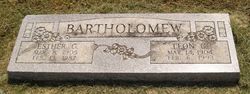
Esther Genevieve Wells Bartholomew
| Birth | : | 8 Mar 1905 Kansas, USA |
| Death | : | 13 Feb 1987 Mulvane, Sumner County, Kansas, USA |
| Burial | : | Indianapolis Cemetery, Rose Hill, Mahaska County, USA |
| Coordinate | : | 41.4053001, -92.4364014 |
| Plot | : | Block 12, Lot 50, Grave M1/3 |
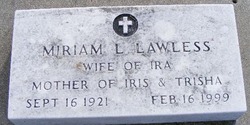
| Description | : | Obituary from Wichita Eagle, Sunday, February 15, 1987: ESTHER G. BARTHOLOMEW, 81, of Mulvane, homemaker, died Friday, Feb. 13, 1987. Service 2 p.m. Monday, Senter-Smith Mortuary, Mulvane. Survivors: husband, Leon; son, . . .; daughter,. . .; sisters, Helen Preston of Udall, Miriam Lawless of Mulvane; two grandchildren. Memorial has been established with Mulvane United Methodist Church. Husband - Leon Bartholomew Father - Raymond Wells Mother - Alice Wells |
frequently asked questions (FAQ):
-
Where is Esther Genevieve Wells Bartholomew's memorial?
Esther Genevieve Wells Bartholomew's memorial is located at: Indianapolis Cemetery, Rose Hill, Mahaska County, USA.
-
When did Esther Genevieve Wells Bartholomew death?
Esther Genevieve Wells Bartholomew death on 13 Feb 1987 in Mulvane, Sumner County, Kansas, USA
-
Where are the coordinates of the Esther Genevieve Wells Bartholomew's memorial?
Latitude: 41.4053001
Longitude: -92.4364014
Family Members:
Parent
Spouse

Siblings
Children

Flowers:


Nearby Cemetories:
1. Indianapolis Cemetery
Rose Hill, Mahaska County, USA
Coordinate: 41.4053001, -92.4364014
2. Tinsley Cemetery
Mahaska County, USA
Coordinate: 41.3941994, -92.4783020
3. Bedwell Cemetery
Monroe Township, Mahaska County, USA
Coordinate: 41.3667400, -92.4637400
4. Rice Cemetery
What Cheer, Keokuk County, USA
Coordinate: 41.3793983, -92.3891983
5. Coal Creek Cemetery
What Cheer, Keokuk County, USA
Coordinate: 41.4392520, -92.3843340
6. Hopewell Cemetery
Rose Hill, Mahaska County, USA
Coordinate: 41.3502998, -92.4494019
7. Waddell Cemetery
Keokuk County, USA
Coordinate: 41.3574982, -92.3874969
8. Mormon Point Cemetery
Mahaska County, USA
Coordinate: 41.4344406, -92.5080566
9. Turner-Tinkerville-Wapalo Cemetery
Rose Hill, Mahaska County, USA
Coordinate: 41.3426130, -92.4177970
10. Roberts Cemetery
Mahaska County, USA
Coordinate: 41.3793983, -92.5235977
11. Highland Cemetery
What Cheer, Keokuk County, USA
Coordinate: 41.3936005, -92.3407974
12. McFarlan Cemetery
What Cheer, Keokuk County, USA
Coordinate: 41.4085999, -92.3371964
13. Wymore Cemetery
Rose Hill, Mahaska County, USA
Coordinate: 41.3499985, -92.5069427
14. Saint Josephs Cemetery
What Cheer, Keokuk County, USA
Coordinate: 41.4007988, -92.3300018
15. Sixteen Cemetery
Thornburg, Keokuk County, USA
Coordinate: 41.4622002, -92.3538971
16. Hewitt Cemetery
Delta, Keokuk County, USA
Coordinate: 41.3277874, -92.3807409
17. Jackson Cemetery
Rose Hill, Mahaska County, USA
Coordinate: 41.3191986, -92.4730988
18. Springfield Cemetery
Delta, Keokuk County, USA
Coordinate: 41.3386002, -92.3531036
19. Old Rose Hill Cemetery
Rose Hill, Mahaska County, USA
Coordinate: 41.3209991, -92.4929962
20. Ruby Cemetery
Lacey, Mahaska County, USA
Coordinate: 41.3633320, -92.5527550
21. Barnes City Cemetery
Barnes City, Mahaska County, USA
Coordinate: 41.5036390, -92.4746930
22. Saint Martin Evangelical Lutheran Cemetery
Keokuk County, USA
Coordinate: 41.4100075, -92.2971268
23. Humes Cemetery
Thornburg, Keokuk County, USA
Coordinate: 41.4085999, -92.2968979
24. Union Mills Cemetery
Union Mills, Mahaska County, USA
Coordinate: 41.4482994, -92.5643997