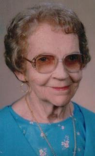
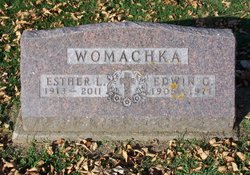
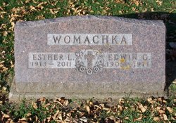
Esther Laurine Peet Womachka
| Birth | : | 13 Jun 1913 Anamosa, Jones County, Iowa, USA |
| Death | : | 16 Feb 2011 Cedar Rapids, Linn County, Iowa, USA |
| Burial | : | Mount Hope Cemetery, Maquoketa, Jackson County, USA |
| Coordinate | : | 42.0615616, -90.6619720 |
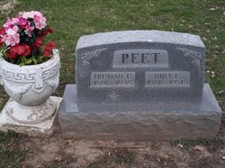
| Description | : | Esther was born June 13, 1913, in Anamosa to Truman and Nina (Beardsley) Peet. She was a graduate of Strawberry Point High School and Cedar Rapids Business College. On October 27, 1937, she married Edwin Womachka, and they resided in Maquoketa. Edwin died December 6, 1971. Esther spent almost 20 years working as a nurses aide at Jackson County Public Hospital in Maquoketa. After her retirement she worked several years as a private aide. Knitting and crocheting were her hobbies, and she made many afghans and pairs of slippers for family and friends. She was also a 50-year member of... Read More |
frequently asked questions (FAQ):
-
Where is Esther Laurine Peet Womachka's memorial?
Esther Laurine Peet Womachka's memorial is located at: Mount Hope Cemetery, Maquoketa, Jackson County, USA.
-
When did Esther Laurine Peet Womachka death?
Esther Laurine Peet Womachka death on 16 Feb 2011 in Cedar Rapids, Linn County, Iowa, USA
-
Where are the coordinates of the Esther Laurine Peet Womachka's memorial?
Latitude: 42.0615616
Longitude: -90.6619720
Family Members:
Parent
Spouse
Siblings
Flowers:
Nearby Cemetories:
1. Mount Hope Cemetery
Maquoketa, Jackson County, USA
Coordinate: 42.0615616, -90.6619720
2. Sacred Heart Cemetery
Maquoketa, Jackson County, USA
Coordinate: 42.0583496, -90.6617966
3. Bridgeport Cemetery
Maquoketa, Jackson County, USA
Coordinate: 42.0906000, -90.6267000
4. Union Cemetery
Brookfield Township, Clinton County, USA
Coordinate: 42.0182991, -90.6694031
5. Goddard Cemetery
Maquoketa, Jackson County, USA
Coordinate: 42.0391998, -90.7335968
6. Codfish Hollow Cemetery
Maquoketa, Jackson County, USA
Coordinate: 42.0727997, -90.5793991
7. Tilton Cemetery
Jackson County, USA
Coordinate: 42.1236000, -90.6798000
8. Buckhorn Waterford Cemetery
Buckhorn, Jackson County, USA
Coordinate: 42.0607986, -90.7517014
9. Saint Patrick's Cemetery
Delmar, Clinton County, USA
Coordinate: 42.0036011, -90.6149979
10. Esgate Cemetery
Maquoketa, Jackson County, USA
Coordinate: 42.1292000, -90.7142029
11. Rathbun Cemetery
Maquoketa, Jackson County, USA
Coordinate: 42.0402000, -90.5570000
12. Evergreen Cemetery
Delmar, Clinton County, USA
Coordinate: 41.9897003, -90.6057968
13. Elwood Cemetery
Elwood, Clinton County, USA
Coordinate: 41.9935989, -90.7307968
14. Risinger Cemetery
Andrew, Jackson County, USA
Coordinate: 42.1241787, -90.5548475
15. Union Center Cemetery
Maquoketa, Jackson County, USA
Coordinate: 42.0546989, -90.5246964
16. Saint Johns Catholic Cemetery
Andrew, Jackson County, USA
Coordinate: 42.1509760, -90.5888680
17. Andrew Cemetery
Andrew, Jackson County, USA
Coordinate: 42.1519430, -90.5895330
18. Busch Cemetery
Clinton County, USA
Coordinate: 41.9996986, -90.7818985
19. Pence Cemetery
Baldwin, Jackson County, USA
Coordinate: 42.0746994, -90.8106003
20. East Iron Hill Cemetery
Farmers Creek Township, Jackson County, USA
Coordinate: 42.1465797, -90.7591019
21. Sutton Cemetery
Fulton, Jackson County, USA
Coordinate: 42.1677000, -90.7143000
22. West Iron Hill Cemetery
Jackson County, USA
Coordinate: 42.1460000, -90.7686000
23. Bloomfield Cemetery
Clinton County, USA
Coordinate: 41.9458008, -90.6194000
24. Springbrook Amish-Mennonite Cemetery
Bellevue, Jackson County, USA
Coordinate: 42.1570340, -90.5515440

