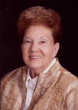
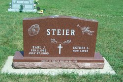
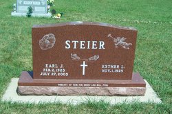
Esther Lydia Ruhnke Steier
| Birth | : | 1 Nov 1925 Whittemore, Kossuth County, Iowa, USA |
| Death | : | 11 Nov 2013 Algona, Kossuth County, Iowa, USA |
| Burial | : | Saint Michaels Catholic Cemetery, Whittemore, Kossuth County, USA |
| Coordinate | : | 43.0827000, -94.4322500 |
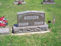
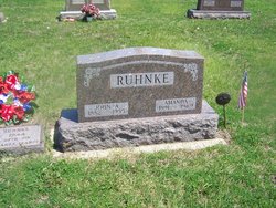
| Description | : | Esther Lydia Steier was born November 1, 1925 at Whittemore, Iowa to John and Amanda (Dau) Ruhnke. She attended country school before graduating from Fenton High School in 1943. She worked at Vans Music Store in Mason City until her marriage to Earl Steier on March 27, 1951 in Mason City. The couple then farmed west of Whittemore. In 1978, Esther organized a German Band for the Whittemore Centennial and helped start the pageant. In 1989, she helped organize a chorus for St. Michael's Centennial Pageant and for many years played Taps for the Whittemore American Legion at military funerals... Read More |
frequently asked questions (FAQ):
-
Where is Esther Lydia Ruhnke Steier's memorial?
Esther Lydia Ruhnke Steier's memorial is located at: Saint Michaels Catholic Cemetery, Whittemore, Kossuth County, USA.
-
When did Esther Lydia Ruhnke Steier death?
Esther Lydia Ruhnke Steier death on 11 Nov 2013 in Algona, Kossuth County, Iowa, USA
-
Where are the coordinates of the Esther Lydia Ruhnke Steier's memorial?
Latitude: 43.0827000
Longitude: -94.4322500
Family Members:
Parent
Spouse
Siblings
Children
Flowers:
Nearby Cemetories:
1. Saint Michaels Catholic Cemetery
Whittemore, Kossuth County, USA
Coordinate: 43.0827000, -94.4322500
2. Plainview Cemetery
Whittemore, Kossuth County, USA
Coordinate: 43.0667000, -94.4091720
3. Saint Pauls Lutheran Cemetery
Whittemore, Kossuth County, USA
Coordinate: 43.0530014, -94.4135971
4. Saint John's Lutheran Cemetery
Fairfield Township, Palo Alto County, USA
Coordinate: 43.1265000, -94.5017000
5. Saint Luke's Lutheran Cemetery
Fairfield Township, Palo Alto County, USA
Coordinate: 43.1545000, -94.4723000
6. Garfield Township Cemetery
Kossuth County, USA
Coordinate: 42.9947000, -94.4080000
7. Riverside Cemetery
Fern Valley Township, Palo Alto County, USA
Coordinate: 43.0200000, -94.5220000
8. Immanuel Lutheran Cemetery
Lotts Creek, Kossuth County, USA
Coordinate: 43.1627000, -94.3630000
9. North Saint John's Lutheran Cemetery
Independence Township, Palo Alto County, USA
Coordinate: 43.1696281, -94.5077438
10. Apostolic V Christian Cemetery
Kossuth County, USA
Coordinate: 42.9630870, -94.4238290
11. Fenton United Methodist Cemetery
Fenton, Kossuth County, USA
Coordinate: 43.2052994, -94.4262009
12. West Bend Cemetery
West Bend, Palo Alto County, USA
Coordinate: 42.9590000, -94.4548000
13. Fenton Township Cemetery
Lone Rock, Kossuth County, USA
Coordinate: 43.1977997, -94.3535995
14. Union Township Cemetery
Kossuth County, USA
Coordinate: 43.1417007, -94.2619019
15. Saint Johns Lutheran Cemetery
Fenton, Kossuth County, USA
Coordinate: 43.2239000, -94.4289000
16. Riverside Cemetery
West Bend, Palo Alto County, USA
Coordinate: 42.9512000, -94.5120000
17. Riverview Cemetery
Algona, Kossuth County, USA
Coordinate: 43.0766983, -94.2257996
18. East Lawn Cemetery
Algona, Kossuth County, USA
Coordinate: 43.0583000, -94.2249985
19. Lincoln Cemetery
West Bend, Palo Alto County, USA
Coordinate: 42.9596842, -94.5602466
20. Calvary Cemetery
Algona, Kossuth County, USA
Coordinate: 43.0819016, -94.2114029
21. Vernon Township Cemetery
Vernon Township, Palo Alto County, USA
Coordinate: 43.1840000, -94.6185000
22. Saint Johns Catholic Cemetery
Emmetsburg, Palo Alto County, USA
Coordinate: 43.0913200, -94.6790000
23. Evergreen Cemetery
Emmetsburg, Palo Alto County, USA
Coordinate: 43.0940018, -94.6791992
24. Laurel Hill Cemetery
Irvington, Kossuth County, USA
Coordinate: 43.0017014, -94.1939011

