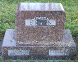
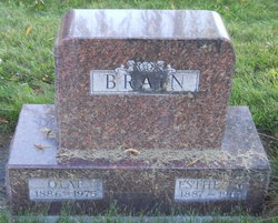
Esther Marie Zimmerman Brain
| Birth | : | 31 Oct 1887 Birnamwood, Shawano County, Wisconsin, USA |
| Death | : | 12 Apr 1967 Saint Ignatius, Lake County, Montana, USA |
| Burial | : | Bury St Edmunds Cemetery, Bury St Edmunds, St Edmundsbury Borough, England |
| Coordinate | : | 52.2438030, 0.7014930 |
| Description | : | Raised on northwest Wisconsin farms, including Barron County from 1906 to her 1915 marriage. After their Wisconsin marriage in 1915 Olaf & Esther homesteaded in Idaho & Montana. From their homesteading days in the early 1900s to their deaths, they spent their adult lives in Idaho and Montana. In 1920 Esther was a logging camp cook and Olaf was a teamster, driving teams of work animals in Idaho. In 1930 Olaf was farming his own land in Montana. In the 1940 census, Olaf was a cook at a mine/lumber mill, owned by the Klockmann Bros., Continental Mining, in... Read More |
frequently asked questions (FAQ):
-
Where is Esther Marie Zimmerman Brain's memorial?
Esther Marie Zimmerman Brain's memorial is located at: Bury St Edmunds Cemetery, Bury St Edmunds, St Edmundsbury Borough, England.
-
When did Esther Marie Zimmerman Brain death?
Esther Marie Zimmerman Brain death on 12 Apr 1967 in Saint Ignatius, Lake County, Montana, USA
-
Where are the coordinates of the Esther Marie Zimmerman Brain's memorial?
Latitude: 52.2438030
Longitude: 0.7014930
Family Members:
Flowers:
Nearby Cemetories:
1. Bury St Edmunds Cemetery
Bury St Edmunds, St Edmundsbury Borough, England
Coordinate: 52.2438030, 0.7014930
2. St. Edmundsbury Cathedral
Bury St Edmunds, St Edmundsbury Borough, England
Coordinate: 52.2439340, 0.7170190
3. St. Mary's Churchyard
Bury St Edmunds, St Edmundsbury Borough, England
Coordinate: 52.2424630, 0.7172480
4. Bury St Edmunds Abbey
Bury St Edmunds, St Edmundsbury Borough, England
Coordinate: 52.2441060, 0.7192360
5. Saint Mary's Churchyard
Westley, St Edmundsbury Borough, England
Coordinate: 52.2486230, 0.6701530
6. Saint Leonard's Churchyard
Horringer, St Edmundsbury Borough, England
Coordinate: 52.2250540, 0.6750640
7. Saint Martin's Churchyard
Fornham St Martin, St Edmundsbury Borough, England
Coordinate: 52.2695570, 0.7133080
8. West Suffolk Crematorium
Risby, St Edmundsbury Borough, England
Coordinate: 52.2600280, 0.6648640
9. All Saints Churchyard
Fornham St Genevieve, St Edmundsbury Borough, England
Coordinate: 52.2759800, 0.6920480
10. All Saints Fornham Churchyard
Bury St Edmunds, St Edmundsbury Borough, England
Coordinate: 52.2760548, 0.6920269
11. St Peter's Churchyard
Nowton, St Edmundsbury Borough, England
Coordinate: 52.2109220, 0.7257590
12. St. Mary's Churchyard
Ickworth, St Edmundsbury Borough, England
Coordinate: 52.2184440, 0.6516990
13. St Nicholas Churchyard
Little Saxham, St Edmundsbury Borough, England
Coordinate: 52.2421640, 0.6338780
14. Holy Innocents Churchyard
Great Barton, St Edmundsbury Borough, England
Coordinate: 52.2600380, 0.7678410
15. St Giles War Memorial - Risby
Risby, St Edmundsbury Borough, England
Coordinate: 52.2660130, 0.6396260
16. St Giles Churchyard
Risby, St Edmundsbury Borough, England
Coordinate: 52.2661320, 0.6397400
17. All Saints Churchyard
Hawstead, St Edmundsbury Borough, England
Coordinate: 52.1998300, 0.7143900
18. Church of the Reconciliation
Hengrave, St Edmundsbury Borough, England
Coordinate: 52.2850270, 0.6733120
19. St Nicholas Churchyard
Rushbrooke, St Edmundsbury Borough, England
Coordinate: 52.2193810, 0.7704070
20. Church of St. Thomas à Becket
Great Whelnetham, St Edmundsbury Borough, England
Coordinate: 52.2003200, 0.7468860
21. St Andrew Church
Great Saxham, St Edmundsbury Borough, England
Coordinate: 52.2343860, 0.6179690
22. St. Andrew's Churchyard
Timworth, St Edmundsbury Borough, England
Coordinate: 52.2940830, 0.7269200
23. Whepstead Cemetery
Whepstead, St Edmundsbury Borough, England
Coordinate: 52.1922830, 0.6806830
24. St Mary Magdalene Churchyard
Little Whelnetham, St Edmundsbury Borough, England
Coordinate: 52.2062540, 0.7628880


