
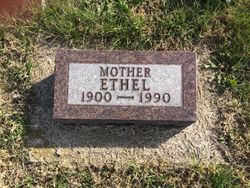

Ethel B Alford Haun
| Birth | : | 10 Sep 1900 Boyd County, Nebraska, USA |
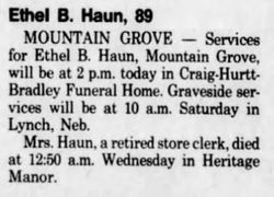
| Death | : | 25 Apr 1990 Mountain Grove, Wright County, Missouri, USA |
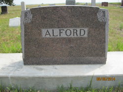
| Burial | : | Alford Cemetery, Monowi, Boyd County, USA |
| Coordinate | : | 42.7997017, -98.3450012 |
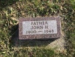
| Description | : | Ethel grew up on the family farm near Monowi, NE. She married John Haun on 11 Oct 1923 in Boyd county, NE (marriage book 4A, page 7). They lived in Edgemont, SD for a time and then moved back to a farm near Lynch, NE. John and Ethel had two daughters, Ferne Nyquist and Phyllis. |
frequently asked questions (FAQ):
-
Where is Ethel B Alford Haun's memorial?
Ethel B Alford Haun's memorial is located at: Alford Cemetery, Monowi, Boyd County, USA.
-
When did Ethel B Alford Haun death?
Ethel B Alford Haun death on 25 Apr 1990 in Mountain Grove, Wright County, Missouri, USA
-
Where are the coordinates of the Ethel B Alford Haun's memorial?
Latitude: 42.7997017
Longitude: -98.3450012
Family Members:
Parent

Spouse
Siblings


Children
Flowers:


Nearby Cemetories:
1. Alford Cemetery
Monowi, Boyd County, USA
Coordinate: 42.7997017, -98.3450012
2. Riha Cemetery
Verdel, Knox County, USA
Coordinate: 42.7930000, -98.3086000
3. Beulah Cemetery
Monowi, Boyd County, USA
Coordinate: 42.8610992, -98.3692017
4. ZCBJ Bohemian National Cemetery
Lynch, Boyd County, USA
Coordinate: 42.8286000, -98.4550100
5. Pleasant Hill Cemetery
Lynch, Boyd County, USA
Coordinate: 42.8199997, -98.4674988
6. ABVM Catholic Cemetery
Lynch, Boyd County, USA
Coordinate: 42.8352000, -98.4675000
7. National Cemetery
Pishelville, Knox County, USA
Coordinate: 42.7190000, -98.2500000
8. Ponca Valley Cemetery
Verdel, Knox County, USA
Coordinate: 42.8135000, -98.1990000
9. Highland Cemetery
Lynch, Boyd County, USA
Coordinate: 42.8718987, -98.4561005
10. Dorsey Cemetery
Holt County, USA
Coordinate: 42.6755981, -98.3339005
11. Holy Fellowship Cemetery
Greenwood, Charles Mix County, USA
Coordinate: 42.9308014, -98.3788986
12. Greenwood Episcopal Cemetery
Greenwood, Charles Mix County, USA
Coordinate: 42.9307833, -98.3795556
13. Greenwood Presbyterian Cemetery
Greenwood, Charles Mix County, USA
Coordinate: 42.9318533, -98.3792422
14. Old Holy Name Cemetery
Dante, Charles Mix County, USA
Coordinate: 42.8868700, -98.2032900
15. Ponca Evangelical Lutheran Cemetery
Niobrara, Knox County, USA
Coordinate: 42.7428000, -98.1621000
16. Riverview Cemetery
Knox County, USA
Coordinate: 42.7322006, -98.1619034
17. Old Paddock Cemetery
Paddock, Holt County, USA
Coordinate: 42.7705000, -98.5509000
18. Pleasant View Cemetery
Lynch, Boyd County, USA
Coordinate: 42.9147300, -98.4863400
19. Star Cemetery
Holt County, USA
Coordinate: 42.6408005, -98.3435974
20. Scottville Cemetery
O'Neill, Holt County, USA
Coordinate: 42.6834120, -98.5120140
21. Pleasant Hill Cemetery
Verdigre, Knox County, USA
Coordinate: 42.6837500, -98.1619500
22. Bristow Cemetery
Bristow, Boyd County, USA
Coordinate: 42.8321991, -98.5856018
23. New Holy Name Cemetery
Dante, Charles Mix County, USA
Coordinate: 42.9122900, -98.1510800
24. Rosedale Covenant Cemetery
Bristow, Boyd County, USA
Coordinate: 42.8722390, -98.5751470