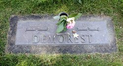
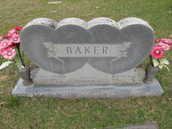
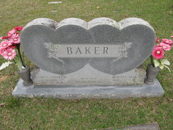
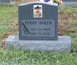
Ethel Baker Demorest
| Birth | : | 28 Mar 1910 Grannis, Polk County, Arkansas, USA |
| Death | : | 12 Nov 1998 Springfield, Lane County, Oregon, USA |
| Burial | : | Springfield Memorial Gardens, Springfield, Lane County, USA |
| Coordinate | : | 44.0430984, -122.8936005 |
frequently asked questions (FAQ):
-
Where is Ethel Baker Demorest's memorial?
Ethel Baker Demorest's memorial is located at: Springfield Memorial Gardens, Springfield, Lane County, USA.
-
When did Ethel Baker Demorest death?
Ethel Baker Demorest death on 12 Nov 1998 in Springfield, Lane County, Oregon, USA
-
Where are the coordinates of the Ethel Baker Demorest's memorial?
Latitude: 44.0430984
Longitude: -122.8936005
Family Members:
Parent
Spouse
Siblings
Flowers:
Nearby Cemetories:
1. Springfield Memorial Gardens
Springfield, Lane County, USA
Coordinate: 44.0430984, -122.8936005
2. Smith-Weyerhauser Cemetery
Lane County, USA
Coordinate: 44.0252991, -122.9139023
3. Mount Vernon Pioneer Cemetery
Springfield, Lane County, USA
Coordinate: 44.0345000, -122.9300000
4. Wallace Cemetery
Lane County, USA
Coordinate: 44.0078011, -122.8936005
5. Camp Creek Cemetery
Springfield, Lane County, USA
Coordinate: 44.0790800, -122.8648600
6. Kesey Family Farm Cemetery
Eugene, Lane County, USA
Coordinate: 43.9902510, -122.9320650
7. Stafford Cemetery
Lane County, USA
Coordinate: 44.1143990, -122.9143982
8. Saint Alice Catholic Church Cemetery
Springfield, Lane County, USA
Coordinate: 44.0513000, -123.0034000
9. Pleasant Hill Cemetery
Pleasant Hill, Lane County, USA
Coordinate: 43.9626579, -122.9203949
10. Valley View Cemetery
Marcola, Lane County, USA
Coordinate: 44.1280910, -122.9308690
11. Pioneer Memorial Cemetery Park
Springfield, Lane County, USA
Coordinate: 44.0438000, -123.0213000
12. Fall Creek Christian Church Cemetery
Lane County, USA
Coordinate: 43.9653015, -122.8221970
13. Goshen Grange 561 Cemetery
Goshen, Lane County, USA
Coordinate: 43.9888916, -123.0034180
14. Sellers Cemetery
Lane County, USA
Coordinate: 43.9500008, -122.9499969
15. Keeney Cemetery
Pleasant Hill, Lane County, USA
Coordinate: 43.9495280, -122.9506800
16. Evergreen Hill Cemetery
Eugene, Lane County, USA
Coordinate: 44.0933800, -123.0183700
17. Laurel Grove Cemetery
Springfield, Lane County, USA
Coordinate: 44.0379982, -123.0432968
18. Marcola Cemetery
Marcola, Lane County, USA
Coordinate: 44.1709940, -122.8721730
19. Saint Thomas Memorial Garden and Columbarium
Eugene, Lane County, USA
Coordinate: 44.0778280, -123.0683440
20. Eugene Pioneer Cemetery
Eugene, Lane County, USA
Coordinate: 44.0416985, -123.0749969
21. Masonic Cemetery
Eugene, Lane County, USA
Coordinate: 44.0322000, -123.0754000
22. Central Lutheran Church Columbarium
Eugene, Lane County, USA
Coordinate: 44.0398000, -123.0761000
23. Wesley United Methodist Cemetery
Eugene, Lane County, USA
Coordinate: 44.0768900, -123.0779900
24. Episcopal Church of the Resurrection Memorial Gard
Eugene, Lane County, USA
Coordinate: 44.0129000, -123.0806000

