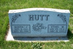
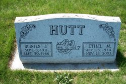
Ethel May Stanley Hutt
| Birth | : | 25 Apr 1914 Burdett, Washington County, Colorado, USA |
| Death | : | 18 Nov 2003 Sterling, Logan County, Colorado, USA |
| Burial | : | Queens Meadow Point Cemetery, Keyser, Mineral County, USA |
| Coordinate | : | 39.4291992, -78.9627991 |
| Description | : | Ethel May Hutt, 89, of Sterling, died Tuesday, Nov. 18, 2003, in Sterling. Visitation will be Thursday, Nov. 20 from 10 a.m. to 7 p.m. at Chaney-Reager Funeral Home. Funeral services will be Friday, Nov. 21 at 2 p.m. at Berean Church, 12527 CR 37, with Rev Ronald Smithgall officiating. Burial will follow at Riverside Cemetery Mrs. Hutt was born April 25, 1914, in Burdett to Herbert and Corella (Lair) Stanley. She attended Hillcrest School and graduated from Otis High School in 1932. She helped her parents on the farm until her marriage to Quinten Hutt on April 12, 1936, in Sterling. To... Read More |
frequently asked questions (FAQ):
-
Where is Ethel May Stanley Hutt's memorial?
Ethel May Stanley Hutt's memorial is located at: Queens Meadow Point Cemetery, Keyser, Mineral County, USA.
-
When did Ethel May Stanley Hutt death?
Ethel May Stanley Hutt death on 18 Nov 2003 in Sterling, Logan County, Colorado, USA
-
Where are the coordinates of the Ethel May Stanley Hutt's memorial?
Latitude: 39.4291992
Longitude: -78.9627991
Family Members:
Parent
Spouse
Siblings
Flowers:
Nearby Cemetories:
1. Queens Meadow Point Cemetery
Keyser, Mineral County, USA
Coordinate: 39.4291992, -78.9627991
2. Potomac Memorial Gardens
Keyser, Mineral County, USA
Coordinate: 39.4312000, -78.9579700
3. Dayton Cemetery
McCoole, Allegany County, USA
Coordinate: 39.4437000, -78.9573400
4. Locust Cemetery
Keyser, Mineral County, USA
Coordinate: 39.4449577, -78.9769135
5. Town Hill Cemetery
Petersburg, Grant County, USA
Coordinate: 39.4351762, -78.9882074
6. Thorn Rose Hill Cemetery
Keyser, Mineral County, USA
Coordinate: 39.4374352, -78.9929199
7. Arnold Cemetery
Keyser, Mineral County, USA
Coordinate: 39.4263992, -78.9950027
8. Saint Thomas Cemetery
Keyser, Mineral County, USA
Coordinate: 39.4406900, -78.9960300
9. Saint Mary's Cemetery
Keyser, Mineral County, USA
Coordinate: 39.4403000, -78.9963989
10. Cabin Run Cemetery
Keyser, Mineral County, USA
Coordinate: 39.4206009, -78.9216995
11. Sears Cemetery
Mineral County, USA
Coordinate: 39.4026900, -78.9148200
12. Leatherman-Parish Cemetery
Keyser, Mineral County, USA
Coordinate: 39.4075080, -79.0150020
13. Dawson Cemetery
Dawson, Allegany County, USA
Coordinate: 39.4737360, -78.9464880
14. Barrick and Rines Cemetery
Mineral County, USA
Coordinate: 39.3994010, -79.0143540
15. Duling Cemetery
New Creek, Mineral County, USA
Coordinate: 39.3906525, -79.0041940
16. County Poor House Cemetery
Mineral County, USA
Coordinate: 39.4788710, -78.9411070
17. Mount Zion Cemetery
Mineral County, USA
Coordinate: 39.4642900, -78.8974500
18. Orr Cemetery
Independence, Preston County, USA
Coordinate: 39.4252620, -78.8777500
19. Urice Cemetery
Mineral County, USA
Coordinate: 39.4687400, -78.8923000
20. Miller Cemetery
Westernport, Allegany County, USA
Coordinate: 39.4888110, -79.0043140
21. Bane Cemetery
Burlington, Mineral County, USA
Coordinate: 39.3579200, -78.9598200
22. Thrush Cemetery #01
Burlington, Mineral County, USA
Coordinate: 39.3588200, -78.9289400
23. Arnold Cemetery #2
Ridgeville, Mineral County, USA
Coordinate: 39.3612890, -79.0072440
24. Duckworth Cemetery at Stoney Run
Westernport, Allegany County, USA
Coordinate: 39.4984280, -79.0136400


