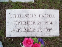
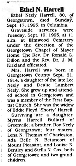
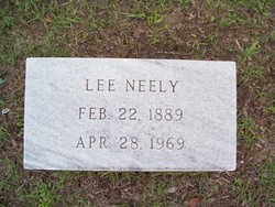
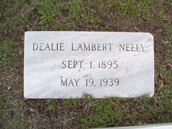
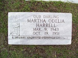
Ethel Neely Harrell
| Birth | : | 21 Sep 1914 |
| Death | : | 17 Sep 1995 |
| Burial | : | Collinsville Cemetery, Collinsville, Whitsunday Region, Australia |
| Coordinate | : | -20.5690210, 147.8369070 |
| Inscription | : | Ethel Neely Harrell September 21 1914 September 17 1995 |
frequently asked questions (FAQ):
-
Where is Ethel Neely Harrell's memorial?
Ethel Neely Harrell's memorial is located at: Collinsville Cemetery, Collinsville, Whitsunday Region, Australia.
-
When did Ethel Neely Harrell death?
Ethel Neely Harrell death on 17 Sep 1995 in
-
Where are the coordinates of the Ethel Neely Harrell's memorial?
Latitude: -20.5690210
Longitude: 147.8369070
Family Members:
Parent
Spouse
Siblings
Children
Flowers:
Nearby Cemetories:
1. Collinsville Cemetery
Collinsville, Whitsunday Region, Australia
Coordinate: -20.5690210, 147.8369070
2. Cunningham Family Cemetery
Collinsville, Whitsunday Region, Australia
Coordinate: -20.4982000, 147.6299000
3. Bowen Flemington Road Cemetery
Bowen, Whitsunday Region, Australia
Coordinate: -20.0059100, 148.2123100
4. Stone Island Homestead Cemetery
Bowen, Whitsunday Region, Australia
Coordinate: -20.0361500, 148.2790300
5. Bowen General Cemetery
Bowen, Whitsunday Region, Australia
Coordinate: -20.0014860, 148.2321260
6. Proserpine General Cemetery
Proserpine, Whitsunday Region, Australia
Coordinate: -20.3953000, 148.5638000
7. Proserpine Lawn Cemetery
Proserpine, Whitsunday Region, Australia
Coordinate: -20.3929770, 148.5636941
8. St Paul's Anglican Church Columbarium Wall
Proserpine, Whitsunday Region, Australia
Coordinate: -20.4016710, 148.5800580
9. Mount Coolon Cemetery
Mount Coolon, Whitsunday Region, Australia
Coordinate: -21.3870730, 147.3336270
10. Finch Hatton Cemetery
Finch Hatton, Mackay Region, Australia
Coordinate: -21.1417670, 148.6587180
11. Home Hill General Cemetery
Home Hill, Burdekin Shire, Australia
Coordinate: -19.6630800, 147.4259200
12. St Helens Anglican Church Columbarium Wall
Home Hill, Burdekin Shire, Australia
Coordinate: -19.6572720, 147.4130880
13. Ravenswood Cemetery
Ravenswood, Charters Towers Region, Australia
Coordinate: -20.1116040, 146.8872210
14. Pinnacle Cemetery
Pinnacle, Mackay Region, Australia
Coordinate: -21.1474530, 148.7124820
15. Mount Britton Cemetery
Nebo, Isaac Region, Australia
Coordinate: -21.4041410, 148.5417400
16. Ayr Cemetery
Ayr, Burdekin Shire, Australia
Coordinate: -19.5641000, 147.3909940
17. Jolimont Cemetery
Kuttabul, Mackay Region, Australia
Coordinate: -21.0330800, 148.9045300
18. Mirani Cemetery
Mirani, Mackay Region, Australia
Coordinate: -21.1610090, 148.8515450
19. Hampden Cemetery
Hampden, Mackay Region, Australia
Coordinate: -21.0619800, 148.9343390
20. Double Peaks Cemetery
Mackay Region, Australia
Coordinate: -21.1994530, 148.8914720
21. Marian Cemetery
Marian, Mackay Region, Australia
Coordinate: -21.1469138, 148.9642882
22. Mandarana Cemetery
Mackay, Mackay Region, Australia
Coordinate: -21.0906510, 149.0389450
23. Giru-Woodstock Road Homestead Cemetery
Giru, Burdekin Shire, Australia
Coordinate: -19.5477500, 147.0598300
24. Walkerston Cemetery
Walkerston, Mackay Region, Australia
Coordinate: -21.1613710, 149.0785820

