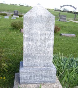
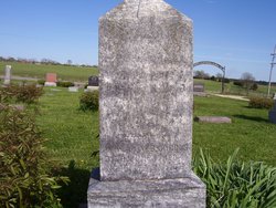
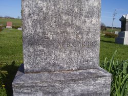
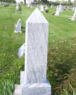
Ettie S. Plummer Jacobs
| Birth | : | 4 Sep 1866 Elkhart, Logan County, Illinois, USA |
| Death | : | 17 Jun 1904 Jackson County, Kansas, USA |
| Burial | : | Gembrook Cemetery, Gembrook, Cardinia Shire, Australia |
| Coordinate | : | -37.9568643, 145.5542234 |
| Plot | : | Section 4 (east), Block 2, Lot 93 |
| Inscription | : | 37 yrs 9 mos 13 days |
| Description | : | Etta S. Plummer was born in Elkhart, Logan county, Ill., Sept. 4, 1866. Died at her home south of town, June 17, 1904, aged 37 years, 9 mo., 13 clays. Her early years were spent at Elkhart ... Oct. 11, 1888, she was united in marriage to Milton B. Jacobs. After a residence of two years in Illinois they moved to Jackson county, Kas., where they have since resided. To them were born six children five boys and one girl. One boy, the eldest, died two years ago. In 1897, she united with her husband with the Christian church at... Read More |
frequently asked questions (FAQ):
-
Where is Ettie S. Plummer Jacobs's memorial?
Ettie S. Plummer Jacobs's memorial is located at: Gembrook Cemetery, Gembrook, Cardinia Shire, Australia.
-
When did Ettie S. Plummer Jacobs death?
Ettie S. Plummer Jacobs death on 17 Jun 1904 in Jackson County, Kansas, USA
-
Where are the coordinates of the Ettie S. Plummer Jacobs's memorial?
Latitude: -37.9568643
Longitude: 145.5542234
Family Members:
Spouse
Children
Flowers:
Nearby Cemetories:
1. Gembrook Cemetery
Gembrook, Cardinia Shire, Australia
Coordinate: -37.9568643, 145.5542234
2. Maryknoll Cemetery
Maryknoll, Cardinia Shire, Australia
Coordinate: -38.0279016, 145.6027254
3. Emerald Cemetery
Avonsleigh, Cardinia Shire, Australia
Coordinate: -37.9066920, 145.4700360
4. Beenak Cemetery
Beenak, Yarra Ranges Shire, Australia
Coordinate: -37.8894180, 145.6445400
5. Pakenham Cemetery
Pakenham, Cardinia Shire, Australia
Coordinate: -38.0561540, 145.4513150
6. Berwick Cemetery
Berwick, Casey City, Australia
Coordinate: -38.0256491, 145.3561884
7. Harkaway Cemetery
Harkaway, Casey City, Australia
Coordinate: -38.0061210, 145.3369090
8. Bunyip Cemetery
Bunyip, Cardinia Shire, Australia
Coordinate: -38.0838160, 145.7169040
9. Upper Yarra Public Cemetery
Wesburn, Yarra Ranges Shire, Australia
Coordinate: -37.7784828, 145.6368072
10. Ferntree Gully Cemetery
Ferntree Gully, Knox City, Australia
Coordinate: -37.8822620, 145.2979050
11. St Simon the Apostle Parish Memorial Garden
Rowville, Knox City, Australia
Coordinate: -37.9256700, 145.2445000
12. Drouin West Cemetery
Drouin West, Baw Baw Shire, Australia
Coordinate: -38.0923773, 145.8431423
13. Cranbourne Cemetery
Cranbourne, Casey City, Australia
Coordinate: -38.1118510, 145.2728020
14. Lilydale Lawn Cemetery
Lilydale, Yarra Ranges Shire, Australia
Coordinate: -37.7464730, 145.3382850
15. Dandenong Cemetery
Dandenong, Greater Dandenong City, Australia
Coordinate: -38.0002721, 145.2148034
16. Coranderrk Aboriginal Cemetery
Healesville, Yarra Ranges Shire, Australia
Coordinate: -37.6869170, 145.5052990
17. Drouin Cemetery
Drouin, Baw Baw Shire, Australia
Coordinate: -38.1230656, 145.8318535
18. Lilydale Memorial Park
Lilydale, Yarra Ranges Shire, Australia
Coordinate: -37.7361400, 145.3427400
19. Melbourne Chevra Kadisha Lyndhurst Cemetery
Lyndhurst, Casey City, Australia
Coordinate: -38.0616800, 145.2289600
20. MCK Springvale Cemetery
Noble Park, Greater Dandenong City, Australia
Coordinate: -37.9458220, 145.1875877
21. Tooradin Christ Church Memorial Garden
Tooradin, Casey City, Australia
Coordinate: -38.2109390, 145.3781320
22. Our Lady of Perpetual Help Catholic Memorial Wall
Ringwood, Maroondah City, Australia
Coordinate: -37.8158091, 145.2322232
23. Victoria Cremation Memorial
Springvale, Greater Dandenong City, Australia
Coordinate: -37.9421161, 145.1843990
24. St. Paul's Anglican Memorial Lawn
Ringwood, Maroondah City, Australia
Coordinate: -37.8103347, 145.2311387

