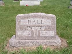
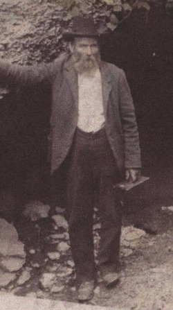
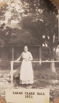
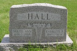
Everett R. Hall
| Birth | : | 8 May 1885 Ray County, Missouri, USA |
| Death | : | 15 Mar 1954 Ray County, Missouri, USA |
| Burial | : | Haynie Cemetery, Blaine, Whatcom County, USA |
| Coordinate | : | 48.9641991, -122.6585999 |
| Plot | : | Section 3 |
| Description | : | Everett, son of Solomon Fletcher Hall & Sarah Jane Clark, married Nell Ann Woodroof, daughter of Robert Woodruff & Alice Burton, 10 August 1907, Richmond, Ray Co.,MO. The obituary of Everett R. Hall from "The Richmond News" dated Wednesday, March 17, 1954, reads as follows: E. R. Hall Rites Held At Orrick Today Services for E. R. Hall, 68, were conducted by the Rev. Samuel Binch at the Orrick Baptist church at 2 o'clock this afternoon. Burial was in South Point cemetery near Orrick. Mr. Hall, retired farmer, died at 9:17 o'clock Monday night at the home of a daughter, Mrs. Juanita McMullin,... Read More |
frequently asked questions (FAQ):
-
Where is Everett R. Hall's memorial?
Everett R. Hall's memorial is located at: Haynie Cemetery, Blaine, Whatcom County, USA.
-
When did Everett R. Hall death?
Everett R. Hall death on 15 Mar 1954 in Ray County, Missouri, USA
-
Where are the coordinates of the Everett R. Hall's memorial?
Latitude: 48.9641991
Longitude: -122.6585999
Family Members:
Parent
Spouse
Siblings
Children
Flowers:
Nearby Cemetories:
1. Haynie Cemetery
Blaine, Whatcom County, USA
Coordinate: 48.9641991, -122.6585999
2. Blaine Cemetery
Blaine, Whatcom County, USA
Coordinate: 48.9935989, -122.7063980
3. Blaine Masonic Cemetery (Defunct)
Blaine, Whatcom County, USA
Coordinate: 48.9936000, -122.7064000
4. Hillsdale Cemetery
Whatcom County, USA
Coordinate: 48.9538994, -122.7230988
5. Zion Lutheran Cemetery
Ferndale, Whatcom County, USA
Coordinate: 48.9030000, -122.6612000
6. Heritage Gardens Cemetery
Surrey, Greater Vancouver Regional District, Canada
Coordinate: 49.0309420, -122.6940590
7. Enterprise Cemetery
Ferndale, Whatcom County, USA
Coordinate: 48.8969002, -122.6252975
8. Hazelmere Cemetery
Hazelmere, Greater Vancouver Regional District, Canada
Coordinate: 49.0319023, -122.7032089
9. Semiahmoo First Nations Cemetery
Semiahmoo, Greater Vancouver Regional District, Canada
Coordinate: 49.0158600, -122.7866400
10. Langley Lawn Cemetery
Langley, Greater Vancouver Regional District, Canada
Coordinate: 49.0811768, -122.6497803
11. Lynden Cemetery
Lynden, Whatcom County, USA
Coordinate: 48.9381229, -122.4838150
12. Monumenta Cemetery
Lynden, Whatcom County, USA
Coordinate: 48.9399986, -122.4831009
13. Murrayville Cemetery
Murrayville, Greater Vancouver Regional District, Canada
Coordinate: 49.0837898, -122.6300354
14. Gardens of Gethsemani Cemetery and Mausoleum
Surrey, Greater Vancouver Regional District, Canada
Coordinate: 49.0598300, -122.7853100
15. Woodlawn Cemetery
Ferndale, Whatcom County, USA
Coordinate: 48.8578300, -122.5436500
16. Sunnyside Lawn Cemetery
Surrey, Greater Vancouver Regional District, Canada
Coordinate: 49.0520439, -122.8077545
17. Temple Sholom Cemetery
White Rock, Greater Vancouver Regional District, Canada
Coordinate: 49.0530300, -122.8072600
18. Beth Tikvah Cemetery
Surrey, Greater Vancouver Regional District, Canada
Coordinate: 49.0529160, -122.8090020
19. Victory Memorial Park
Surrey, Greater Vancouver Regional District, Canada
Coordinate: 49.0558701, -122.8099823
20. Mountain View Cemetery
Ferndale, Whatcom County, USA
Coordinate: 48.8250600, -122.6436010
21. Greenacres Memorial Park
Ferndale, Whatcom County, USA
Coordinate: 48.8495255, -122.5377502
22. Greenwood Cemetery
Greenwood, Whatcom County, USA
Coordinate: 48.9094900, -122.4578500
23. St Albans
Langley, Greater Vancouver Regional District, Canada
Coordinate: 49.1155980, -122.6242640
24. Surrey Centre Cemetery
Cloverdale, Greater Vancouver Regional District, Canada
Coordinate: 49.1090698, -122.7611465

