
| Birth | : | 24 Apr 1871 South Carolina, USA |
| Death | : | 14 Nov 1928 Orangeburg County, South Carolina, USA |
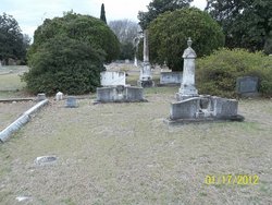
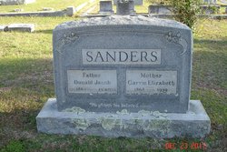
| Burial | : | North Cemetery, Sturbridge, Worcester County, USA |
| Coordinate | : | 42.1128006, -72.0768967 |
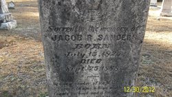
| Description | : | Fannie was first married to Julius S. Fairey. She and Julius never had any children. Julius was the son of George K. Fairey and Mary Ann Carn. |
frequently asked questions (FAQ):
-
Where is Fannie E. Sanders Ruple's memorial?
Fannie E. Sanders Ruple's memorial is located at: North Cemetery, Sturbridge, Worcester County, USA.
-
When did Fannie E. Sanders Ruple death?
Fannie E. Sanders Ruple death on 14 Nov 1928 in Orangeburg County, South Carolina, USA
-
Where are the coordinates of the Fannie E. Sanders Ruple's memorial?
Latitude: 42.1128006
Longitude: -72.0768967
Family Members:
Parent
Spouse

Siblings
Flowers:


Nearby Cemetories:
1. North Cemetery
Sturbridge, Worcester County, USA
Coordinate: 42.1128006, -72.0768967
2. Old Burial Ground
Sturbridge, Worcester County, USA
Coordinate: 42.1074500, -72.0805700
3. Saint Anne Cemetery
Sturbridge, Worcester County, USA
Coordinate: 42.1185989, -72.1082993
4. Saint George Cemetery
Southbridge, Worcester County, USA
Coordinate: 42.0833015, -72.0353012
5. Barefoot Cemetery
Charlton, Worcester County, USA
Coordinate: 42.1307800, -72.0231100
6. Saint Marys Cemetery
Southbridge, Worcester County, USA
Coordinate: 42.0805900, -72.0242000
7. Old Notre Dame Cemetery
Southbridge, Worcester County, USA
Coordinate: 42.0806900, -72.0228200
8. Oak Ridge Cemetery
Southbridge, Worcester County, USA
Coordinate: 42.0718430, -72.0325680
9. Little Alum Pond Cemetery
Brimfield, Hampden County, USA
Coordinate: 42.1362750, -72.1537020
10. Union Cemetery
Charlton, Worcester County, USA
Coordinate: 42.1444016, -71.9957962
11. South Warren Cemetery
Warren, Worcester County, USA
Coordinate: 42.1609300, -72.1461700
12. Podunk Cemetery
East Brookfield, Worcester County, USA
Coordinate: 42.1767006, -72.0318985
13. Dresser Cemetery
Charlton, Worcester County, USA
Coordinate: 42.0949300, -71.9788800
14. Holland Cemetery
Holland, Hampden County, USA
Coordinate: 42.0677590, -72.1645520
15. Westridge Cemetery
Charlton, Worcester County, USA
Coordinate: 42.1344890, -71.9724550
16. Saint Hedwig Cemetery
Southbridge, Worcester County, USA
Coordinate: 42.0456000, -72.0141400
17. Bay Path Cemetery
Charlton, Worcester County, USA
Coordinate: 42.1308320, -71.9687870
18. New Notre Dame Cemetery
Southbridge, Worcester County, USA
Coordinate: 42.0443990, -72.0138680
19. Morse Cemetery
Southbridge, Worcester County, USA
Coordinate: 42.0381860, -72.0114000
20. Depot Cemetery
Charlton, Worcester County, USA
Coordinate: 42.1705933, -71.9834290
21. West Brimfield Cemetery
Brimfield, Hampden County, USA
Coordinate: 42.1320526, -72.1984542
22. Brimfield Cemetery
Brimfield, Hampden County, USA
Coordinate: 42.1191406, -72.2008896
23. Fitts Burial Yard
Charlton, Worcester County, USA
Coordinate: 42.0920900, -71.9550900
24. Cranberry Meadow Cemetery
Charlton, Worcester County, USA
Coordinate: 42.1849100, -71.9968300