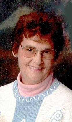
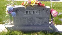
Farrell Kay Smidt Reier
| Birth | : | 15 Jan 1937 Cozad, Dawson County, Nebraska, USA |
| Death | : | 13 Apr 2014 Kearney, Buffalo County, Nebraska, USA |
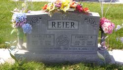
| Burial | : | Cozad Cemetery, Cozad, Dawson County, USA |
| Coordinate | : | 40.8605995, -99.9475021 |
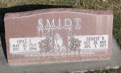
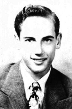
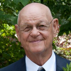
| Description | : | Farrell Kay Reier, age 77 of Cozad, passed away April 13, 2014 at Good Samaritan Hospital in Kearney. Farrell was born January 15, 1937 to Earnest and Opal (Chadwick) Smidt at Cozad. Farrell grew up on a farm northeast of Cozad and graduated from Cozad High School in 1954.On January 16, 1955, Farrell married Charles Reier. The couple made their home at Cozad. To this union 4 children were born, Tonia, James, Stacy and KaDon. Farrell worked as a hairdresser for many years and as a Teachers Aide. Farrell loved the outdoors, especially gardening, yard... Read More |
frequently asked questions (FAQ):
-
Where is Farrell Kay Smidt Reier's memorial?
Farrell Kay Smidt Reier's memorial is located at: Cozad Cemetery, Cozad, Dawson County, USA.
-
When did Farrell Kay Smidt Reier death?
Farrell Kay Smidt Reier death on 13 Apr 2014 in Kearney, Buffalo County, Nebraska, USA
-
Where are the coordinates of the Farrell Kay Smidt Reier's memorial?
Latitude: 40.8605995
Longitude: -99.9475021
Family Members:
Parent
Spouse
Siblings
Children
Flowers:
Nearby Cemetories:
1. Cozad Cemetery
Cozad, Dawson County, USA
Coordinate: 40.8605995, -99.9475021
2. Grace Cemetery
Cozad, Dawson County, USA
Coordinate: 40.8602982, -99.8644028
3. Cottonwood Cemetery
Dawson County, USA
Coordinate: 40.9322014, -99.9197006
4. Saint Johns Lutheran Cemetery
Lexington, Dawson County, USA
Coordinate: 40.9019012, -99.8458023
5. Buffalo Grove Presbyterian Church Cemetery
Buffalo, Dawson County, USA
Coordinate: 40.8721000, -99.8270000
6. Fairview Cemetery
Dawson County, USA
Coordinate: 40.7719002, -99.9955978
7. Rhinehart Cemetery
Cozad, Dawson County, USA
Coordinate: 40.9599000, -99.9105000
8. Willow Island Cemetery
Cozad, Dawson County, USA
Coordinate: 40.9016991, -100.0755997
9. Walnut Grove Cemetery
Cozad, Dawson County, USA
Coordinate: 40.9763985, -99.9944000
10. Block Cemetery
Cozad, Dawson County, USA
Coordinate: 40.9753000, -100.0085000
11. Hillside Cemetery
Dawson County, USA
Coordinate: 40.8946991, -99.7869034
12. Hewitt Cemetery
Lexington, Dawson County, USA
Coordinate: 40.8588982, -99.7769012
13. Pleasant View Cemetery
Dawson County, USA
Coordinate: 40.8293991, -100.1132965
14. Grand View Cemetery
Gothenburg, Dawson County, USA
Coordinate: 40.9474983, -100.0907974
15. Rose Hill Cemetery
Dawson County, USA
Coordinate: 40.9888992, -99.8442001
16. Gothenburg Cemetery
Gothenburg, Dawson County, USA
Coordinate: 40.9458008, -100.1397018
17. Christ Lutheran Church Cemetery
Gothenburg, Dawson County, USA
Coordinate: 40.9623000, -100.1287000
18. First United Methodist Church Columbarium
Lexington, Dawson County, USA
Coordinate: 40.7810000, -99.7397000
19. Greenwood Cemetery
Lexington, Dawson County, USA
Coordinate: 40.7956467, -99.7286682
20. Buffalo First Lutheran Cemetery Old
Buffalo, Dawson County, USA
Coordinate: 41.0100000, -99.8152000
21. Buffalo First Lutheran Cemetery New
Buffalo, Dawson County, USA
Coordinate: 41.0127000, -99.8150000
22. Salem Cemetery
Dawson County, USA
Coordinate: 40.9961014, -100.1268997
23. Saint Anns Cemetery
Lexington, Dawson County, USA
Coordinate: 40.7789001, -99.7114029
24. Eustis East Cemetery
Eustis, Frontier County, USA
Coordinate: 40.6714100, -100.0199780

