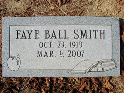
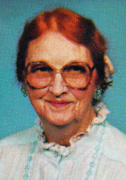
Faye Ball Smith
| Birth | : | 29 Oct 1913 Cabell County, West Virginia, USA |
| Death | : | 9 Mar 2007 Cabell County, West Virginia, USA |
| Burial | : | Rising Sun Cemetery, Pleasant Hill, Polk County, USA |
| Coordinate | : | 41.5996360, -93.4810580 |
| Description | : | Faye was a daughter of the late Lucian, Sr. and Virginia Sweet Ball and the wife of William Clark Smith. She was a retired school teacher of 44 years, she taught at the old Fisher School on Kilgore Creek and at Highlawn Elementary, Huntington. |
frequently asked questions (FAQ):
-
Where is Faye Ball Smith's memorial?
Faye Ball Smith's memorial is located at: Rising Sun Cemetery, Pleasant Hill, Polk County, USA.
-
When did Faye Ball Smith death?
Faye Ball Smith death on 9 Mar 2007 in Cabell County, West Virginia, USA
-
Where are the coordinates of the Faye Ball Smith's memorial?
Latitude: 41.5996360
Longitude: -93.4810580
Family Members:
Parent
Spouse
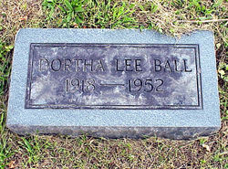
Siblings
Flowers:
Nearby Cemetories:
1. Rising Sun Cemetery
Pleasant Hill, Polk County, USA
Coordinate: 41.5996360, -93.4810580
2. Harvey Cemetery
Delaware Township, Polk County, USA
Coordinate: 41.6153902, -93.5045475
3. Oakwood Cemetery
Pleasant Hill, Polk County, USA
Coordinate: 41.5835991, -93.5258026
4. Stuart Cemetery
Four Mile Township, Polk County, USA
Coordinate: 41.5671997, -93.4480972
5. Canfield Cemetery
Clay Township, Polk County, USA
Coordinate: 41.6046982, -93.4257965
6. Laurel Hill Cemetery
Des Moines, Polk County, USA
Coordinate: 41.5914001, -93.5417023
7. Sims Cemetery
Des Moines, Polk County, USA
Coordinate: 41.6006000, -93.5439000
8. New Altoona Cemetery
Clay Township, Polk County, USA
Coordinate: 41.6521988, -93.4458008
9. Old Altoona Cemetery
Clay Township, Polk County, USA
Coordinate: 41.6577666, -93.4446564
10. Warren-Powers Cemetery
Camp Township, Polk County, USA
Coordinate: 41.5447006, -93.4225006
11. Saint Mark's Episcopal Church Columbarium
Des Moines, Polk County, USA
Coordinate: 41.6241750, -93.5743290
12. Children of Israel Cemetery
Des Moines, Polk County, USA
Coordinate: 41.6040634, -93.5809904
13. Avon Cemetery
Des Moines, Polk County, USA
Coordinate: 41.5299988, -93.5338974
14. Spry Cemetery
Camp Township, Polk County, USA
Coordinate: 41.5607986, -93.3861008
15. Hendricks Cemetery
Polk County, USA
Coordinate: 41.5883400, -93.5954700
16. Berwick Cemetery
Delaware Township, Polk County, USA
Coordinate: 41.6735992, -93.5472031
17. Scott Gravesite
Des Moines, Polk County, USA
Coordinate: 41.5877000, -93.6008500
18. Wicker Cemetery
Runnells, Polk County, USA
Coordinate: 41.5153008, -93.4105988
19. Bondurant Cemetery
Bondurant, Polk County, USA
Coordinate: 41.6995727, -93.4530705
20. Elm Grove Cemetery
Des Moines, Polk County, USA
Coordinate: 41.5253348, -93.5768008
21. Iowa Industrial School for Girls Cemetery
Mitchellville, Polk County, USA
Coordinate: 41.6606950, -93.3676460
22. Allen Township Cemetery
Carlisle, Warren County, USA
Coordinate: 41.4909800, -93.4906480
23. Carlisle Cemetery
Carlisle, Warren County, USA
Coordinate: 41.4907990, -93.4907990
24. Cathedral Church of Saint Paul Columbarium
Des Moines, Polk County, USA
Coordinate: 41.5878500, -93.6291500


