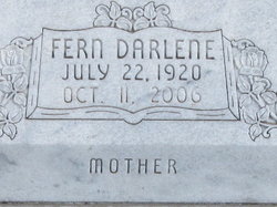
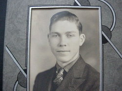
Fern D Froelich Muller
| Birth | : | 22 Jul 1920 Abilene, Dickinson County, Kansas, USA |
| Death | : | 14 Oct 2006 Enterprise, Dickinson County, Kansas, USA |
| Burial | : | Taylor Cemetery, Taylor, Loup County, USA |
| Coordinate | : | 41.7571983, -99.3861008 |
| Description | : | Fern and her husband were married in 1941 in Fairbury Nebraska. They lived and farmed South of Solomon Kansas. |
frequently asked questions (FAQ):
-
Where is Fern D Froelich Muller's memorial?
Fern D Froelich Muller's memorial is located at: Taylor Cemetery, Taylor, Loup County, USA.
-
When did Fern D Froelich Muller death?
Fern D Froelich Muller death on 14 Oct 2006 in Enterprise, Dickinson County, Kansas, USA
-
Where are the coordinates of the Fern D Froelich Muller's memorial?
Latitude: 41.7571983
Longitude: -99.3861008
Family Members:
Spouse
Flowers:
Nearby Cemetories:
1. Kent Cemetery
Taylor, Loup County, USA
Coordinate: 41.7416992, -99.3088989
2. Mount Hope Cemetery
Sargent, Custer County, USA
Coordinate: 41.6768990, -99.3855972
3. Saint Marys Cemetery
Sargent, Custer County, USA
Coordinate: 41.6768990, -99.4044037
4. West Union Cemetery
Sargent, Custer County, USA
Coordinate: 41.6763992, -99.4608002
5. Madison Square Cemetery
Taylor, Loup County, USA
Coordinate: 41.7694016, -99.5314026
6. Almeria Cemetery
Almeria, Loup County, USA
Coordinate: 41.8177986, -99.5128021
7. Predmore Cemetery
Walworth, Custer County, USA
Coordinate: 41.6755981, -99.5674973
8. Jack Shafer Memorial Cemetery
Burwell, Garfield County, USA
Coordinate: 41.8202200, -99.1835500
9. Parker Cemetery
Burwell, Garfield County, USA
Coordinate: 41.8203011, -99.1821976
10. Bohemian Brotherhood Cemetery
Elyria, Valley County, USA
Coordinate: 41.6618996, -99.1866989
11. Moulton Cemetery
Loup County, USA
Coordinate: 41.8574982, -99.5852966
12. Somerford Cemetery
Sargent, Custer County, USA
Coordinate: 41.5793991, -99.4328003
13. Cottonwood Cemetery
Burwell, Garfield County, USA
Coordinate: 41.7681007, -99.1418991
14. Littlefield Cemetery
Burwell, Garfield County, USA
Coordinate: 41.8093987, -99.1389008
15. Longwood Cemetery
Comstock, Custer County, USA
Coordinate: 41.5966988, -99.2356033
16. Banner Cemetery
Burwell, Garfield County, USA
Coordinate: 41.8031006, -99.1235962
17. Round Valley Cemetery
Custer County, USA
Coordinate: 41.5758018, -99.5180969
18. Boleszyn Cemetery
Elyria, Valley County, USA
Coordinate: 41.6691000, -99.1315000
19. Gates Cemetery
Gates, Custer County, USA
Coordinate: 41.6492004, -99.6361008
20. Czech National Cemetery
Valley County, USA
Coordinate: 41.6250000, -99.1537000
21. Douglas Grove Cemetery
Comstock, Custer County, USA
Coordinate: 41.5489006, -99.2881012
22. Potter Brown Cemetery
Burwell, Garfield County, USA
Coordinate: 41.7489000, -99.0668500
23. Saint Wenceslaus Catholic Cemetery
Valley County, USA
Coordinate: 41.6103000, -99.1336000
24. Round Park Cemetery
Valley County, USA
Coordinate: 41.5525017, -99.1825027


