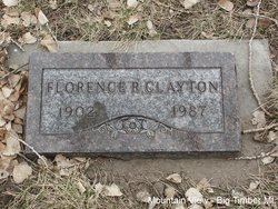
Florence K. Rickel Clayton
| Birth | : | 1 Aug 1902 San Bernardino County, California, USA |
| Death | : | 30 Jan 1987 San Bernardino County, California, USA |
| Burial | : | Hailesboro Cemetery, Hailesboro, St. Lawrence County, USA |
| Coordinate | : | 44.3114204, -75.4501572 |
| Plot | : | Section 5 Block 23AR Lot 1 Grave 9 |
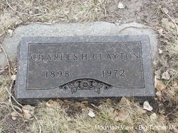
| Description | : | Big Timber Pioneer, April 22, 1987 Florence Rickel Clayton, native of Upland, California died January 30 in Alta Loma, CA. Mrs. Clayton married Charlie Clayton a fiddle maker and gold miner up the main Boulder, in 1972. She had many friends in the Big Timber vicinity. Contributor: Julia Kinsey (48922386) • |
frequently asked questions (FAQ):
-
Where is Florence K. Rickel Clayton's memorial?
Florence K. Rickel Clayton's memorial is located at: Hailesboro Cemetery, Hailesboro, St. Lawrence County, USA.
-
When did Florence K. Rickel Clayton death?
Florence K. Rickel Clayton death on 30 Jan 1987 in San Bernardino County, California, USA
-
Where are the coordinates of the Florence K. Rickel Clayton's memorial?
Latitude: 44.3114204
Longitude: -75.4501572
Family Members:
Flowers:
Nearby Cemetories:
1. Hailesboro Cemetery
Hailesboro, St. Lawrence County, USA
Coordinate: 44.3114204, -75.4501572
2. Bay Road Cemetery
Fowler, St. Lawrence County, USA
Coordinate: 44.3141518, -75.4392014
3. Saint James Cemetery
Gouverneur, St. Lawrence County, USA
Coordinate: 44.3205986, -75.4661026
4. East Riverside Cemetery
Gouverneur, St. Lawrence County, USA
Coordinate: 44.3247986, -75.4587631
5. Riverside Cemetery
Gouverneur, St. Lawrence County, USA
Coordinate: 44.3293991, -75.4666977
6. Saint James Cemetery
Gouverneur, St. Lawrence County, USA
Coordinate: 44.3339005, -75.4499969
7. Smith Road Cemetery
Fowler, St. Lawrence County, USA
Coordinate: 44.2703285, -75.4897995
8. Fowler Baptist Church Cemetery
Fowler, St. Lawrence County, USA
Coordinate: 44.2775307, -75.3875275
9. West Fowler Cemetery
West Fowler, St. Lawrence County, USA
Coordinate: 44.2580986, -75.4811020
10. Little Bow Cemetery
Gouverneur, St. Lawrence County, USA
Coordinate: 44.3517494, -75.5148926
11. Gulf Cemetery
Hailesboro, St. Lawrence County, USA
Coordinate: 44.2769012, -75.3593979
12. Balmat Cemetery
Balmat, St. Lawrence County, USA
Coordinate: 44.2469500, -75.3953200
13. Somerville Cemetery
Rossie, St. Lawrence County, USA
Coordinate: 44.2789001, -75.5504608
14. Spragueville Cemetery
Antwerp, Jefferson County, USA
Coordinate: 44.2571297, -75.5383377
15. Fullerville Cemetery
Fullerville, St. Lawrence County, USA
Coordinate: 44.2670593, -75.3424683
16. Rices Corners Cemetery
Fowler, St. Lawrence County, USA
Coordinate: 44.2205086, -75.4446411
17. Wegatchie Cemetery
Rossie, St. Lawrence County, USA
Coordinate: 44.3031998, -75.5910645
18. Beartown Pioneer Burying Ground
Hermon, St. Lawrence County, USA
Coordinate: 44.3852806, -75.3526764
19. Pine Hill Cemetery
St. Lawrence County, USA
Coordinate: 44.3856010, -75.5532990
20. North Gouverneur Cemetery
North Gouverneur, St. Lawrence County, USA
Coordinate: 44.4160995, -75.4741974
21. Wayside Cemetery
Richville, St. Lawrence County, USA
Coordinate: 44.4122009, -75.3983002
22. Kinne Cemetery
Antwerp, Jefferson County, USA
Coordinate: 44.2511100, -75.5875100
23. Fuller Road Cemetery
Antwerp, Jefferson County, USA
Coordinate: 44.2158120, -75.5433250
24. New Oxbow Cemetery
Oxbow, Jefferson County, USA
Coordinate: 44.2867500, -75.6137900


